Category:Ponsonby, Cumbria
Jump to navigation
Jump to search
village and civil parish in Cumbria, UK | |||||
| Upload media | |||||
| Instance of | |||||
|---|---|---|---|---|---|
| Location | Copeland, Cumbria, North West England, England | ||||
| Population |
| ||||
 | |||||
Subcategories
This category has the following 7 subcategories, out of 7 total.
C
- Cold Fell, Copeland (6 F)
P
- Ponsonby Fell (10 F)
- Ponsonby Parish Church (1 F)
S
- Scargreen Fords (4 F)
- Stakes Bridge (3 F)
Media in category "Ponsonby, Cumbria"
The following 101 files are in this category, out of 101 total.
-
19thC Gravestones in Ponsonby Churchyard - geograph.org.uk - 3998480.jpg 4,000 × 3,000; 3.19 MB
-
A595 approaching Calder Bridge - geograph.org.uk - 6323305.jpg 800 × 600; 126 KB
-
A595 towards Egremont - geograph.org.uk - 6323347.jpg 640 × 480; 53 KB
-
Abbey Flats Farm - geograph.org.uk - 3129443.jpg 800 × 600; 233 KB
-
Abbey Flatts Farm - geograph.org.uk - 3587538.jpg 2,592 × 1,944; 1.28 MB
-
Access road for Monkwood Cottage - geograph.org.uk - 5525489.jpg 1,500 × 1,125; 2.48 MB
-
Access road near to Calder Abbey - geograph.org.uk - 5525493.jpg 1,500 × 1,125; 1.95 MB
-
Ancient footpath - geograph.org.uk - 1218338.jpg 640 × 480; 152 KB
-
Around high tide - Seascale Banks - geograph.org.uk - 4665384.jpg 1,469 × 1,102; 626 KB
-
Blackbeck - Sellafield Road - geograph.org.uk - 55342.jpg 640 × 480; 76 KB
-
Bridge over clearway. - geograph.org.uk - 97342.jpg 640 × 480; 73 KB
-
Bridleway beside Scargreen Beck - geograph.org.uk - 6090000.jpg 1,600 × 1,200; 877 KB
-
Cold Fell Road - geograph.org.uk - 1619885.jpg 640 × 480; 60 KB
-
Coldfell gate. - geograph.org.uk - 4976026.jpg 640 × 480; 73 KB
-
Employment in 1881.jpg 483 × 439; 52 KB
-
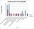
Employment in 2001.jpg 576 × 492; 59 KB
-
Enclosure on west side of River Calder - geograph.org.uk - 6822873.jpg 1,024 × 633; 198 KB
-
Enclosure, Stone Pike - geograph.org.uk - 1532571.jpg 640 × 480; 73 KB
-
Farm lane between Ponsonby and Calder Hall - geograph.org.uk - 5988095.jpg 4,032 × 3,024; 3.7 MB
-
Farm lane heading towards Calder Hall - geograph.org.uk - 5988093.jpg 4,032 × 3,024; 3.2 MB
-
Farm lane near Ponsonby - geograph.org.uk - 5988052.jpg 4,032 × 3,024; 1.9 MB
-
Farmery - geograph.org.uk - 1218372.jpg 640 × 480; 138 KB
-
Field and power lines, Calder Bridge - geograph.org.uk - 6323346.jpg 800 × 600; 82 KB
-
Field on In Fell - geograph.org.uk - 4539835.jpg 640 × 480; 50 KB
-
Flats, Abbey Garth, Calder Bridge - geograph.org.uk - 6323338.jpg 800 × 600; 131 KB
-
Gazing through the fence - geograph.org.uk - 5988111.jpg 4,032 × 3,024; 4.08 MB
-
Grass with rushes at southern Ponsonby Fell - geograph.org.uk - 6090058.jpg 2,000 × 1,193; 2.05 MB
-
Grassy moorland of Ponsonby Fell - geograph.org.uk - 6090879.jpg 1,600 × 971; 518 KB
-
Grassy slope on Swainson Knott - geograph.org.uk - 6090882.jpg 2,000 × 1,302; 2.16 MB
-
Grazing near Calder Bridge - geograph.org.uk - 6323304.jpg 800 × 600; 71 KB
-
Heading north from Cold Fell - geograph.org.uk - 3129461.jpg 800 × 600; 202 KB
-
Historical Map of Ponsonby, Cumbria.jpg 522 × 425; 88 KB
-
In Fell top - geograph.org.uk - 4539843.jpg 640 × 480; 59 KB
-
Irresistible force meets immovable obstacle - geograph.org.uk - 5988103.jpg 4,032 × 3,024; 3.98 MB
-
Lay-by on A595 - geograph.org.uk - 4038972.jpg 1,024 × 768; 102 KB
-
Lodge to Pelham House - geograph.org.uk - 6323342.jpg 800 × 497; 104 KB
-
Looking towards Sellafield works from Ponsonby Church - geograph.org.uk - 5988117.jpg 4,032 × 3,024; 978 KB
-
Lookout Tower - geograph.org.uk - 1218492.jpg 640 × 480; 132 KB
-
Low Prior Scales - geograph.org.uk - 1218502.jpg 640 × 480; 170 KB
-
Moorland of Ponsonby Fell - geograph.org.uk - 6090022.jpg 1,600 × 986; 480 KB
-
North Drive towards Pelham House - geograph.org.uk - 6323343.jpg 800 × 600; 133 KB
-
Old store on In Fell - geograph.org.uk - 4539839.jpg 640 × 480; 48 KB
-
On Stone Pike - geograph.org.uk - 1532574.jpg 640 × 480; 70 KB
-
On Swainson Knott - geograph.org.uk - 1218412.jpg 640 × 480; 94 KB
-
On Swainson Knott - geograph.org.uk - 1532578.jpg 480 × 640; 67 KB
-
On Swainson Knott - geograph.org.uk - 1532580.jpg 640 × 480; 57 KB
-
Ordnance Survey Cut Mark - geograph.org.uk - 5186317.jpg 640 × 490; 118 KB
-
Ponsonby Church at dusk - geograph.org.uk - 5988115.jpg 4,032 × 3,024; 1.74 MB
-
Ponsonby Fell - geograph.org.uk - 3309976.jpg 1,600 × 1,200; 949 KB
-
Ponsonby. - geograph.org.uk - 109102.jpg 640 × 480; 58 KB
-
Railway near Sellafield - geograph.org.uk - 6656597.jpg 1,200 × 805; 1.11 MB
-
Road bridge over the River Calder at Calder Bridge - geograph.org.uk - 3027400.jpg 4,000 × 3,000; 4.85 MB
-
Rough ground near Comb Beck - geograph.org.uk - 3029136.jpg 1,024 × 682; 90 KB
-
Science and Nature - geograph.org.uk - 2798974.jpg 1,024 × 683; 163 KB
-
Second roundabout to Sellafield. - geograph.org.uk - 97357.jpg 640 × 407; 54 KB
-
Sellafield (Calder Hall) Power Station - geograph.org.uk - 6026683.jpg 2,000 × 1,366; 1.74 MB
-
Sellafield from the air - geograph.org.uk - 4651256.jpg 640 × 317; 88 KB
-
Sellafield from the air - geograph.org.uk - 4651260.jpg 640 × 357; 101 KB
-
Sellafield Nuclear Power complex - geograph.org.uk - 3435355.jpg 1,024 × 502; 55 KB
-
Sellafield-Windscale-Calder Hall - geograph.org.uk - 5461507.jpg 2,173 × 1,624; 1.65 MB
-
Service station, Calder Bridge - geograph.org.uk - 6323340.jpg 800 × 463; 65 KB
-
Sheep grazing near Newmill Farm - geograph.org.uk - 6323302.jpg 800 × 600; 85 KB
-
Skalderscew Beck Waterfall - geograph.org.uk - 3553601.jpg 3,072 × 2,304; 3.16 MB
-
Skalderskew - geograph.org.uk - 1534343.jpg 640 × 480; 60 KB
-
Skalderskew Beck ravine - geograph.org.uk - 3553621.jpg 3,072 × 2,304; 2.92 MB
-
Small cairn at summit of Cold Fell - geograph.org.uk - 6822479.jpg 1,024 × 633; 227 KB
-
St Bridget's Church Calder Bridge - geograph.org.uk - 3027389.jpg 3,721 × 2,796; 5.4 MB
-
St Bridget's Church, Calder Bridge - geograph.org.uk - 6323309.jpg 800 × 560; 106 KB
-
St Bridgets Church, Calderbridge - geograph.org.uk - 3125947.jpg 800 × 600; 256 KB
-
Stone Pike - geograph.org.uk - 3585148.jpg 2,592 × 1,944; 1.57 MB
-
Strudda Bank - geograph.org.uk - 1218470.jpg 640 × 480; 78 KB
-
Swainson Knott - geograph.org.uk - 3309990.jpg 1,600 × 1,200; 1.22 MB
-
The clearway approach to Sellafield. - geograph.org.uk - 97344.jpg 640 × 480; 81 KB
-
The east slopes of Swainson Knott - geograph.org.uk - 3585168.jpg 2,592 × 1,944; 1.3 MB
-
The Golden Fleece, Calderbridge - geograph.org.uk - 3125998.jpg 600 × 800; 234 KB
-
The road from Thornholme Farm to Calder Bridge - geograph.org.uk - 3587534.jpg 2,592 × 1,944; 1.65 MB
-
The road over Cold Fell - geograph.org.uk - 3129453.jpg 800 × 600; 212 KB
-
The road to Calder Bridge, on Cold Fell - geograph.org.uk - 3587540.jpg 2,592 × 1,944; 1.38 MB
-
The road to Thornholme Farm - geograph.org.uk - 3587531.jpg 2,592 × 1,944; 1.13 MB
-
The slopes of Cold Fell - geograph.org.uk - 3096298.jpg 2,592 × 1,944; 1.72 MB
-
The south slopes of Ponsonby Fell - geograph.org.uk - 3585136.jpg 2,592 × 1,944; 1.23 MB
-
The Stanley Arms, Calder Bridge - geograph.org.uk - 6323307.jpg 800 × 523; 75 KB
-
The summit of Ponsonby Fell - geograph.org.uk - 3585121.jpg 2,592 × 1,944; 1.39 MB
-
The summit of Swainson Knott - geograph.org.uk - 3585164.jpg 2,592 × 1,944; 1.35 MB
-
The top of Cold Fell - geograph.org.uk - 4976038.jpg 640 × 480; 74 KB
-
The War Memorial at Calderbridge - geograph.org.uk - 3125957.jpg 800 × 600; 273 KB
-
The War Memorial at Calderbridge - geograph.org.uk - 3125962.jpg 800 × 600; 327 KB
-
Thornholme Farm - geograph.org.uk - 1218451.jpg 640 × 480; 82 KB
-
Timber merchants, Calder Bridge - geograph.org.uk - 6323344.jpg 800 × 600; 144 KB
-
Towards Sellafield - geograph.org.uk - 4879472.jpg 640 × 401; 59 KB
-
Walled path to Farmery - geograph.org.uk - 1218357.jpg 640 × 480; 101 KB
-
Walling at Stone Pike - geograph.org.uk - 6090713.jpg 1,600 × 906; 491 KB
-
Woodland above Scargreen Beck - geograph.org.uk - 6089995.jpg 1,600 × 1,200; 1.11 MB
-
Worm Gill Ford - geograph.org.uk - 6367450.jpg 4,032 × 3,024; 6.63 MB


