Category:Ponds in South Yorkshire
Jump to navigation
Jump to search
Subcategories
This category has only the following subcategory.
V
Media in category "Ponds in South Yorkshire"
The following 47 files are in this category, out of 47 total.
-
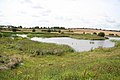
 A dew pond on Hoyland Hill - geograph.org.uk - 758694.jpg 640 × 480; 67 KB
-
 A frozen Denaby Ings - geograph.org.uk - 1631454.jpg 640 × 480; 71 KB
-
 A peaceful oasis - geograph.org.uk - 400861.jpg 640 × 480; 86 KB
-
 AskernSpaPool(DavidPickersgill)Mar2008.jpg 640 × 456; 126 KB
-
 Boggy pool on Rud Hill with view towards Redmires reservoirs - geograph.org.uk - 2621934.jpg 1,818 × 2,424; 1.82 MB
-

-
 Crookhouse pond - geograph.org.uk - 1256930.jpg 640 × 480; 123 KB
-

-
 Denaby Ings - geograph.org.uk - 1630649.jpg 640 × 480; 55 KB
-
 Fishing Pond - geograph.org.uk - 447835.jpg 640 × 512; 75 KB
-
 Frozen pond at Ravenfied park - geograph.org.uk - 1658266.jpg 640 × 480; 51 KB
-
 Loxley Park. - geograph.org.uk - 132695.jpg 640 × 480; 230 KB
-
 Mexborough Low Pasture - geograph.org.uk - 926101.jpg 640 × 427; 73 KB
-
 Mill Pond - geograph.org.uk - 386695.jpg 640 × 480; 149 KB
-

-
 Morley Pond - geograph.org.uk - 895092.jpg 640 × 480; 101 KB
-
 Morley Pond Wentworth Estate - geograph.org.uk - 772684.jpg 640 × 480; 109 KB
-
 No fishing today - geograph.org.uk - 1631458.jpg 640 × 480; 70 KB
-
 Overgrown pond - lake, Endcliffe Park - geograph.org.uk - 170132.jpg 640 × 480; 150 KB
-
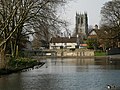
 ParkPooltowardsStLukes.jpg 2,809 × 2,107; 1.85 MB
-
 Pissy Beds Common - geograph.org.uk - 741033.jpg 640 × 495; 61 KB
-
 Pond - geograph.org.uk - 117733.jpg 640 × 480; 57 KB
-
 Pond at Deepcar, South Yorkshire - geograph.org.uk - 128328.jpg 640 × 480; 213 KB
-
 Pond at Frecheville - geograph.org.uk - 1239363.jpg 640 × 480; 43 KB
-
 Pond In Dearne Valley Park - geograph.org.uk - 1382711.jpg 640 × 480; 125 KB
-
 Rush Hour - geograph.org.uk - 645196.jpg 640 × 480; 91 KB
-
 Sunrise at Grimethorpe.JPG 6,000 × 4,000; 14.51 MB
-
 The pond at Crook House farm. - geograph.org.uk - 517453.jpg 640 × 480; 152 KB
-
 Wire Mill Dam, Porter Valley - geograph.org.uk - 158938.jpg 640 × 480; 66 KB
-
 A man made pond - geograph.org.uk - 658985.jpg 640 × 474; 66 KB
-
 A pond in Wharncliffe Woods - geograph.org.uk - 713691.jpg 640 × 480; 138 KB
-
 Athersley Community Lake - geograph.org.uk - 486135.jpg 640 × 426; 115 KB
-

-
 Duck pond. - geograph.org.uk - 517434.jpg 640 × 636; 156 KB
-
 Fishing by the garden centre - geograph.org.uk - 407483.jpg 640 × 480; 145 KB
-
 Fishing Pond - geograph.org.uk - 178144.jpg 640 × 427; 79 KB
-
 Fishing pond. - geograph.org.uk - 530826.jpg 640 × 480; 81 KB
-
 Mickleden Pond - geograph.org.uk - 393438.jpg 640 × 427; 341 KB
-
 Milton pond - geograph.org.uk - 567310.jpg 640 × 466; 141 KB
-
 Muddy waters^ - geograph.org.uk - 530830.jpg 640 × 480; 122 KB
-
 Pond - Wharncliffe Heath - geograph.org.uk - 456913.jpg 640 × 480; 139 KB
-
 Pond at Graves Park - geograph.org.uk - 421183.jpg 640 × 617; 297 KB
-
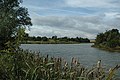
 Pond below Thrybergh - geograph.org.uk - 635199.jpg 640 × 437; 89 KB
-

-
 The Pond at Crook House farm - geograph.org.uk - 329806.jpg 640 × 480; 75 KB
-
 Through the trees to Blacker Dam - geograph.org.uk - 113590.jpg 640 × 426; 207 KB
-
 Woodhouse Grange , fishing ponds. - geograph.org.uk - 397058.jpg 640 × 480; 98 KB


Mar2008.jpg)


