Category:Ponders End
Jump to navigation
Jump to search
commercial and residential district of the London Borough of Enfield, London, England  | |||||
| Upload media | |||||
| Instance of | |||||
|---|---|---|---|---|---|
| Location | London Borough of Enfield, Greater London, London, England | ||||
| Located in or next to body of water | |||||
 | |||||
Subcategories
This category has the following 3 subcategories, out of 3 total.
P
- Ponder's End Lock (11 F)
- Ponders End railway station (21 F)
W
- Wright's Flour Mill (6 F)
Media in category "Ponders End"
The following 49 files are in this category, out of 49 total.
-
 2022-02-26 Navigation Inn, former well station, Ponders End (1).jpg 3,856 × 2,892; 1.84 MB
-
 2022-02-26 Navigation Inn, former well station, Ponders End (2).jpg 3,901 × 2,194; 1.75 MB
-
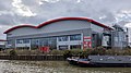 2022-03-05 Camden Town Brewery, Ponders End.jpg 3,119 × 1,754; 1.03 MB
-
 Aberdare Rd - geograph.org.uk - 3249034.jpg 640 × 430; 53 KB
-
 Aberdare Road, Enfield - geograph.org.uk - 1199205.jpg 640 × 481; 72 KB
-

-
 Alma Road - geograph.org.uk - 2988863.jpg 4,000 × 3,000; 5.12 MB
-
 Anglesey Road, Enfield - geograph.org.uk - 1199181.jpg 640 × 481; 111 KB
-
 Brecon Road, closed off by gate - geograph.org.uk - 4148313.jpg 640 × 480; 69 KB
-

-
 Colmore Road, Ponders End - geograph.org.uk - 3923256.jpg 2,560 × 1,920; 2 MB
-
 Container trash.jpg 2,576 × 1,932; 895 KB
-
 Cowlands Avenue - geograph.org.uk - 3250530.jpg 640 × 430; 61 KB
-
 Durants Rd - geograph.org.uk - 3250519.jpg 640 × 430; 62 KB
-
 Glyn Road, Ponders End - geograph.org.uk - 1199243.jpg 640 × 480; 72 KB
-
 Green St - geograph.org.uk - 3250588.jpg 640 × 430; 90 KB
-
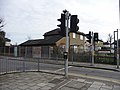
 Height restriction sign for rail bridge - geograph.org.uk - 1270777.jpg 640 × 480; 142 KB
-
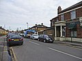
 Hertford Road, Ponders End - geograph.org.uk - 1200731.jpg 640 × 481; 69 KB
-
 Hertford Road, Ponders End - geograph.org.uk - 1201137.jpg 640 × 483; 60 KB
-

-
 Kingsway off Southbury Rd - geograph.org.uk - 3249032.jpg 640 × 430; 54 KB
-
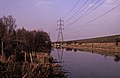
 Lee Valley Reservoirs.jpg 3,872 × 2,592; 3.12 MB
-
 Nag's Head Road, Ponders End - geograph.org.uk - 3924093.jpg 2,560 × 1,920; 1.49 MB
-
 Nags Head Rd (A110) - geograph.org.uk - 3249046.jpg 640 × 430; 69 KB
-
 New Family - geograph.org.uk - 748246.jpg 640 × 426; 92 KB
-

-
 Path to Cowlands Avenue - geograph.org.uk - 3250525.jpg 640 × 430; 89 KB
-
-
 Ponders End to Brimsdown railway line - geograph.org.uk - 418823.jpg 640 × 480; 117 KB
-
 Ponders End Working Men's Social Club - geograph.org.uk - 678883.jpg 640 × 480; 70 KB
-
 Ponders End, A110 Nags Head Road - geograph.org.uk - 678896.jpg 640 × 480; 74 KB
-
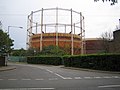 Ponders End, Gasworks - geograph.org.uk - 418756.jpg 640 × 480; 78 KB
-
 Ponders End, High Street - geograph.org.uk - 678890.jpg 640 × 480; 91 KB
-

-

-
 Ponders End, The former Railway Hotel - geograph.org.uk - 417866.jpg 640 × 480; 107 KB
-
 Ponders End.JPG 2,304 × 1,728; 1.68 MB
-
 Ponders End.jpg 640 × 480; 92 KB
-
-

-
 Southbury Road, Ponders End - geograph.org.uk - 1199574.jpg 481 × 640; 102 KB
-
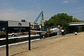 Summer at Ponders End Lock - geograph.org.uk - 748274.jpg 640 × 426; 63 KB
-
 Swansea Rd - geograph.org.uk - 3249035.jpg 640 × 430; 92 KB
-
 Swansea Road, Ponders End - geograph.org.uk - 1199226.jpg 640 × 480; 77 KB
-
 The Navigation Inn - geograph.org.uk - 748231.jpg 640 × 427; 74 KB
-
 The Ride - geograph.org.uk - 3250531.jpg 640 × 430; 69 KB
-
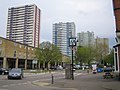
 Tower blocks, Ponders End - geograph.org.uk - 3220292.jpg 640 × 480; 120 KB
-
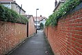
 Urban footpath, Ponders End - geograph.org.uk - 3250515.jpg 640 × 430; 81 KB
-
 Wharf Road Park, Ponders End - geograph.org.uk - 391228.jpg 640 × 480; 96 KB
.jpg)
.jpg)


_-_geograph.org.uk_-_3249046.jpg)


