Category:Political maps of Samoa
Jump to navigation
Jump to search
Countries of Oceania: Australia · Fiji · Federated States of Micronesia · Kiribati · Marshall Islands · Nauru · New Zealand · Palau · Papua New Guinea · Samoa · Solomon Islands · Tonga · Tuvalu · Vanuatu
Other areas: American Samoa · Clipperton Island · Cook Islands · French Polynesia · Hawaii · New Caledonia · Niue · Northern Mariana Islands · Wallis and Futuna – Partly: Indonesia · French Southern and Antarctic Lands
Other areas: American Samoa · Clipperton Island · Cook Islands · French Polynesia · Hawaii · New Caledonia · Niue · Northern Mariana Islands · Wallis and Futuna – Partly: Indonesia · French Southern and Antarctic Lands
Subcategories
This category has the following 3 subcategories, out of 3 total.
Media in category "Political maps of Samoa"
The following 17 files are in this category, out of 17 total.
-
 Location of Leulumoega.png 425 × 209; 10 KB
-
 Samoa Constituency borders (labelled en).png 2,176 × 1,254; 375 KB
-
 Samoa District borders (numbered).png 2,000 × 935; 97 KB
-
 Samoa districts named.png 1,000 × 486; 21 KB
-
 Samoa districts numbered.png 500 × 243; 9 KB
-
 Samoa districts numbered2.png 500 × 243; 119 KB
-
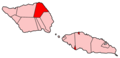
 Samoa-A'ana.png 400 × 194; 5 KB
-
 Samoa-Aiga-i-le-Tai.png 400 × 194; 5 KB
-
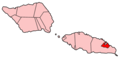
 Samoa-Atua.png 400 × 194; 5 KB
-
 Samoa-Fa'asaleleaga.png 400 × 194; 5 KB
-
 Samoa-Gaga'emauga.png 400 × 194; 5 KB
-
 Samoa-Gagaifomauga.png 400 × 194; 5 KB
-
 Samoa-Palauli.png 400 × 194; 5 KB
-
 Samoa-Satupa'itea.png 400 × 194; 5 KB
-
 Samoa-Tuamasaga.png 400 × 194; 5 KB
-
 Samoa-Va'a-o-Fonoti.png 400 × 194; 5 KB
-
 Samoa-Vaisigano.png 400 × 194; 5 KB

.png)
.png)


