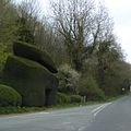
Category:Plowden, Shropshire
Jump to navigation
Jump to search
village in Shropshire, UK | |||||
| Upload media | |||||
| Instance of | |||||
|---|---|---|---|---|---|
| Location | Lydbury North, Shropshire, West Midlands, England | ||||
 | |||||
Media in category "Plowden, Shropshire"
The following 8 files are in this category, out of 8 total.
-
A topiary gateway at Plowden (geograph 4503892).jpg 1,599 × 1,600; 390 KB
-
Churchmoor Gutter - geograph.org.uk - 1222049.jpg 600 × 450; 312 KB
-
Former railway station, Plowden.jpg 4,608 × 3,456; 6.59 MB
-
Plowden and Topiary - geograph.org.uk - 617925.jpg 640 × 480; 112 KB
-
Private drive to Plowden Hall - geograph.org.uk - 1232206.jpg 600 × 450; 286 KB
-
Road junction at Plowden (geograph 2744548).jpg 640 × 469; 76 KB
-
Sheep grazing, Plowden (geograph 4093981).jpg 640 × 480; 244 KB
-
St. Walburgha's RC Church at Plowden - geograph.org.uk - 1232219.jpg 600 × 450; 337 KB


