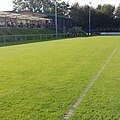
Category:Playing fields in the City of Wakefield
Jump to navigation
Jump to search
Subcategories
This category has the following 3 subcategories, out of 3 total.
C
P
W
Media in category "Playing fields in the City of Wakefield"
The following 56 files are in this category, out of 56 total.
-
Barracks Field Football pitches - geograph.org.uk - 581042.jpg 640 × 480; 76 KB
-
Carleton High School playing field - geograph.org.uk - 2388600.jpg 2,235 × 1,296; 1.5 MB
-
Carleton High school under re-construction - geograph.org.uk - 2388596.jpg 2,230 × 1,296; 1.54 MB
-
Chestnut tree by all weather pitch - geograph.org.uk - 6617083.jpg 1,024 × 609; 108 KB
-
Crisp Winters morning - geograph.org.uk - 1845912.jpg 640 × 483; 58 KB
-
Half time, BFA Cup - geograph.org.uk - 287636.jpg 640 × 480; 110 KB
-
Henry Moore's Snowman - geograph.org.uk - 1639623.jpg 640 × 480; 66 KB
-
Horbury Road Playing Fields - geograph.org.uk - 1028096.jpg 640 × 480; 93 KB
-
Netherton Junior and Infants School - geograph.org.uk - 132375.jpg 640 × 480; 126 KB
-
No play today - geograph.org.uk - 2935938.jpg 1,024 × 768; 125 KB
-
Nostell.jpg 3,104 × 3,104; 2.92 MB
-
Ossett Trinity ARLFC - geograph.org.uk - 1026975.jpg 480 × 640; 63 KB
-
Playing Field - Agbrigg Road - geograph.org.uk - 2129272.jpg 640 × 480; 111 KB
-
Playing Field - end of New Row - geograph.org.uk - 3634803.jpg 640 × 480; 51 KB
-
Playing field off Windermere Drive - geograph.org.uk - 2476636.jpg 1,024 × 768; 75 KB
-
Playing Fields - Batley Road - geograph.org.uk - 3647248.jpg 640 × 353; 38 KB
-
Playing Fields - end of Parker Road - geograph.org.uk - 4516946.jpg 640 × 480; 66 KB
-
Playing fields - geograph.org.uk - 1046383.jpg 640 × 467; 53 KB
-
Playing fields - geograph.org.uk - 928342.jpg 640 × 480; 85 KB
-
Playing Fields - Rook's Nest Road - geograph.org.uk - 4031031.jpg 640 × 480; 60 KB
-
Playing Fields - Thornes Park - geograph.org.uk - 3882076.jpg 640 × 480; 55 KB
-
Playing fields near Stanley Ferry - geograph.org.uk - 6493112.jpg 1,024 × 768; 306 KB
-
Playing fields off Ferry Lane, Stanley - geograph.org.uk - 6492852.jpg 1,024 × 768; 92 KB
-
Playing fields on the north bank of Alverthorpe Beck - geograph.org.uk - 6502940.jpg 1,600 × 1,200; 449 KB
-
Playing Fields, Eastmoor Estate. - geograph.org.uk - 286595.jpg 640 × 480; 74 KB
-
Playing fields, Queen's Park - geograph.org.uk - 3830457.jpg 1,920 × 990; 341 KB
-
Recreation Ground Castleford - geograph.org.uk - 2568624.jpg 450 × 640; 72 KB
-
Rugby Field - Ferry Lane - geograph.org.uk - 4008656.jpg 640 × 480; 67 KB
-
Rugby ground at Milnthorpe - geograph.org.uk - 6589574.jpg 1,024 × 768; 133 KB
-
Rugby pitch by Westfield View - geograph.org.uk - 3280507.jpg 1,024 × 768; 122 KB
-
Rugby pitch in the Christmas holidays - geograph.org.uk - 2213068.jpg 1,024 × 768; 106 KB
-
Sandal Tennis Club - Walton Lane - geograph.org.uk - 4582600.jpg 640 × 480; 66 KB
-
School playing field, Ferrybridge Road - geograph.org.uk - 2476147.jpg 1,600 × 1,200; 567 KB
-
School rugby match at Normanton RLFC. - geograph.org.uk - 5360.jpg 640 × 426; 65 KB
-
Snowy running track - geograph.org.uk - 1639638.jpg 640 × 463; 70 KB
-
Sports Ground - Mill Hill Lane - geograph.org.uk - 5328694.jpg 621 × 456; 55 KB
-
Sports pitches - geograph.org.uk - 875849.jpg 640 × 480; 75 KB
-
View of North Wakefield - geograph.org.uk - 1138146.jpg 640 × 480; 245 KB
-
Westfields and Westwood road estate Cutsyke - geograph.org.uk - 2746178.jpg 1,600 × 1,200; 274 KB


