Category:Plans of castles in North Rhine-Westphalia
Jump to navigation
Jump to search
Federal states of Germany:
Subcategories
This category has the following 2 subcategories, out of 2 total.
G
S
Media in category "Plans of castles in North Rhine-Westphalia"
The following 129 files are in this category, out of 129 total.
-
 2010-05-11 Vlotho 121.jpg 1,600 × 1,200; 872 KB
-
 2010-05-11 Vlotho 122.jpg 1,600 × 1,200; 624 KB
-
 2010-05-11 Vlotho 123.jpg 1,600 × 1,200; 593 KB
-
 2010-05-11 Vlotho 124.jpg 1,600 × 1,200; 561 KB
-
 Altena - Burg Altena 05 ies.jpg 3,888 × 2,592; 1.45 MB
-
 Aspel Grundriss.png 998 × 1,140; 124 KB
-
 Ausschnitt Karte Kalkum.jpg 1,815 × 1,818; 2.24 MB
-
 Beschuss und Sprengung der Godesburg 1583- Français.jpg 1,535 × 918; 132 KB
-
 Beschuss und Sprengung der Godesburg 1583.jpg 1,535 × 918; 179 KB
-
 Borgholzhausen Burg Ravensberg Grundriss 1909.jpg 611 × 351; 123 KB
-
 Burg Berge ( abgegangen) Grundriss (7124646741).jpg 1,024 × 768; 772 KB
-
 Burg Boetzelaer Lageplan 1731.jpg 1,206 × 1,825; 572 KB
-
 Burg Dinslaken Klevisches Kataster 1734.jpg 494 × 477; 87 KB
-
 Burg Duerboslar Lageplan.jpg 984 × 980; 250 KB
-
 Burg Friedestrom Grundrisse Suedtor.jpg 847 × 577; 48 KB
-
 Burg Friedestrom Grundrisse Torturm.jpg 1,382 × 431; 75 KB
-
 Burg Kempen Grundriss Rekonstruktion Wiethase.jpg 937 × 828; 313 KB
-
 Burg Schwarzenberg Grundriss (7124645905).jpg 1,024 × 768; 665 KB
-
 BurgAltendorfGrundriss.png 1,977 × 1,410; 116 KB
-
 BurgBrueggenFloorplan.jpg 1,457 × 1,833; 153 KB
-
 BurgHardenbergGrundriss.jpg 864 × 788; 424 KB
-
 BurgSchoenforstEnde16Jh.jpg 950 × 720; 122 KB
-
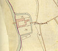 Diesdonk 1895.jpg 751 × 656; 119 KB
-
-
 Essen-Alteburg Plan.jpg 922 × 1,000; 184 KB
-
 FlooplanTripsCastle.jpg 688 × 574; 81 KB
-
 FloorplanTripsCastleManorHouse.jpg 592 × 668; 47 KB
-
 Ginsburg Grundriss V2.svg 2,530 × 1,970; 75 KB
-
 Grimberg-1908.jpg 1,200 × 1,090; 170 KB
-
 Grundriss Burg Angermund.jpg 1,412 × 990; 255 KB
-
 Grundriss Burg Blankenstein.svg 3,233 × 2,200; 115 KB
-
 Grundriss Burg Frankenberg.svg 1,493 × 1,274; 85 KB
-
 Grundriss Burg Friedestrom.svg 2,868 × 2,150; 34 KB
-
 Grundriss Burg Goedersheim.jpg 1,576 × 984; 283 KB
-
 Grundriss Burg Irnich 1902.jpg 918 × 946; 171 KB
-
 Grundriss Burg Laurenzberg 1902.jpg 1,200 × 970; 248 KB
-
 Grundriss Burg Vischering EG.svg 1,125 × 1,355; 78 KB
-
 Grundriss Burg Wachtendonk.svg 670 × 354; 28 KB
-
 Grundriss Haus Bodelschwingh.svg 2,151 × 1,180; 59 KB
-
 Grundriss Haus Effeld.jpg 1,368 × 1,468; 138 KB
-
 Grundriss Haus Luettinghof.svg 1,408 × 1,320; 27 KB
-
 Grundriss Haus Vlassrath.svg 1,020 × 915; 31 KB
-
 Grundriss Huelchrath Ludwig Arntz 1892.jpg 1,768 × 2,195; 432 KB
-
 Grundriss Residenzschloss Muenster - Schlaun.jpg 2,702 × 1,284; 911 KB
-
 Grundriss Schloss Burg 2.png 712 × 723; 40 KB
-
 Grundriss Schloss Burg 21.jpg 712 × 723; 462 KB
-
 Grundriss Schloss Elsum.jpg 2,559 × 2,625; 513 KB
-
 Grundriss Schloss Horst c. 1850.jpg 1,343 × 1,434; 362 KB
-
 Grundriss Schloss Horst mit Legende.jpg 2,529 × 1,434; 538 KB
-
 Grundriss Schloss Kalkum fr.svg 2,487 × 3,504; 324 KB
-
 Grundriss Schloss Kalkum.svg 2,487 × 3,504; 320 KB
-
 Grundriss Wohnbau Altes Schloss Grevenbroich.jpg 869 × 378; 61 KB
-
 GrundrissBurgStolberg.png 881 × 669; 85 KB
-
 GrundrissSchlossSchellenberg.png 1,536 × 1,148; 243 KB
-
 Hardtburg-Plan.jpg 800 × 800; 84 KB
-
 Haus Aspel Klevisches Kataster 1734.jpg 1,325 × 2,004; 755 KB
-
 Haus Vlassrath - Plan 1877.jpg 1,648 × 1,752; 572 KB
-
 HausKambach05.jpg 753 × 468; 176 KB
-
 Hilden Heidenburg Holterhoefchen.jpg 1,800 × 1,200; 342 KB
-
 Hondsdorf.png 542 × 398; 447 KB
-
 Huenenburg Bad Waldliesborn.jpg 1,000 × 836; 283 KB
-
 Kaiserpfalz Keyserswerdt Grundriss (6978561310).jpg 1,024 × 768; 533 KB
-
 Karte Kalkum.jpg 2,512 × 1,909; 1.09 MB
-
 KatasterplanSchlossLaer.gif 1,391 × 1,140; 389 KB
-
 KattenturmEssenGrundriss.png 1,869 × 1,420; 90 KB
-
 Lagepan Haus Eyll Straelen 1831.jpg 756 × 727; 205 KB
-
 Lageplaene Schloss Linzenich.jpg 1,218 × 438; 117 KB
-
 Lageplan Bodelschwingh 2.jpg 705 × 718; 101 KB
-
 Lageplan Burg Alsdorf.svg 1,362 × 970; 23 KB
-
 Lageplan Burg Frenz Nies.jpg 1,260 × 799; 237 KB
-
 Lageplan Haus Aspel 1733.jpg 1,074 × 1,561; 1.09 MB
-
 Lageplan Haus Dellwig.svg 2,064 × 2,768; 40 KB
-
 Lageplan Haus Effeld.png 966 × 842; 136 KB
-
 Lageplan Haus Eyll.svg 1,725 × 1,089; 127 KB
-
 Lageplan Haus Grimberg.jpg 832 × 613; 249 KB
-
 Lageplan Haus Honsdorf.jpg 994 × 932; 200 KB
-
 Lageplan Haus Traar um 1930.png 1,097 × 1,317; 409 KB
-
 Lageplan Haus Vogelsang.svg 1,200 × 673; 33 KB
-
 Lageplan Haus Weitmar.svg 717 × 629; 20 KB
-
 Lageplan Schloss Burg.svg 1,602 × 1,575; 157 KB
-
 Lageplan Schloss Georghausen.jpg 2,670 × 1,636; 1.06 MB
-
 Lageplan Schloss Grimberg Ludorff.jpg 1,175 × 2,022; 452 KB
-
 Lageplan Schloss Horst.jpg 1,884 × 1,504; 603 KB
-
 Lageplan Schloss Hueth.svg 810 × 700; 24 KB
-
 Lageplan Schloss Tuernich.svg 3,854 × 2,274; 99 KB
-
 Lageplan Schloss Wewer.svg 627 × 945; 37 KB
-
 Lageplan Soerser Haus 19. Jh.png 819 × 1,056; 106 KB
-
 Lageplan Vischering.svg 2,479 × 2,200; 80 KB
-
 Leverkusen - Schloss Morsbroich 01 ies.jpg 2,048 × 1,536; 496 KB
-
 Limberg Grundriss 1907.jpg 268 × 410; 23 KB
-
 Mülheim adR - Am Schloss Broich - Schloss - courtyard 17 ies.jpg 3,744 × 5,616; 5.08 MB
-
 NeueIsenburgGrundriss.png 1,814 × 682; 170 KB
-
 NRW, Hattingen - Burg Blankenstein (scheme).jpg 2,000 × 1,361; 662 KB
-
 PfalzKaiserswerth03.gif 1,279 × 792; 774 KB
-
 Plan Burg Kempen.svg 1,159 × 996; 11 KB
-
 Plan des Holthöfchens (um 1875).JPG 1,358 × 937; 226 KB
-
 Plan Haus Ingenraedt.png 1,080 × 648; 13 KB
-
 PlanGesamtanlageSchlossMerlsheim.jpg 1,751 × 2,304; 2.07 MB
-
 Burg Rosenau romanische Burganlage Grundriss.jpg 855 × 1,209; 125 KB
-
 Schloss Grimberg 1823.jpg 2,132 × 1,944; 813 KB
-
 Schloss Holte Lageplan.jpg 740 × 558; 95 KB
-
 Schloss Horst Katasterkarte 1768.jpg 1,950 × 1,221; 986 KB
-
 Schloss Landsberg Ratingen Gartenanlagen 1904.jpg 1,069 × 741; 270 KB
-
 Schloss Oberhausen Grundriss.svg 800 × 968; 26 KB
-
 Schloss Oberhausen Plan.png 842 × 768; 62 KB
-
 Schloss Raesfeld 1729 Detail.jpg 1,672 × 1,254; 1.83 MB
-
 Schloss Raesfeld Lageplan 1729.png 1,129 × 838; 30 KB
-
 SchlossDyckGrundriss.jpg 2,106 × 1,575; 648 KB
-
 SchlossHaagGrundriss.jpg 1,470 × 2,313; 1.66 MB
-
 SchlossHerten01.jpg 1,146 × 1,440; 922 KB
-
 SchlossLembeckGrundrissHochparterre.png 1,780 × 2,584; 134 KB
-
 SchlossLembeckPlanHochparterreGrundrissReinking1819.jpg 2,333 × 1,368; 2.5 MB
-
 Schlosspark Herten Uebersichtsplan.svg 1,650 × 1,250; 727 KB
-
 SchlossRhederSchlossareal1859.png 1,071 × 1,725; 3.42 MB
-
 SchlossRingenberg06.jpg 662 × 787; 314 KB
-
 SchlossWissenGrundriss.jpg 1,477 × 1,209; 431 KB
-
 SI Ginsburg-Lageplan Hochkant.png 740 × 740; 80 KB
-
 SI Oberes Schloss Lageplan 2010.png 940 × 637; 70 KB
-
 Steinfunder Grundriss.svg 1,895 × 1,317; 32 KB
-
 Stromberg Burg Grundriss 1897.jpg 1,256 × 1,114; 352 KB
-
 Herrenhaus Grundriss4 DG.png 3,390 × 2,068; 104 KB
-
 Haus Traar Lageplan 1760.svg 650 × 650; 43 KB
-
 Haus Traar Lageplan 1873.svg 650 × 650; 54 KB
-
 Haus Traar Lageplan 1955.svg 650 × 650; 74 KB
-
 Haus Traar Lageplan 1980.svg 650 × 650; 78 KB
-
 Haus Traar Lageplan 2009.svg 650 × 650; 72 KB
-
 Haus Traar Lageplan.svg 2,636 × 500; 147 KB
-
 Herrenhaus Grundriss1 KG.png 3,390 × 2,068; 121 KB
-
 Herrenhaus Grundriss2 EG.png 3,390 × 2,068; 210 KB


_Grundriss_(7124646741).jpg)


.jpg)


.jpg)


.JPG)


.jpg)