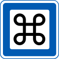
Category:Place of Interest signs
Jump to navigation
Jump to search
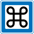
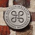
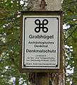
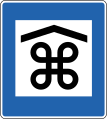
English: Looped square, also known as Place of Interest Sign
Deutsch: Schleifenquadrat, Symbol für Sehenswürdigkeit
- Unicode U+2318
Media in category "Place of Interest signs"
The following 99 files are in this category, out of 99 total.
-
Bad-Schwartau Riesebusch Burg Tafel-2.JPG 2,048 × 1,536; 1.37 MB
-
Baerentafel 2011-09-05.jpg 3,200 × 2,400; 5.08 MB
-
Bodendenkmal Mölln Landwehr.JPG 2,448 × 2,448; 2.52 MB
-
Bordesholm - Brautberg - Informationstafel.jpg 1,530 × 1,014; 623 KB
-
Borg Stegen - Schild.png 3,153 × 2,030; 10.39 MB
-
Burg Havekost - Schild.JPG 1,430 × 967; 576 KB
-
BY road sign 6.15.svg 700 × 1,050; 12 KB
-
Danevirke 12.JPG 1,280 × 960; 354 KB
-
Dannewerk - Ochsenweg - Ochsenweg - Grabhügel a 02 ies.jpg 5,616 × 3,744; 8.37 MB
-
Dannewerk - Ochsenweg - Ochsenweg - Grabhügel Tweebargen 04 ies.jpg 3,744 × 5,616; 9.92 MB
-
Dannewerk - Ochsenweg - Ochsenweg - Grabhügel Tweebargen 05 ies.jpg 5,616 × 3,744; 9.47 MB
-
Dannewerk - Ochsenweg - Ochsenweg - Kograben 03 ies.jpg 5,616 × 3,744; 8.2 MB
-
Den gamle By - Vejskilt.jpg 2,560 × 1,440; 1.62 MB
-
Denmark road sign M52 2b.svg 1,000 × 1,000; 2 KB
-
Denmark road sign M52.svg 1,000 × 1,000; 2 KB
-
Eesti kultuurimälestis embleem.JPG 139 × 137; 5 KB
-
Eesti kultuurimälestis.jpg 936 × 936; 708 KB
-
Estonia road sign 634.svg 776 × 115; 11 KB
-
Estonia road sign 718.svg 601 × 901; 13 KB
-
Finland road sign 716 (1969–2007).svg 3,118 × 2,551; 5 KB
-
Finland road sign 772f (2007–2020).svg 3,118 × 2,551; 5 KB
-
Finland road sign G28.svg 3,189 × 2,622; 5 KB
-
Gemeinde-Blekendorf Grosser-Schlichtenberg - Schild.JPG 2,048 × 1,536; 1.41 MB
-
Gemeinde-Blekendorf Kleiner-Schlichtenberg - Schild-2.JPG 2,048 × 1,536; 1.46 MB
-
Grabhügel im Hellbachtal bei Mölln.JPG 2,448 × 2,448; 1.9 MB
-
Grabhügel Lottbek (Ammersbek).Tafel.ajb.jpg 4,288 × 2,848; 6.33 MB
-
Grabhügel-bei-aukrug-bargfeld-infotafel.jpg 2,592 × 1,944; 1.39 MB
-
Huesby-Steingrab-c.jpg 800 × 600; 168 KB
-
Hólsfjallavegur (Road 864) 1.jpg 3,648 × 2,736; 3.63 MB
-
Højene 01.JPG 2,560 × 1,920; 1.88 MB
-
Hügelgrab Appen 01.jpg 1,232 × 1,355; 661 KB
-
Iceland road sign E02.59.svg 601 × 671; 52 KB
-
Iceland road sign E02.61.svg 601 × 671; 52 KB
-
Kakoehl - Megalithgraeber Kakoehl - Schild.JPG 1,184 × 745; 410 KB
-
Keila-Joa teeviit 2014.jpg 3,005 × 1,997; 2.88 MB
-
Kreis-Ostholstein Katzburg Schild.JPG 1,749 × 1,155; 918 KB
-
Kreis-Ploen Grosssteingraeber Ruserberg Schild.JPG 1,804 × 1,238; 917 KB
-
Kuressaare-Kuivastu maanteel Kõljala silt.jpg 1,728 × 2,304; 1.3 MB
-
Kärkna lahing.JPG 282 × 212; 14 KB
-
Langholz-Steingrab-06.jpg 800 × 600; 96 KB
-
Lithuania road sign 725.svg 700 × 1,050; 9 KB
-
Lost in Iceland (5714047536).jpg 3,888 × 2,592; 1.03 MB
-
M52 fo.svg 1,000 × 1,000; 2 KB
-
Map marker icon – Nicolas Mollet – Sight – Tourism – Classic.png 32 × 37; 1,004 bytes
-
Map marker icon – Nicolas Mollet – Sight – Tourism – Dark.png 32 × 37; 955 bytes
-
Map marker icon – Nicolas Mollet – Sight – Tourism – Light.png 32 × 37; 904 bytes
-
Map marker icon – Nicolas Mollet – Sight – Tourism – Simple.png 32 × 37; 637 bytes
-
Map marker icon – Nicolas Mollet – Sight – Tourism – White.png 32 × 37; 960 bytes
-
Missunde-Ganggrab-7.jpg 800 × 600; 135 KB
-
Munkwolstrup Arnkiel Park 2.jpg 800 × 600; 97 KB
-
Museo road sign 20180925.jpg 4,592 × 3,448; 7.53 MB
-
Museotie opastekilpi.jpg 600 × 671; 61 KB
-
Muu nähtävyys 772f tunnusosa.svg 1,594 × 1,594; 4 KB
-
National monument sign on the Vääna manor house.jpg 3,120 × 4,160; 1,006 KB
-
NationalmonumentEstonia.jpg 323 × 314; 26 KB
-
NO road sign 640.10.svg 213 × 213; 15 KB
-
Norrboda gammelstad 6.jpg 2,592 × 1,936; 6.75 MB
-
Norwegian-road-sign-640.10-Severdighet.png 35 × 35; 5 KB
-
Norwegian-road-sign-640.10-Severdighet.svg 35 × 35; 8 KB
-
Nähtävyys 716 tunnusosa.svg 1,594 × 1,594; 4 KB
-
Nähtävyys liikennemerkki 20170523.jpg 4,592 × 3,448; 13.59 MB
-
PoI.png 1,800 × 1,800; 75 KB
-
Point of Interest Sign.png 120 × 121; 638 bytes
-
Ranamuseum07.JPG 2,592 × 1,944; 1.2 MB
-
Ratekau - Steinkiste von Ratekau - Schild.jpg 1,622 × 1,073; 777 KB
-
Ratekau Haeven Schild-Burg-Raeuberkuhle.JPG 559 × 168; 60 KB
-
Ratekau Hobbersdorf Wehranlage Schild.JPG 1,930 × 1,396; 949 KB
-
Ratekau Langbett-Langenrehm Schild-2.JPG 1,278 × 902; 671 KB
-
Ratekau Pansdorf Blocksberg Tafel.JPG 2,048 × 1,536; 1.42 MB
-
Ratekau Pansdorf Grabhügel Tafel.JPG 2,030 × 1,359; 1.23 MB
-
Ratekau Pansdorf Grellberg-Tafel.JPG 1,971 × 1,303; 1.3 MB
-
Ratekau Ruppersdorfer-See Burg Tafel.JPG 1,941 × 1,193; 1.32 MB
-
Rehbergholz Langbett 1 b.jpg 800 × 600; 86 KB
-
Schild Steensburg 05.JPG 3,648 × 2,736; 2.83 MB
-
Schleswig - Margarethenwallstraße - Danewerk 02 ies.jpg 5,616 × 3,744; 8.49 MB
-
Selk - Brekendorfer Landstraße - Königshügel - Hügelgrab 04 ies.jpg 5,616 × 3,744; 6.41 MB
-
Sevärd.svg 241 × 241; 258 bytes
-
Sevärdhet.svg 20 × 20; 5 KB
-
Shield II.png 290 × 353; 44 KB
-
Shield with Saint John's Arms.svg 290 × 353; 6 KB
-
Sign Grabhügel Groß Sarau 01.JPG 3,648 × 2,736; 2.62 MB
-
Sign of The Queen's walkway. Windsor, England.jpg 3,225 × 3,225; 8.29 MB
-
Sign Turun tuomiokirkko crop.jpg 1,272 × 1,765; 583 KB
-
Sign Turun tuomiokirkko.jpg 3,072 × 2,304; 2.44 MB
-
Sign-6248, Dingle Peninsula, Co. Kerry, Ireland.jpg 4,357 × 3,143; 1.75 MB
-
Steenodde Grabhuegel 7992.jpg 1,024 × 768; 415 KB
-
Suelfeld - Alster-Trave-Kanal-schild.jpg 2,817 × 1,972; 1.8 MB
-
Sweden road sign H22.svg 500 × 500; 6 KB
-
Torvsjökvarnar 8 Åsele Lappland.jpg 5,390 × 3,747; 13.93 MB
-
TrakuPilysLithuania.jpg 420 × 269; 42 KB
-
U+2318.svg 16 × 16; 497 bytes
-
Ua 6.24 service-places of interests.svg 190 × 270; 11 KB
-
UA road sign 6.22 (2021).svg 600 × 900; 1 KB
-
Vägskylt Bungemuseet.jpg 3,024 × 4,032; 2.91 MB
-
Wittenwiewerbargschild.jpg 1,600 × 1,200; 1.07 MB
-
Äʹvv Sign, Skoltsamischen Museum in Neiden.jpg 4,166 × 3,125; 4.42 MB


