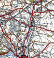
Category:Pickle Bridge Line
Jump to navigation
Jump to search
disused railway in West Yorkshire, England | |||||
| Upload media | |||||
| Instance of | |||||
|---|---|---|---|---|---|
| Location |
| ||||
| |||||
The Pickle Bridge Line, originally of the Lancashire and Yorkshire Railway, connected Pickle Bridge Junction near the former Wyke & Norwood Green station and Anchor Pit Junction near Clifton in West Yorkshire.
Subcategories
This category has the following 5 subcategories, out of 5 total.
Media in category "Pickle Bridge Line"
The following 35 files are in this category, out of 35 total.
-
Pickle Bridge line.png 1,608 × 1,414; 1.2 MB
-
Bailiff Bridge Birkby Lane Bridge-by-Betty-Longbottom.jpg 640 × 505; 58 KB
-
Bailiff Bridge Station site of 1764486 ffe9527d.jpg 640 × 345; 90 KB
-
Benchmark on the railway bridge on Birkby Lane - geograph.org.uk - 2849526.jpg 3,072 × 2,304; 1.34 MB
-
Birkhouse Lane, Clifton - geograph.org.uk - 260587.jpg 640 × 480; 102 KB
-
Bridge abutment, Rastrick - geograph.org.uk - 348152.jpg 640 × 480; 159 KB
-
Bridge notice at Bailiff Bridge.jpg 3,024 × 4,032; 4.76 MB
-
Calderdale Way Footpath Beside Former Railway Line - geograph.org.uk - 4193976.jpg 3,000 × 4,000; 3.38 MB
-
Disused Bailiffe Bridge Branch Line - geograph.org.uk - 5890038.jpg 5,184 × 3,456; 6.87 MB
-
Disused railway at Bailiff Bridge - geograph.org.uk - 2936065.jpg 2,000 × 1,500; 1.79 MB
-
Footbridge over disused railway, Bailiff Bridge - geograph.org.uk - 2936073.jpg 2,000 × 1,500; 1.51 MB
-
Former Rail Bridge on Birkhouse Road - geograph.org.uk - 5162230.jpg 1,600 × 1,065; 858 KB
-
Former rail bridge on Thornhills Beck Lane, Brighouse - geograph.org.uk - 5162073.jpg 1,600 × 1,065; 740 KB
-
Line of disused railway over Birkby lane bridge - geograph.org.uk - 2849543.jpg 3,072 × 2,304; 1.1 MB
-
Pickle Bridge Line from OS map 1945.png 463 × 498; 620 KB
-
Railway bridge on Birkby Lane - geograph.org.uk - 2849535.jpg 3,072 × 2,304; 1.08 MB
-
Remains of railway boundary wall, Clifton - geograph.org.uk - 758796.jpg 640 × 480; 157 KB
-
Retaining wall, Thornhills Beck Lane, Clifton - geograph.org.uk - 6446184.jpg 1,994 × 2,000; 1.75 MB
-
Soap Works, River Street, Rastrick - geograph.org.uk - 348144.jpg 640 × 473; 68 KB
-
Under the railway arch, Oak Hill Wood, Brighouse - geograph.org.uk - 6444639.jpg 2,000 × 1,500; 1.5 MB
-
View from Till Carr Lane, Lightcliffe - geograph.org.uk - 64925.jpg 640 × 480; 139 KB


