Category:Photos from Panoramio ID 6707007
Jump to navigation
Jump to search

Media in category "Photos from Panoramio ID 6707007"
The following 128 files are in this category, out of 128 total.
-
 A10 folowing the banks of the Flakstadtpollen bay. - panoramio.jpg 10,470 × 3,126; 3.17 MB
-
 Airconditioning - panoramio.jpg 3,573 × 2,341; 1.48 MB
-
 Bark Bay - panoramio.jpg 3,840 × 848; 1.92 MB
-
 Bark bay lagune - panoramio (1).jpg 4,896 × 3,264; 6.16 MB
-
 Bark bay lagune - panoramio (2).jpg 4,896 × 3,264; 5.9 MB
-
 Bark bay lagune - panoramio (3).jpg 4,896 × 3,264; 5.66 MB
-
 Bark bay lagune - panoramio.jpg 4,896 × 3,672; 7.03 MB
-
 Bridge on road to Atske ( 15 Km walk ) - panoramio.jpg 5,184 × 3,456; 8.45 MB
-
 Creek near The Copeland river - panoramio (1).jpg 4,896 × 3,672; 6.7 MB
-
 Creek near The Copeland river - panoramio.jpg 4,896 × 3,672; 4.57 MB
-
 Crystal clear water - panoramio.jpg 5,184 × 3,456; 7.72 MB
-
 Duck pond near Hakataramea Valley Rd - panoramio.jpg 4,896 × 2,752; 4.68 MB
-
 Easy access to the Lysefjord on the opposing side of Preikestolen - panoramio.jpg 5,184 × 3,456; 12.35 MB
-
 End of the road to Å - panoramio.jpg 5,184 × 3,456; 5.25 MB
-
 Evening at Silverfallet - panoramio.jpg 5,184 × 3,456; 5.45 MB
-
 Evening sun near Silverfallet - panoramio (1).jpg 5,184 × 3,456; 5.18 MB
-
 Evening sun near Silverfallet - panoramio.jpg 5,184 × 3,456; 5.42 MB
-
 Fantail Fall - panoramio.jpg 3,000 × 4,000; 3.56 MB
-
 Ferntree near lake wilkie - panoramio (1).jpg 3,264 × 4,896; 5.86 MB
-
 Ferntree near lake wilkie - panoramio.jpg 3,672 × 4,896; 5.94 MB
-
 Flagstad Pollen - panoramio.jpg 14,955 × 3,277; 4.16 MB
-
 Flakstad "lagune" - panoramio.jpg 5,184 × 3,456; 5.12 MB
-
 Flakstad pollen - panoramio (1).jpg 5,184 × 3,456; 9.56 MB
-
 Flakstad pollen - panoramio.jpg 5,184 × 3,456; 8.46 MB
-
 Haast beach - panoramio (1).jpg 4,896 × 3,672; 6.69 MB
-
 Haast beach - panoramio.jpg 4,896 × 3,672; 6.95 MB
-
 Haugabreen falls looking down - panoramio.jpg 6,802 × 5,907; 8.87 MB
-
 Hay People Kurow December 2013 - panoramio.jpg 4,896 × 3,672; 3.22 MB
-
 Heritage Court Motor Lodge in Kaikoura - panoramio.jpg 7,536 × 856; 2.34 MB
-
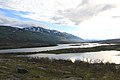
 Hooker Lake - panoramio.jpg 3,568 × 848; 1.31 MB
-
 Kea near the Welcome Flat Hut - panoramio.jpg 4,896 × 3,264; 2.93 MB
-
 Kea near The Welcome Flat Hut - panoramio.jpg 4,896 × 3,264; 4.65 MB
-
 Kubholmleia and Røssøystraumen bridges.jpg 5,184 × 3,456; 5.12 MB
-
 Kurow, home of All Black captain Richie McCaw. - panoramio.jpg 2,560 × 1,712; 2.54 MB
-
 Lake - panoramio (71).jpg 5,184 × 3,456; 7.37 MB
-
 Lake Elterwater - panoramio.jpg 5,920 × 856; 2.18 MB
-
 Lake Hawea - panoramio (1).jpg 4,000 × 3,000; 4.83 MB
-
 Lake Pukaki - panoramio (6).jpg 3,632 × 848; 703 KB
-
 Lake Wilkie - panoramio.jpg 4,896 × 3,672; 6.44 MB
-
 Laksforsen - panoramio (1).jpg 11,280 × 4,025; 4.82 MB
-
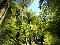 Large tree fern - panoramio.jpg 4,896 × 3,672; 5.27 MB
-
 McLean Falls looking down - panoramio.jpg 4,896 × 3,672; 6.14 MB
-
 McLean Falls seen from the top - panoramio.jpg 4,896 × 3,672; 5.64 MB
-
 McLean Falls, river before the falls - panoramio.jpg 4,896 × 3,672; 5.17 MB
-
 Melting snow in the evening light - panoramio.jpg 5,184 × 3,456; 5.9 MB
-
 Monro Beach - panoramio.jpg 8,000 × 856; 2.3 MB
-
 Moreaki Bolder - panoramio.jpg 4,896 × 3,672; 6.95 MB
-
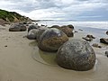 Moreaki Bolders - panoramio (1).jpg 4,896 × 3,672; 6.32 MB
-
 Moreaki Bolders - panoramio (2).jpg 4,896 × 3,672; 6.93 MB
-
 Moreaki Bolders - panoramio.jpg 4,896 × 3,672; 6.65 MB
-
 Mount Burke - panoramio (1).jpg 4,896 × 3,672; 6.54 MB
-
 Mount Burke - panoramio.jpg 4,000 × 3,000; 4.13 MB
-
 Mount Cook seen from Sealy Tarns track - panoramio.jpg 3,672 × 4,896; 4.91 MB
-
 Mount Sefton glacier seen from Sealy Tarns track - panoramio.jpg 4,896 × 3,672; 6.89 MB
-
 Near Kiruna - panoramio (1).jpg 5,184 × 3,456; 8.06 MB
-
 Near Kiruna - panoramio.jpg 5,184 × 3,456; 6.63 MB
-
 Near Monro Beach - panoramio (1).jpg 3,264 × 4,896; 2.11 MB
-
 Near Monro Beach - panoramio.jpg 4,896 × 3,672; 2.3 MB
-
 Near Narvik - panoramio.jpg 5,184 × 3,456; 6.09 MB
-
 Near Silverfallet - panoramio (1).jpg 5,184 × 3,456; 7.68 MB
-
 Near Silverfallet - panoramio (2).jpg 5,184 × 3,456; 5 MB
-
 Near Silverfallet - panoramio.jpg 5,184 × 3,456; 5.51 MB
-
 Nigardsbreen - panoramio (2).jpg 5,184 × 3,456; 8.46 MB
-
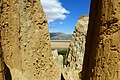 Omarama clay cliffs - panoramio.jpg 2,560 × 1,712; 2.77 MB
-
 On road 63 to Geiranger - panoramio.jpg 5,184 × 3,456; 6.18 MB
-
 On the road to Geianger - panoramio.jpg 5,184 × 3,456; 6.51 MB
-
 On the road to Nusfjord - panoramio.jpg 5,184 × 3,456; 7.69 MB
-
 Parking at Silverfallet - panoramio.jpg 5,184 × 3,456; 5.71 MB
-
 Parking near Aktse - panoramio.jpg 5,184 × 3,456; 9.58 MB
-
 Porarari river - panoramio.jpg 4,896 × 3,264; 4.35 MB
-

-
 Rain forest near Monroe Beach - panoramio (1).jpg 1,104 × 1,520; 863 KB
-
 Rain forest near Monroe Beach - panoramio (2).jpg 4,896 × 3,264; 4.97 MB
-
 Rain forest near Monroe Beach - panoramio (3).jpg 4,896 × 3,264; 6.56 MB
-
 Rain forest near Monroe Beach - panoramio.jpg 4,896 × 3,264; 6.26 MB
-
 Rainbow Isles - panoramio.jpg 4,896 × 3,672; 2.72 MB
-
 Rapa Valley "road" to Skierfe - panoramio.jpg 5,184 × 3,456; 5.59 MB
-
 Rapa Valley - panoramio.jpg 5,184 × 3,456; 5.39 MB
-
 Reine - panoramio (4).jpg 5,184 × 3,456; 5.02 MB
-
 Remaining snow , in the background Smørstabbreen - panoramio.jpg 5,184 × 3,456; 6.37 MB
-
 Remaining snow - panoramio.jpg 5,184 × 3,456; 6.43 MB
-
 Road 63 to Geiranger - panoramio.jpg 5,184 × 3,456; 7.8 MB
-
 Road to Monroe Beach - panoramio.jpg 1,072 × 1,304; 659 KB
-
 Rombak Bridge Narvik.jpg 5,184 × 3,456; 3.01 MB
-
 Save to walk on - panoramio.jpg 5,184 × 3,456; 5.6 MB
-
 Sea kayak, Bark Bay - panoramio.jpg 4,896 × 3,264; 5.8 MB
-
 Sea kayak, Te Pukatea Bay - panoramio.jpg 4,896 × 3,264; 6.08 MB
-
 Sealy Tarn , Sealy Tarns track New Zealand - panoramio.jpg 4,896 × 3,672; 7.1 MB
-
 Ship Creek - panoramio (1).jpg 4,896 × 3,672; 3.03 MB
-
 Ship Creek - panoramio (2).jpg 4,896 × 3,672; 2.25 MB
-
 Ship wreck Creek - panoramio.jpg 7,392 × 856; 2.25 MB
-
 Skierfe - panoramio (1).jpg 5,184 × 3,456; 4.06 MB
-
 Skierfe - panoramio.jpg 5,184 × 3,456; 4.26 MB
-
 Small river at Tautuku Bay - panoramio.jpg 3,672 × 4,896; 6.13 MB
-
 Smørstabbreen - panoramio (1).jpg 8,097 × 2,871; 2.11 MB
-
 Smørstabbreen - panoramio.jpg 5,151 × 2,566; 2.2 MB
-
 Spengerleira - panoramio.jpg 5,184 × 3,456; 5.38 MB
-
 Station Peak - panoramio.jpg 4,896 × 3,672; 6.3 MB
-
 Station Peak looking South over the Waitaki river - panoramio.jpg 4,896 × 2,752; 5.45 MB
-
 Station Peak looking West over the Waitaki river and Kurow - panoramio.jpg 4,896 × 3,672; 2.51 MB
-
 Storvatnet Napp.jpg 5,184 × 3,456; 5.26 MB
-
 Stuga (house) at Jokkmokk Camping Center - panoramio.jpg 5,184 × 3,456; 11.19 MB
-
 Tautuku Bay - panoramio (1).jpg 4,896 × 3,672; 5.92 MB
-
 Tautuku Bay looking at the Rainbow Isles - panoramio (1).jpg 4,896 × 3,264; 2.67 MB
-
 Tautuku Bay looking at the Rainbow Isles - panoramio.jpg 4,896 × 3,672; 2.72 MB
-
 The Copeland river - panoramio (1).jpg 4,896 × 3,672; 6.56 MB
-
 The Copeland river - panoramio (2).jpg 4,896 × 3,672; 6.38 MB
-
 The Copeland river - panoramio.jpg 4,896 × 3,672; 7.05 MB
-
 The Copeland track - panoramio (1).jpg 4,896 × 3,672; 3.99 MB
-
 The Copeland track - panoramio (2).jpg 4,896 × 3,672; 5.39 MB
-
 The Copeland track - panoramio (3).jpg 4,896 × 3,672; 5.71 MB
-
 The Copeland track - panoramio.jpg 4,896 × 3,672; 7.01 MB
-
 The Copeland track, Copeland river - panoramio.jpg 4,896 × 3,672; 6.91 MB
-
 The Copeland track, Kea near the Welcome Flat Hut. - panoramio.jpg 4,896 × 3,264; 4.79 MB
-
 The Stave Church ( Stavkyrkje) of Urnes - panoramio.jpg 5,047 × 5,721; 3.78 MB
-
 The Stave Church ( Stavkyrkje) of Urnes.jpg 5,184 × 3,456; 7.86 MB
-
 Tonga Bay - panoramio.jpg 4,896 × 3,672; 6.72 MB
-
 Tonga Island - panoramio.jpg 4,896 × 3,672; 6.61 MB
-
 Tree at Boundary Creek - panoramio.jpg 3,672 × 4,896; 5.55 MB
-
 Veerhaven Rotterdam - panoramio.jpg 5,184 × 3,456; 10.41 MB
-
 Vestvågøy, Norway - panoramio (2).jpg 5,184 × 3,456; 7.16 MB
-

-
 Welcome Flat Hotpools - panoramio.jpg 4,896 × 3,264; 3.89 MB
-
 Woolshed art , Hakataramea Valley - panoramio.jpg 4,896 × 3,264; 5.6 MB
-
 Woolshed art - panoramio.jpg 4,896 × 3,264; 5.39 MB
-
 Å - panoramio (1).jpg 5,184 × 3,456; 5.12 MB
-
 Å - panoramio (2).jpg 5,184 × 3,456; 5.8 MB
-
 Ågvagnet - panoramio.jpg 5,184 × 3,456; 6.29 MB

.jpg)
.jpg)
.jpg)

_-_panoramio.jpg)
.jpg)


.jpg)


.jpg)


.jpg)

.jpg)


.jpg)
.jpg)


.jpg)
.jpg)

.jpg)


.jpg)

.jpg)


.jpg)
.jpg)

.jpg)


.jpg)
.jpg)
.jpg)


.jpg)


.jpg)
.jpg)
.jpg)


_at_Jokkmokk_Camping_Center_-_panoramio.jpg)
.jpg)
.jpg)

.jpg)
.jpg)

.jpg)
.jpg)
.jpg)


_of_Urnes_-_panoramio.jpg)
_of_Urnes.jpg)


.jpg)


.jpg)
.jpg)

.jpg)
.jpg)
_Friday,_July_04_2014_-_panoramio.jpg)
.jpg)