Category:Photos from Panoramio ID 202223
Jump to navigation
Jump to search

Media in category "Photos from Panoramio ID 202223"
The following 200 files are in this category, out of 288 total.
(previous page) (next page)-
 , Cajon del Maipo, Chile - panoramio.jpg 1,466 × 1,054; 1.17 MB
-
 A 10 kmt de Torres del Paine - panoramio.jpg 2,288 × 1,712; 1.8 MB
-
 Aguas Tranquilas , en Castro, Chiloe - panoramio.jpg 2,288 × 1,712; 1.62 MB
-
 Almacen museo de Porvenir Estrecho de Magallanes - panoramio.jpg 2,288 × 1,712; 1.77 MB
-
 Alto Macul, Santiago ,Chile - panoramio.jpg 2,288 × 1,712; 1.67 MB
-
 Alto Macul, Santiago Chile - panoramio.jpg 2,288 × 1,712; 1.46 MB
-
 Anakena - panoramio.jpg 2,288 × 1,712; 1.99 MB
-
 Anakena Beach, Easter islan - panoramio.jpg 2,287 × 1,679; 856 KB
-
 Ancud, Los Lagos Region, Chile - panoramio (1).jpg 2,288 × 1,712; 2.55 MB
-
 Ancud, Los Lagos Region, Chile - panoramio (2).jpg 2,288 × 1,712; 2.32 MB
-
 Ancud, Los Lagos Region, Chile - panoramio (3).jpg 2,283 × 1,496; 2.5 MB
-
 Ancud, Los Lagos Region, Chile - panoramio (4).jpg 2,288 × 1,712; 2.3 MB
-
 Ancud, Los Lagos Region, Chile - panoramio (5).jpg 2,285 × 1,149; 1.83 MB
-
 Ancud, Los Lagos Region, Chile - panoramio.jpg 2,116 × 1,409; 2.69 MB
-
 Arribando a Peulla, final lago Todos los Santos, Chile - panoramio.jpg 3,072 × 1,728; 2.75 MB
-
 Artesania de Rapanui - panoramio.jpg 2,288 × 1,712; 2.46 MB
-
 Artesania, Easter Islan - panoramio.jpg 2,288 × 1,712; 2.58 MB
-
 Atardecer en , Santiago Chile - panoramio.jpg 2,288 × 1,712; 1.67 MB
-
 Atardecer en Pixi - panoramio.jpg 2,288 × 1,712; 1.51 MB
-
 Avenida en Altomacul - panoramio.jpg 1,600 × 1,200; 1.86 MB
-
 Avenida, Comuna de Porvenir, Magallanes, Chile - panoramio.jpg 2,288 × 1,712; 2.6 MB
-
 Aysén Florido - panoramio (1).jpg 4,608 × 3,456; 9.04 MB
-
 Aysén Florido - panoramio.jpg 4,608 × 3,456; 12.65 MB
-
 Bahia azul IV Region Chile - panoramio.jpg 2,288 × 1,712; 2.27 MB
-
 Banderas, Parque O'Higgins, Santiago de Chile - panoramio.jpg 1,712 × 2,288; 1.84 MB
-
 Barcaza navega por canal frente a isla traiguen - panoramio.jpg 2,288 × 1,712; 802 KB
-
 Barcos en el Estrecho de Magallanes - panoramio (1).jpg 2,288 × 1,712; 1.77 MB
-
 Barcos en el Estrecho de Magallanes - panoramio.jpg 2,288 × 1,712; 1.66 MB
-
 Belleza rapanui - panoramio.jpg 1,712 × 2,288; 788 KB
-
 Bosque de Lengas, Estrecho de Magallanes - panoramio.jpg 2,288 × 1,712; 2.81 MB
-
 Bosque nativo en Isla Aucar, Chiloe, Chile - panoramio.jpg 2,288 × 1,466; 787 KB
-
 Busto Garolfo Centro - panoramio (1).jpg 1,536 × 2,048; 410 KB
-
 Busto Garolfo Centro - panoramio (2).jpg 1,958 × 1,123; 339 KB
-
 Busto Garolfo Centro - panoramio (3).jpg 1,536 × 2,048; 339 KB
-
 Busto Garolfo Centro - panoramio (4).jpg 2,048 × 1,536; 510 KB
-
 Busto Garolfo Centro - panoramio (5).jpg 1,318 × 1,563; 260 KB
-
 Busto Garolfo Centro - panoramio.jpg 2,048 × 1,536; 374 KB
-
 Busto garolfo centro - panoramio.jpg 1,536 × 2,048; 401 KB
-
 Cajon del Maipo, Chile - panoramio.jpg 800 × 599; 321 KB
-
 Caleta piñihuil, Ancud, Chiloe - panoramio.jpg 2,247 × 1,313; 677 KB
-
 Caleta Piñihuil. Ancud - panoramio.jpg 2,288 × 1,177; 653 KB
-
 Calle de Porvenir Estrecho de Magallanes - panoramio (1).jpg 2,288 × 1,432; 1.77 MB
-
 Calle de Porvenir Estrecho de Magallanes - panoramio.jpg 2,194 × 1,375; 2.18 MB
-
 Calle Jorge Shitte, Porvenir - panoramio.jpg 2,288 × 1,712; 1.94 MB
-
 Camino Anakena beach - panoramio.jpg 2,288 × 1,712; 1.09 MB
-
 Camion de los pioneros ,museo de Porvenir Estrecho de Magallanes - panoramio.jpg 2,288 × 1,712; 2.34 MB
-
 Canal frente a 5 hermanas, desde Pto chacabuco - panoramio.jpg 4,608 × 3,456; 8.38 MB
-
 Casa de Porvenir Estrecho de Magallanes - panoramio.jpg 2,288 × 1,712; 2.21 MB
-
 Casa nuevas, Alto Macul 2010 - panoramio.jpg 2,288 × 1,712; 1.32 MB
-
 Casita de Ensenada, Iv Region, Chile - panoramio.jpg 1,280 × 960; 864 KB
-
 Castro, Chiloe - panoramio.jpg 2,129 × 1,115; 1.87 MB
-
 Catamaran navegando por laguna SanRafael, Aysen , Chile - panoramio.jpg 4,608 × 2,361; 6.8 MB
-
 Catamaran saliendo a laguna SanRafael, Aysen , Chile - panoramio.jpg 4,608 × 3,456; 6.55 MB
-
 Caulin bajo, Isla de Chiloe - panoramio.jpg 3,932 × 2,273; 4.33 MB
-
 Caulin. Iglesia en Chiloe - panoramio.jpg 4,288 × 2,416; 4.49 MB
-
 Caverna del Milodon, Puerto natales, Chile - panoramio.jpg 2,278 × 1,429; 2.21 MB
-
 Cerro Castillo, Pto Natales, camino a Parque Torres del Paine - panoramio.jpg 2,288 × 1,712; 2.81 MB
-
 Cerro Concepcion, valparaiso, Chile - panoramio (1).jpg 1,920 × 2,560; 490 KB
-
 Cerro Concepcion, valparaiso, Chile - panoramio (2).jpg 1,809 × 2,274; 1.51 MB
-
 Cerro Concepcion, valparaiso, Chile - panoramio (3).jpg 1,830 × 2,210; 996 KB
-
 Cerro Concepcion, valparaiso, Chile - panoramio (4).jpg 2,560 × 1,920; 895 KB
-
 Cerro Concepcion, valparaiso, Chile - panoramio (5).jpg 2,556 × 1,825; 1.42 MB
-
 Cerro Concepcion, valparaiso, Chile - panoramio (6).jpg 1,890 × 2,280; 1.43 MB
-
 Cerro Concepcion, valparaiso, Chile - panoramio.jpg 2,560 × 1,920; 1.55 MB
-
 Cerro Sombrero, Tierra del Fuego - panoramio.jpg 4,261 × 2,135; 4.35 MB
-
 Cerros de Guanguali, al interior de quilimari, Iv Region, Chile - panoramio (1).jpg 2,288 × 1,712; 2.28 MB
-
 Cerros de Guanguali, al interior de quilimari, Iv Region, Chile - panoramio.jpg 2,288 × 1,712; 2.04 MB
-
 Chonchi, X Región, Chile - panoramio (2).jpg 3,691 × 2,056; 3.18 MB
-
 Cisnes cuello ngro, Chacao,Chiloe - panoramio.jpg 2,288 × 1,712; 2.44 MB
-
 Cisnes de cuello negro, Puerto Natales, Chile - panoramio.jpg 1,069 × 666; 461 KB
-
 Coquimbo Iv Region Chile - panoramio.jpg 1,280 × 960; 532 KB
-
 Coquimbo, barrio Inglés - panoramio.jpg 1,280 × 960; 641 KB
-
 Corderos, Aysén Florido - panoramio.jpg 4,369 × 3,197; 8.8 MB
-
 Cordillera nevada Alto Macul I - panoramio.jpg 2,288 × 1,712; 1.45 MB
-
 Cordillera nevada Alto Macul II - panoramio.jpg 1,782 × 1,162; 1.19 MB
-
 Cordillera nevada Alto Macul III - panoramio.jpg 2,288 × 1,712; 1.85 MB
-
 Cordillera nevada Alto Macul IV - panoramio.jpg 2,288 × 1,712; 1.83 MB
-
 Costanera de Ancud, Chiloe, Chile - panoramio (1).jpg 2,288 × 1,712; 2.25 MB
-
 Costanera de Ancud, Chiloe, Chile - panoramio.jpg 2,100 × 1,432; 2.64 MB
-
 Costanera, de Porvenir Estrecho de Magallanes - panoramio.jpg 2,288 × 1,712; 1.93 MB
-
 Cruzando el canal en Dalcahue, Chile - panoramio.jpg 2,288 × 1,712; 2.29 MB
-
 Delfines., Estrecho de Magallanes - panoramio.jpg 1,847 × 1,151; 1.8 MB
-
 Dimeglio Busto Garolfo - panoramio.jpg 2,048 × 1,536; 512 KB
-
 Easter Island - Anakena - panoramio (1).jpg 2,288 × 1,712; 2.13 MB
-
 Easter Island - Anakena - panoramio.jpg 2,288 × 1,712; 1.85 MB
-
 El ingenio chile cajon del maipo - panoramio.jpg 100 × 75; 2 KB
-
 EL iNGENIO, Cajon del Maipo, Chile - panoramio.jpg 2,288 × 1,712; 1.45 MB
-
 Encuadre natural - panoramio.jpg 1,253 × 940; 919 KB
-
 Entrada a puerto embarque, Porvenir Estrecho de Magallanes - panoramio.jpg 2,061 × 1,289; 1.77 MB
-
 Entrada a Puerto Porvenir Estrecho de Magallanes - panoramio.jpg 2,242 × 1,397; 1.72 MB
-
 Entrada Alto Macul, Santiago ,Chile - panoramio.jpg 2,288 × 1,712; 2.42 MB
-
 Entrando a , Porvenir Estrecho de Magallanes - panoramio.jpg 2,288 × 1,423; 1.92 MB
-
 Entrando al Parque O'Higgins, Santiago de Chile - panoramio.jpg 2,288 × 1,712; 2.46 MB
-
 Estancia de ovinos, sala esquila - panoramio.jpg 2,288 × 1,712; 1.81 MB
-
 Estrecho de Magallanes - panoramio (1).jpg 2,288 × 1,712; 1.72 MB
-
 Estrecho de Magallanes - panoramio.jpg 2,288 × 1,712; 2.65 MB
-
 Estrecho de Magallanes,Punta Arenas, Chile - panoramio.jpg 2,257 × 1,403; 2.39 MB
-
 Familias de Milodones, Pintura del lugar, caverna del Milodon - panoramio.jpg 2,288 × 1,712; 1.61 MB
-
 Faro en Ensenada , IV Region , Chile - panoramio.jpg 1,280 × 960; 413 KB
-
 Frutillar, X Región, Chile - panoramio (1).jpg 3,072 × 1,728; 2.83 MB
-
 Fuerte Chaicura 39, Ancud, X Región, Chile - panoramio.jpg 2,288 × 1,712; 2.19 MB
-
 Gansos, Porvenir Estrecho de Magallanes - panoramio.jpg 1,828 × 1,139; 2.01 MB
-
 Glaciar San Rafael, Aysen Chile - panoramio (1).jpg 2,392 × 1,100; 1.69 MB
-
 Glaciar San Rafael, Aysen Chile - panoramio.jpg 4,608 × 3,456; 9.89 MB
-
 Gravedad cero - panoramio.jpg 2,288 × 1,712; 828 KB
-
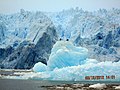
 Hielo de glaciares - panoramio.jpg 4,608 × 3,456; 9.67 MB
-
 Hielo milenario del glaciares - panoramio.jpg 4,608 × 3,456; 9.1 MB
-
 Higuerillas, Valparaiso, Chile - panoramio.jpg 1,600 × 1,200; 903 KB
-
 Horses de quilin - panoramio.jpg 1,898 × 1,422; 2.14 MB
-
 Hotel Faros del Sur, Ancud - panoramio.jpg 2,288 × 1,712; 2.12 MB
-
 Hotel Hanga Roa ocupped by Hito clan ,Rapànui - panoramio.jpg 2,034 × 1,142; 1.14 MB
-
 Huanacos Torres del Paine - panoramio.jpg 1,948 × 1,217; 2.23 MB
-
 ICEBERG LAGUNA SAN RAFAEL - panoramio.jpg 1,280 × 960; 671 KB
-
 Iceberg por canales a Laguna San Rafael - panoramio.jpg 4,608 × 3,456; 4.25 MB
-
 Iglesia de isla Aucar, Chiloe - panoramio.jpg 2,264 × 1,428; 2.17 MB
-
 Iglesia de Puerto natales, Chile - panoramio (1).jpg 2,288 × 1,712; 1.97 MB
-
 Iglesia de Puerto natales, Chile - panoramio.jpg 2,288 × 1,712; 2.15 MB
-
 Iglesia pto porvenir frente plaza - panoramio.jpg 2,288 × 1,712; 2.5 MB
-
 Invierno en Santiago de Chile - panoramio.jpg 2,288 × 1,712; 3.08 MB
-
 Isla Aucar, Chiloe, Chile - panoramio.jpg 2,288 × 1,712; 732 KB
-
 Isla Esmerakda, Lago de Todos Los Santos, Chile - panoramio.jpg 3,072 × 1,728; 2.6 MB
-
 Islotes Rapanui - panoramio.jpg 1,499 × 1,122; 775 KB
-
 Jardines en Ancud, Chiloe, Chile - panoramio.jpg 2,288 × 1,712; 2.14 MB
-
 La Ciudad sobre el campo, Macul, Santiago Chile - panoramio.jpg 2,288 × 1,712; 2.61 MB
-
 Ladera volcan Rano kau - panoramio.jpg 2,288 × 1,712; 1.85 MB
-
 Lago de Todos Los Santos, Chile - panoramio (1).jpg 3,072 × 1,728; 2.41 MB
-
 Lago de Todos Los Santos, Chile - panoramio.jpg 3,072 × 1,728; 2.24 MB
-
 Lago Gral Carrera y Pto Ibañez - panoramio.jpg 2,288 × 1,712; 796 KB
-
 Lago Grey embarcadero - panoramio.jpg 2,288 × 1,712; 1.92 MB
-
 Lago Grey y Torres del Paine - panoramio (1).jpg 2,288 × 1,712; 2.44 MB
-
 Lago Grey y Torres del Paine - panoramio (2).jpg 2,288 × 1,712; 2.04 MB
-
 Lago Grey y Torres del Paine - panoramio (3).jpg 2,288 × 1,712; 1.92 MB
-
 Lago Grey y Torres del Paine - panoramio.jpg 2,288 × 1,712; 2.25 MB
-
 Lago Pehoe y Torres del Paine - panoramio (1).jpg 2,087 × 1,300; 2.06 MB
-
 Lago Pehoe y Torres del Paine - panoramio (2).jpg 2,288 × 1,712; 1.79 MB
-
 Lago Pehoe y Torres del Paine - panoramio.jpg 2,288 × 1,712; 2.1 MB
-
 Lago Riesco, Aysen - panoramio.jpg 4,608 × 2,899; 6.05 MB
-
 Lago Toro y cordillera Ultima Esperanza, Pto Natales - panoramio.jpg 2,288 × 1,712; 2.15 MB
-
 Lago y Torres del Paine - panoramio.jpg 2,288 × 1,712; 1.81 MB
-
 Laguna San Rafael - panoramio.jpg 1,280 × 804; 374 KB
-
 Laguna San Rafael, aysen chile - panoramio.jpg 1,979 × 1,237; 1.44 MB
-
 Liceo, de Porvenir, Estrecho de Magallanes - panoramio.jpg 2,164 × 1,355; 2.26 MB
-
 Llanquihue, X Región, Chile - panoramio.jpg 3,072 × 2,304; 4.29 MB
-
 LLegada a Calle de Porvenir Estrecho de Magallanes - panoramio.jpg 2,288 × 1,712; 2.24 MB
-
 LLegando A Tierra del Fuego, Magallanes, Chile - panoramio.jpg 2,288 × 1,712; 2.39 MB
-
 Los Primeros habitantes - panoramio.jpg 2,288 × 1,712; 2.42 MB
-
 LOs Vilos - panoramio.jpg 1,280 × 960; 805 KB
-
 Lupines Aysén Florido - panoramio.jpg 4,566 × 3,300; 11.74 MB
-
 Majestuosa es la blanca montaña. desde alto Macul - panoramio.jpg 2,288 × 1,712; 1.79 MB
-
 Manualidades de rapanui - panoramio.jpg 2,288 × 1,712; 2.01 MB
-
 Marineras Back 1 - panoramio.jpg 1,716 × 1,285; 1.06 MB
-
 Marineras Back 2 - panoramio.jpg 1,700 × 1,273; 1.36 MB
-
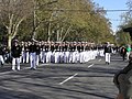
 Marineras en Parque O'Higgins, Santiago de Chile - panoramio.jpg 2,288 × 1,712; 2.52 MB
-
 Marineras front 1 - panoramio.jpg 1,243 × 930; 780 KB
-
 Marineras front 2 - panoramio.jpg 2,230 × 1,466; 1.69 MB
-
 Marinos Chilotes ,descienden de los Indios Chonos, Quemchi, Chiloe - panoramio.jpg 2,109 × 1,370; 548 KB
-
 Marinos en Parque O'Higgins, Santiago de Chile - panoramio.jpg 2,288 × 1,712; 895 KB
-
 Maunga Orito Hilles, Esaster islan - panoramio.jpg 2,283 × 1,287; 2.9 MB
-
 Mirada alEstrecho de Magallanes - panoramio.jpg 2,288 × 1,712; 2.29 MB
-
 Mirada alEstrecho de Magallanes,Punta Arenas, Chile - panoramio.jpg 2,288 × 1,712; 2.33 MB
-
 Mirando a la montaña, Alto Macul 2010 - panoramio.jpg 1,762 × 960; 819 KB
-
 Mirando a Santiago dede, Alto Macul 2010 - panoramio.jpg 2,272 × 1,231; 1.08 MB
-
 Mirando hacia el Este de rapanui - panoramio.jpg 2,288 × 1,712; 1.91 MB
-
 Muelle viejo, Los Vilos - panoramio.jpg 888 × 592; 313 KB
-
 Nahia Mansa. Estrecho de Magallanes - panoramio.jpg 2,288 × 1,712; 1.87 MB
-
 Natales, Región de Magallanes y de la Antártica Chilena, Chile - panoramio.jpg 3,072 × 2,304; 4.91 MB
-
 Navega en laguna San Rafael - panoramio.jpg 4,608 × 3,456; 9.71 MB
-
 Navegando a laguna san rafael de aysen - panoramio.jpg 2,288 × 1,712; 758 KB
-
 Orongo piko - panoramio (1).jpg 2,288 × 1,712; 1.66 MB
-
 Orongo piko - panoramio.jpg 2,288 × 1,712; 778 KB
-
 Palacio de La Moneda, Santiago de Chile - panoramio.jpg 2,288 × 1,712; 1.82 MB
-
 Palafitos de Castro, Chiloe - panoramio.jpg 2,274 × 1,539; 2.15 MB
-
 Palmeras del Parque O´Higgins, Santiago de Chile - panoramio.jpg 1,681 × 2,052; 2.25 MB
-
 Parque Alto Macul, La florida, santiago, chile - panoramio (1).jpg 2,719 × 1,400; 2.12 MB
-
 Parque Alto Macul, La florida, santiago, chile - panoramio (2).jpg 2,694 × 1,695; 3.34 MB
-
 Parque Alto Macul, La florida, santiago, chile - panoramio (3).jpg 3,047 × 1,354; 2.78 MB
-
 Parque Alto Macul, La florida, santiago, chile - panoramio.jpg 3,043 × 1,560; 2.64 MB
-
 Parque Ayken , Aysen - panoramio.jpg 4,608 × 3,456; 7.45 MB
-
 Parque Ayken, Aysén Florido - panoramio.jpg 4,494 × 2,844; 11.43 MB
-
 Parque Botanico en Isla Aucar, Chiloe - panoramio (1).jpg 2,278 × 1,689; 753 KB
-
 Parque Botanico en Isla Aucar, Chiloe - panoramio.jpg 2,288 × 1,624; 851 KB
-
 Parque Nacional de Chiloe - panoramio (1).jpg 2,288 × 1,712; 2.22 MB
-
 Parque Nacional de Chiloe - panoramio.jpg 2,271 × 1,331; 2.13 MB
-
 Parque O'Higgins Bicentenario 2010 - panoramio.jpg 2,288 × 1,712; 2.8 MB
-
 Parque O'Higgins, Santiago de Chile - panoramio.jpg 2,288 × 1,712; 1.29 MB
-
 Parque O´Higgins,2010, Santiago de Chile - panoramio.jpg 2,146 × 1,331; 2.03 MB
-
 Parque Viña Cousiño Macul - panoramio.jpg 2,270 × 1,486; 1.97 MB
-
 Paso del medio , canales de Aysen - panoramio.jpg 4,608 × 3,456; 9.52 MB
-
 Patagonia Chilena rumbo a Punta Arenas Chile - panoramio.jpg 3,072 × 2,304; 4.89 MB
-
 Pato en Caleta Piñihuil. Ancud - panoramio.jpg 2,173 × 1,282; 1.89 MB
-
 Pesqueros en Puerto de Coquimbo - panoramio.jpg 640 × 480; 176 KB
-
 Peulla, final lago Todos los Santos, Chile - panoramio (1).jpg 2,838 × 1,540; 3.39 MB
-
 Peulla, final lago Todos los Santos, Chile - panoramio (3).jpg 3,072 × 1,728; 3.91 MB
-
 Peulla, final lago Todos los Santos, Chile - panoramio (4).jpg 3,072 × 1,728; 3.97 MB
-
 Peulla, final lago Todos los Santos, Chile - panoramio.jpg 3,072 × 1,644; 2.64 MB
-
 Pilar de casa tipica - panoramio.jpg 2,288 × 1,712; 2.34 MB
-
 Pinguinos Humbold. en Caleta Piñihuil. Ancud - panoramio (1).jpg 2,288 × 1,712; 2.75 MB
-
 Pinguinos Humbold. en Caleta Piñihuil. Ancud - panoramio.jpg 2,272 × 1,471; 2.25 MB
-
 Pinguinos Humbold. en Playa Arena gruesa, Ancud - panoramio.jpg 2,288 × 1,712; 2.12 MB
-
 Pinguinos Rey, Parque del mismo nombre, bahia inutil ,Tierra del Fuego - panoramio.jpg 4,288 × 2,137; 4.45 MB


.jpg)
.jpg)
.jpg)
.jpg)
.jpg)


.jpg)


.jpg)


.jpg)
.jpg)
.jpg)
.jpg)
.jpg)


.jpg)


.jpg)
.jpg)
.jpg)
.jpg)
.jpg)
.jpg)


.jpg)

.jpg)


.jpg)


.jpg)


.jpg)


.jpg)


.jpg)


.jpg)


.jpg)


.jpg)
.jpg)
.jpg)

.jpg)
.jpg)


.jpg)


.jpg)
.jpg)
.jpg)


.jpg)

.jpg)


.jpg)
.jpg)
.jpg)


.jpg)


