Category:Permafrost maps
Jump to navigation
Jump to search
Media in category "Permafrost maps"
The following 20 files are in this category, out of 20 total.
-
Alaska permafrost zones.jpg 1,603 × 980; 306 KB
-
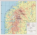
Alpine permafrost in Scandinavia 03.jpg 1,279 × 597; 205 KB
-
Alpine permafrost in Scandinavia 04.jpg 2,497 × 2,125; 1.39 MB
-
Alpine permafrost in Scandinavia 05.jpg 1,998 × 1,885; 1.1 MB
-
Alpine permafrost in Scandinavia 06.jpg 795 × 1,077; 265 KB
-
Alpine permafrost in Scandinavia 07.jpg 1,506 × 1,370; 857 KB
-
Alpine permafrost in Scandinavia 10.jpg 773 × 1,013; 184 KB
-
Alpine permafrost in Scandinavia 11.jpg 1,270 × 930; 258 KB
-
Alpine permafrost in Scandinavia 12.jpg 1,339 × 1,631; 378 KB
-
Alpine permafrost in Scandinavia 15.jpg 1,278 × 692; 291 KB
-
Alpine permafrost in Scandinavia 17.jpg 1,387 × 1,245; 653 KB
-
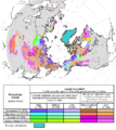
Circum-Arctic Map of Permafrost and Ground Ice Conditions.png 683 × 766; 29 KB
-
Cryosphere atlas northleg122159163110472.png 280 × 149; 4 KB
-
Frozenground.gif 352 × 350; 34 KB
-
Interpolated-best-estimate-maximum-permafrost-depth-map-for-the-0--C-isotherm.png 2,067 × 2,253; 776 KB
-
Permafrost Extent in the Northern Hemisphere (SVS30578).pdf 1,500 × 843, 2 pages; 4.16 MB
-
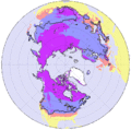
Permafrost NH.png 525 × 554; 45 KB
-
Permafrost Regions in the Soviet Union - DPLA - 584242333d15cc804d3d59af7833c422.jpg 3,282 × 2,554; 1.45 MB


