Category:Penysarn
Jump to navigation
Jump to search
village in United Kingdom | |||||
| Upload media | |||||
| Pronunciation audio | |||||
|---|---|---|---|---|---|
| Instance of | |||||
| Location | Anglesey, Irish Sea | ||||
 | |||||
English: Penysarn is a small village located in the northeastern corner of Anglesey, Wales. The village hovers on the northeastern side of Parys Mountain at approximately 140-150 feet above sea level.
Media in category "Penysarn"
The following 68 files are in this category, out of 68 total.
-
A5025 Approaching Penysarn Bypass - geograph.org.uk - 1436497.jpg 640 × 480; 119 KB
-
Allt Nebo, Penysarn - geograph.org.uk - 1401858.jpg 640 × 480; 87 KB
-
Capel Bosra Chapel, Penysarn - geograph.org.uk - 1179877.jpg 640 × 480; 62 KB
-
Chapel Street, Penysarn - geograph.org.uk - 1408297.jpg 640 × 480; 68 KB
-
Cofeb Penysarn 1.jpg 1,836 × 3,264; 512 KB
-
Cofeb Penysarn 2.jpg 180 × 101; 49 KB
-
Cofeb Penysarn 3.jpg 180 × 101; 54 KB
-
Grazing land south of Pengorffwysfa - geograph.org.uk - 1408837.jpg 640 × 480; 61 KB
-
Joining the A 5025 Penysarn bypass - geograph.org.uk - 1112313.jpg 640 × 480; 25 KB
-
Launder pillars at Pearl Shaft - geograph.org.uk - 1180415.jpg 640 × 453; 56 KB
-
Moorland above the B5111 - geograph.org.uk - 1278651.jpg 640 × 480; 74 KB
-
Mynwent Penysarn Cemetery - geograph.org.uk - 1180262.jpg 640 × 415; 56 KB
-
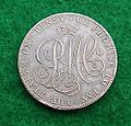
Parys Penny.jpg 250 × 240; 17 KB
-
Penysarn Bypass - geograph.org.uk - 1436502.jpg 640 × 480; 134 KB
-
Penysarn Bypass - Northern End - geograph.org.uk - 1436507.jpg 640 × 480; 141 KB
-
Rhos-mynach Farm - geograph.org.uk - 735111.jpg 640 × 480; 74 KB
-
Sheltered accommodation at Penysarn - geograph.org.uk - 1112303.jpg 640 × 480; 40 KB
-
Start of the Bryn Mor path - geograph.org.uk - 748037.jpg 640 × 480; 62 KB
-
The Garreg Fawr stack from the north - geograph.org.uk - 757185.jpg 640 × 480; 62 KB
-
The lower end of Allt Nebo, Penysarn - geograph.org.uk - 1408830.jpg 640 × 334; 58 KB
-
The Nebo Telecommunications Masts - geograph.org.uk - 747427.jpg 480 × 640; 52 KB
-
The Ogof Fach geo - geograph.org.uk - 757121.jpg 640 × 480; 92 KB
-
The Penysarn War Memorial - geograph.org.uk - 1180108.jpg 640 × 521; 67 KB
-
The Penysarn War Memorial - geograph.org.uk - 1214757.jpg 640 × 274; 38 KB
-
The village hall at Penysarn - geograph.org.uk - 1401844.jpg 640 × 480; 79 KB
-
Ty Canol from the road - geograph.org.uk - 747853.jpg 640 × 465; 58 KB
-
View north along a very wet footpath - geograph.org.uk - 747616.jpg 640 × 480; 74 KB
-
View uphill towards Bosra Chapel - geograph.org.uk - 1180101.jpg 640 × 480; 48 KB
-
Wave-cut platform north of Portobello - geograph.org.uk - 737714.jpg 640 × 480; 86 KB
-
Wave-cut platform north of Portobello - geograph.org.uk - 756275.jpg 640 × 480; 82 KB
-
Y Bedol, Penysarn - geograph.org.uk - 392326.jpg 640 × 480; 73 KB
-
Derelict houses at Pensarn - geograph.org.uk - 392318.jpg 640 × 480; 88 KB
-
Footpath eastwards across the fields - geograph.org.uk - 747595.jpg 640 × 480; 95 KB
-
Gorse flanked track - geograph.org.uk - 747608.jpg 640 × 480; 88 KB


