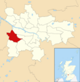
Category:Penilee
Jump to navigation
Jump to search
suburb of Glasgow, Scotland, UK | |||||
| Upload media | |||||
| Instance of | |||||
|---|---|---|---|---|---|
| Location |
| ||||
 | |||||
Media in category "Penilee"
The following 14 files are in this category, out of 14 total.
-
Blocks of flats, Kelhead Path (geograph 6026854).jpg 1,210 × 1,600; 411 KB
-
Blocks of flats, Tinwald Path (geograph 6026803).jpg 1,600 × 1,134; 335 KB
-
Corse Road (geograph 1984664).jpg 640 × 480; 120 KB
-
Craigmuir Place (geograph 3434610).jpg 640 × 480; 261 KB
-
Derelict housing, Corse Road, Penilee - geograph.org.uk - 69198.jpg 640 × 458; 112 KB
-
Glasgow wards 2017 no04 Cardonald.png 2,000 × 2,040; 504 KB
-
Linburn Road (geograph 2089893).jpg 640 × 480; 132 KB
-
Linburn Road (geograph 2089898).jpg 640 × 402; 101 KB
-
Map of Renfrewshire Sheet 012, Ordnance Survey, 1863-1864.jpg 10,706 × 7,173; 15.2 MB
-
Map of Renfrewshire Sheet 012, Ordnance Survey, 1863-1864.tiff 10,706 × 7,173; 219.71 MB
-
Our Lady and St George Church - geograph.org.uk - 1188953.jpg 640 × 480; 98 KB
-
Rebuilt railway bridge (geograph 3434765).jpg 640 × 480; 254 KB
-
Sandwood Road houses - geograph.org.uk - 1188949.jpg 640 × 480; 147 KB
-
Shops and flats, Penilee Road - geograph.org.uk - 1188974.jpg 640 × 480; 134 KB


