Category:Penegoes
Jump to navigation
Jump to search
hamlet in the county of Powys, Wales  | |||||
| Upload media | |||||
| Instance of | |||||
|---|---|---|---|---|---|
| Location | Powys, Wales | ||||
| Connects with |
| ||||
| Population |
| ||||
| Area |
| ||||
 | |||||
Català: Penegoes és un poblet en la comarca gal·lesa de Powys, en l'antic comtat de Montgomeryshire; està situat en la carretera A489 entre Glantwymyn i Machynlleth. Sembla que el nom de Penegoes procedeix de Penegwest, pel nom d'un petit sobirà gal·lès (Egwest), que hi fou decapitat. Al 1987 la Comissió Gal·lesa per als Límits dels Governs Locals fusionà Isygarreg, Penegoes i Uwchygarreg per fer la comunitat de Cadfach, amb capitalitat a Penegoes, que n'era el nucli més gran.
Cymraeg: Pentref bychan yn ardal Maldwyn, gogledd-orllewin Powys, yw Penegoes . Gorwedd ar yr A489 ar y ffordd i Fallwyd tua 2 filltir i'r dwyrain o dref Machynlleth, ar lan Afon Dyfi. Caiff y gymuned, Cadfarch, ei enw o Eglwys Sant Cadfarch ym Mhenegoes.
English: Penegoes is a village in the Welsh principal area of Powys located on the A489 road between Cemmaes Road and Machynlleth.
Media in category "Penegoes"
The following 74 files are in this category, out of 74 total.
-
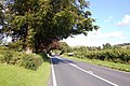 A489 approaching Penegoes - geograph.org.uk - 1433990.jpg 640 × 425; 102 KB
-
 Across the Llyfnant Bridge - geograph.org.uk - 580991.jpg 640 × 480; 91 KB
-
 Along Glyndwr's Way - geograph.org.uk - 668102.jpg 640 × 427; 77 KB
-
 Back down the valley - geograph.org.uk - 668268.jpg 640 × 427; 50 KB
-
 Clipyn Du - geograph.org.uk - 514561.jpg 479 × 640; 51 KB
-

-
 East end, Penegoes - geograph.org.uk - 784951.jpg 640 × 428; 90 KB
-
 Farm gate at Hendreseifion - geograph.org.uk - 240557.jpg 640 × 480; 189 KB
-
 Former school at Penygoes from A489 - geograph.org.uk - 3089056.jpg 640 × 404; 51 KB
-
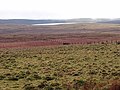
 Grassland by the Nant Cwm yr Erw - geograph.org.uk - 677683.jpg 640 × 479; 65 KB
-
 Hags on Ochr Llygnant - geograph.org.uk - 513996.jpg 640 × 479; 81 KB
-
 Millennium Milepost - geograph.org.uk - 296049.jpg 480 × 640; 202 KB
-
 Penegoes passing the old school - geograph.org.uk - 3559404.jpg 640 × 469; 53 KB
-
 Penegoes Water Mill, near Machynlleth - geograph.org.uk - 38865.jpg 640 × 430; 115 KB
-
Penegoes.ogg 0.9 s; 12 KB
-
 Abandoned farmhouse - geograph.org.uk - 561772.jpg 640 × 433; 100 KB
-
 Above Rhiwgam farmhouse - geograph.org.uk - 561778.jpg 640 × 427; 92 KB
-
 Afon Crewi - geograph.org.uk - 791781.jpg 640 × 480; 163 KB
-
 Afon Hengwm - geograph.org.uk - 677615.jpg 479 × 640; 105 KB
-
 Approved by the Postmaster General - geograph.org.uk - 676731.jpg 480 × 640; 79 KB
-
 Are they molehills^ - geograph.org.uk - 633101.jpg 640 × 427; 84 KB
-
 Banc Rhoswydol forest - geograph.org.uk - 811178.jpg 479 × 640; 102 KB
-
 Birch wood in Cwm yr Erw - geograph.org.uk - 677701.jpg 479 × 640; 128 KB
-
 Bridge over the Afon Dyfi - geograph.org.uk - 1459412.jpg 640 × 426; 84 KB
-
 Cefn Modfedd - geograph.org.uk - 677042.jpg 640 × 479; 38 KB
-
 Cefn Modfedd - geograph.org.uk - 677055.jpg 479 × 640; 65 KB
-
 Cleiriau Uchaf farm - geograph.org.uk - 677101.jpg 640 × 479; 36 KB
-
 Commins Pant Glas - geograph.org.uk - 676791.jpg 640 × 479; 48 KB
-
 Croesau Hyddgen - geograph.org.uk - 513990.jpg 640 × 479; 50 KB
-
 Cwm yr Erw - geograph.org.uk - 677691.jpg 640 × 479; 85 KB
-
 Dyfi Bryncynfil forest - geograph.org.uk - 676774.jpg 479 × 640; 89 KB
-
 Dyfi Valley - geograph.org.uk - 568668.jpg 640 × 480; 354 KB
-
 Edge of the plateau - geograph.org.uk - 606231.jpg 425 × 640; 92 KB
-
 Entrance to Glaslyn - geograph.org.uk - 296054.jpg 640 × 480; 121 KB
-
 Esgair Fochnant - geograph.org.uk - 633107.jpg 640 × 427; 50 KB
-
 Foel Llettymorfudd - geograph.org.uk - 296061.jpg 640 × 480; 180 KB
-
 Footbridge in the Hengwm valley - geograph.org.uk - 741656.jpg 640 × 427; 104 KB
-
 Ford over Nant Tarren-fedw-ddu - geograph.org.uk - 411688.jpg 480 × 640; 91 KB
-
 Ford through Afon Hengwm - geograph.org.uk - 677595.jpg 640 × 480; 106 KB
-
 Former school, Penegoes - geograph.org.uk - 1434009.jpg 640 × 425; 70 KB
-
 Gorse and rocks by the wayside - geograph.org.uk - 676756.jpg 640 × 480; 97 KB
-
 Grazing north of Nant Cymdu - geograph.org.uk - 512601.jpg 1,024 × 685; 823 KB
-
 Hafodwnog - geograph.org.uk - 668324.jpg 640 × 427; 62 KB
-
 Head of the valley. - geograph.org.uk - 561788.jpg 640 × 427; 91 KB
-
 Hillside near Cefncyfrifol - geograph.org.uk - 677731.jpg 640 × 480; 59 KB
-
 Isolated tree near Pen y Banc - geograph.org.uk - 676836.jpg 479 × 640; 37 KB
-
 King of the Hill - geograph.org.uk - 677016.jpg 640 × 480; 46 KB
-
 Looking across the upper Cwm Dulas - geograph.org.uk - 669963.jpg 640 × 479; 39 KB
-
 Looking towards Forge - geograph.org.uk - 296456.jpg 640 × 480; 227 KB
-

-
 Marshland by the Llyfnant - geograph.org.uk - 580953.jpg 640 × 480; 68 KB
-
 Moss cover on birch tree - geograph.org.uk - 677722.jpg 479 × 640; 113 KB
-
 Nant Ceniarth - geograph.org.uk - 676705.jpg 479 × 640; 93 KB
-
 Nant y Cleiriau - geograph.org.uk - 677108.jpg 640 × 479; 32 KB
-
 North from Rhiw Goch - geograph.org.uk - 668206.jpg 640 × 427; 69 KB
-
 Ochr Llygnant - geograph.org.uk - 513993.jpg 640 × 479; 49 KB
-
 Pasture at Bryn y Fedwen - geograph.org.uk - 296029.jpg 640 × 480; 194 KB
-
 Pasture at Cae Eithaf - geograph.org.uk - 296064.jpg 640 × 480; 176 KB
-
 Pasture at Cae Heulen - geograph.org.uk - 296317.jpg 640 × 480; 278 KB
-
 Pasture at Lluest Dropyns - geograph.org.uk - 296028.jpg 640 × 480; 201 KB
-
 Pasture in Cwm Ceniarth - geograph.org.uk - 296465.jpg 640 × 480; 182 KB
-
 Pen y Banc - geograph.org.uk - 676974.jpg 640 × 480; 41 KB
-
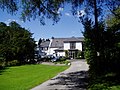 Plas Dolguog Hotel - geograph.org.uk - 522070.jpg 640 × 480; 116 KB
-
 Rhaeadr Ddu weir and drain - geograph.org.uk - 514539.jpg 640 × 479; 61 KB
-
 Rock outcrop at Bryn y Fedwen - geograph.org.uk - 296030.jpg 640 × 480; 193 KB
-
 Sheep at Bwlch Coch - geograph.org.uk - 296063.jpg 640 × 480; 260 KB
-
 Sheep feeder - geograph.org.uk - 677074.jpg 479 × 640; 44 KB
-
 Sheep walking Glyndwr's Way - geograph.org.uk - 676965.jpg 640 × 480; 45 KB
-
 Sheep's head in a bucket - geograph.org.uk - 296062.jpg 640 × 480; 274 KB
-
 Spot the cow - geograph.org.uk - 677710.jpg 640 × 480; 112 KB
-
 Spruce, battling on - geograph.org.uk - 514575.jpg 479 × 640; 83 KB
-
 Track in grazing land - geograph.org.uk - 676991.jpg 640 × 479; 55 KB
-
 Traffic jam - geograph.org.uk - 677067.jpg 640 × 479; 50 KB
-
 Tree overlooking the Dyfi valley - geograph.org.uk - 677030.jpg 640 × 622; 112 KB


