Category:Pencombe with Grendon Warren
Jump to navigation
Jump to search

civil parish in Herefordshire, England | |||||
| Upload media | |||||
| Instance of | |||||
|---|---|---|---|---|---|
| Location | Herefordshire, West Midlands, England | ||||
| Population |
| ||||
 | |||||
Pencombe with Grendon Warren is a civil parish in the county of Herefordshire, England. The parish was created in 1895 from the parishes of Pencombe and Grendon Warren, its only nucleated settlement being the village of Pencombe.
Media in category "Pencombe with Grendon Warren"
The following 163 files are in this category, out of 163 total.
-

-
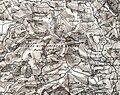 Pencombe with Grendon Warren detail in OS Hereford (Hills) sheet 198 - 1892-1908.jpg 1,097 × 865; 1.52 MB
-
 Across Swainhill Dingle - geograph.org.uk - 910052.jpg 640 × 359; 65 KB
-

-
 Arable land - geograph.org.uk - 4281794.jpg 800 × 451; 195 KB
-
 Arable land near Marsh Court - geograph.org.uk - 5357599.jpg 1,024 × 768; 254 KB
-
 Bare earth, Hawkhurst - geograph.org.uk - 6004056.jpg 1,024 × 683; 358 KB
-
 Big ploughed field above Pencombe - geograph.org.uk - 1005984.jpg 640 × 480; 68 KB
-
 Bitterley Hyde - geograph.org.uk - 4281818.jpg 800 × 451; 182 KB
-
 Bitterley Hyde - geograph.org.uk - 5357592.jpg 1,024 × 768; 338 KB
-
 Bodenham to Pencombe road - geograph.org.uk - 5499122.jpg 1,024 × 683; 365 KB
-
 Bridge over the Lodon - geograph.org.uk - 6004048.jpg 1,024 × 683; 372 KB
-

-
 Bridleway near Marston Firs - geograph.org.uk - 3235520.jpg 680 × 1,024; 355 KB
-
 Bridleway to Durstone - geograph.org.uk - 117639.jpg 640 × 479; 75 KB
-
 Bridleway to Durstone Cottages - geograph.org.uk - 1006035.jpg 640 × 480; 133 KB
-
 Bridleway to Grendon Court - geograph.org.uk - 1516811.jpg 640 × 480; 116 KB
-
 Cattle in a field - geograph.org.uk - 5357919.jpg 1,024 × 768; 269 KB
-
 Cherry orchard - geograph.org.uk - 4281805.jpg 800 × 451; 231 KB
-
 Cherry orchard near Sidnall - geograph.org.uk - 6291528.jpg 1,024 × 574; 154 KB
-
 Church Farm Driveway - geograph.org.uk - 1235651.jpg 640 × 480; 173 KB
-
 Country road - geograph.org.uk - 5357900.jpg 1,024 × 768; 253 KB
-
 Country road on Hegdon Hill - geograph.org.uk - 5357930.jpg 1,024 × 768; 196 KB
-
 Countryside near Hegdon Hill - geograph.org.uk - 842056.jpg 640 × 424; 46 KB
-
 Daffodils and Distance - geograph.org.uk - 1235654.jpg 640 × 480; 87 KB
-
 Daffodils at Little Hegdon - 1 - geograph.org.uk - 1516856.jpg 640 × 480; 149 KB
-
 Daffodils at Little Hegdon - 2 - geograph.org.uk - 1516861.jpg 640 × 480; 129 KB
-
 Deeply incised track - geograph.org.uk - 4281780.jpg 800 × 451; 220 KB
-
 Dew pond near Grendon Court - geograph.org.uk - 1516779.jpg 640 × 480; 98 KB
-
 Durstone Cottage - geograph.org.uk - 117670.jpg 640 × 479; 109 KB
-
 Edge of Dudale's Wood - geograph.org.uk - 3102955.jpg 1,600 × 1,200; 678 KB
-
 End Of The Day Near Hegdon Hill - geograph.org.uk - 1235667.jpg 640 × 480; 149 KB
-
 Entrance to Church House Farm - geograph.org.uk - 5357888.jpg 1,024 × 768; 294 KB
-
 Entrance to Little Hegdon - geograph.org.uk - 1516868.jpg 640 × 480; 132 KB
-
 Entrance to Marsh Court Farm - geograph.org.uk - 818943.jpg 640 × 424; 63 KB
-
 Entrance to Stone Farm - geograph.org.uk - 818910.jpg 640 × 424; 40 KB
-
 Farm Access Off The Pencombe Lane - geograph.org.uk - 1365690.jpg 640 × 480; 249 KB
-
 Farm drive on Hegdon Hill - geograph.org.uk - 6003460.jpg 1,024 × 683; 404 KB
-
 Farm road - geograph.org.uk - 908659.jpg 640 × 480; 80 KB
-
 Farm road to Durstone Farm - geograph.org.uk - 5189722.jpg 600 × 800; 201 KB
-
 Farm road to Wootton Farm - geograph.org.uk - 4281800.jpg 800 × 451; 154 KB
-
 Farm road, Durstone - geograph.org.uk - 6004039.jpg 1,024 × 683; 377 KB
-
 Farm track near Grendon Court - geograph.org.uk - 1516791.jpg 640 × 480; 120 KB
-
 Farmland access track - geograph.org.uk - 5357881.jpg 768 × 1,024; 244 KB
-
 Farmland at Marsh Court - geograph.org.uk - 5357604.jpg 1,024 × 768; 224 KB
-
 Farmland near Pencombe - geograph.org.uk - 5357866.jpg 1,024 × 576; 138 KB
-
 Farmland near Pencombe - geograph.org.uk - 5358009.jpg 1,024 × 768; 217 KB
-
 Farmland north of Hegdon Hill - geograph.org.uk - 1517244.jpg 640 × 480; 99 KB
-
 Farmland on Hegdon Hill - geograph.org.uk - 3235507.jpg 1,024 × 680; 226 KB
-
 Farmland west of Grendon Court Farm - geograph.org.uk - 1516807.jpg 640 × 480; 124 KB
-
 Farmland west of Hegdon Hill - geograph.org.uk - 1517216.jpg 640 × 480; 88 KB
-
 Field beside Holly Grove - geograph.org.uk - 5357579.jpg 800 × 600; 148 KB
-
 Field boundary near Pencombe Hall - geograph.org.uk - 6291524.jpg 1,024 × 575; 169 KB
-
 Field near Pencombe - geograph.org.uk - 5501783.jpg 1,024 × 684; 353 KB
-
 Field near Pencombe - geograph.org.uk - 5501785.jpg 1,024 × 684; 269 KB
-
 Field near Pencombe - geograph.org.uk - 5501789.jpg 1,024 × 684; 314 KB
-
 Field off Durstone bridleway - geograph.org.uk - 1006042.jpg 640 × 480; 77 KB
-
 Field with trig point on Hegdon Hill. - geograph.org.uk - 3290033.jpg 1,500 × 1,015; 1.36 MB
-
 Field, Hawkhurst - geograph.org.uk - 6004050.jpg 1,024 × 683; 393 KB
-
 Field, Pencombe - geograph.org.uk - 5501827.jpg 1,024 × 684; 319 KB
-
 Footpath sign - geograph.org.uk - 4281810.jpg 800 × 451; 208 KB
-
 Forage crop - geograph.org.uk - 4281816.jpg 800 × 451; 200 KB
-
 Gas enclosure on Hegdon Hill - geograph.org.uk - 5501800.jpg 1,024 × 684; 550 KB
-
 Geographer and welcoming committee - geograph.org.uk - 3103341.jpg 3,072 × 2,304; 3.25 MB
-
 Grazing land at Grendon Court - geograph.org.uk - 1516797.jpg 640 × 480; 133 KB
-
 Hedgerow oaks - geograph.org.uk - 1448162.jpg 640 × 480; 124 KB
-
 Hegdon Hill - geograph.org.uk - 1516872.jpg 640 × 480; 124 KB
-
 Hegdon Hill - geograph.org.uk - 4281791.jpg 800 × 451; 177 KB
-
 Hegdon Hill triangle - geograph.org.uk - 1005970.jpg 640 × 480; 71 KB
-
 Hegdon Hill Trig - geograph.org.uk - 3370576.jpg 2,592 × 1,944; 1.54 MB
-
 Hegdon Hill Trig - geograph.org.uk - 842060.jpg 640 × 424; 41 KB
-
 Herefordshire farmland - geograph.org.uk - 908633.jpg 640 × 319; 59 KB
-
 Hollywell Cottage - geograph.org.uk - 3235512.jpg 1,024 × 680; 186 KB
-
 Holywell Cottage - geograph.org.uk - 6003456.jpg 1,024 × 683; 297 KB
-
 Houseleek, Sempervivum tectorum - geograph.org.uk - 908647.jpg 640 × 480; 151 KB
-
 Hyde Bridge - geograph.org.uk - 4281776.jpg 800 × 451; 209 KB
-
 Lane and fields from Hegdon Hill - geograph.org.uk - 1005973.jpg 640 × 480; 76 KB
-
 Lane at Hegdon Hill - 1 - geograph.org.uk - 1517204.jpg 640 × 480; 128 KB
-
 Lane at Hegdon Hill - 2 - geograph.org.uk - 1517209.jpg 640 × 480; 131 KB
-
 Lane to Pencombe - geograph.org.uk - 4281787.jpg 800 × 451; 180 KB
-
 Lane to Pencombe Cross - geograph.org.uk - 1005950.jpg 640 × 480; 89 KB
-
 Lane to Pencombe Cross - geograph.org.uk - 4281807.jpg 800 × 451; 182 KB
-
 Lane To Pencombe Near Hollybush Cottage - geograph.org.uk - 1365687.jpg 640 × 480; 169 KB
-
 Lane to the crest of Hegdon Hill - geograph.org.uk - 4281786.jpg 800 × 451; 193 KB
-
 Large meadow at Grendon Court Farm - geograph.org.uk - 1516802.jpg 640 × 480; 79 KB
-
 Lodon Valley fields - geograph.org.uk - 1006046.jpg 640 × 480; 101 KB
-
 Marker Post - geograph.org.uk - 1200763.jpg 640 × 480; 236 KB
-
 Marsh Court - geograph.org.uk - 4281813.jpg 800 × 451; 174 KB
-
 Meadows at Grendon Court - geograph.org.uk - 1516786.jpg 640 × 480; 120 KB
-
 Muck bury on Hegdon Hill - geograph.org.uk - 5357973.jpg 1,024 × 576; 191 KB
-
 New House Farm, Pencombe - geograph.org.uk - 6291536.jpg 1,024 × 575; 179 KB
-
 North To Pencombe - geograph.org.uk - 1200761.jpg 640 × 480; 168 KB
-
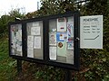 Notices at Pencombe-Little Cowarne Village Hall - geograph.org.uk - 5931026.jpg 3,648 × 2,736; 4.59 MB
-
 Oats near Marsh Court - geograph.org.uk - 5499124.jpg 1,024 × 683; 309 KB
-
 Oilseed rape crop - geograph.org.uk - 5357606.jpg 1,024 × 576; 242 KB
-
 Old Bridge over the River Lodon - geograph.org.uk - 117498.jpg 640 × 479; 159 KB
-
 Old oak in a field - geograph.org.uk - 4281819.jpg 800 × 451; 152 KB
-
 Old road surface - geograph.org.uk - 910353.jpg 359 × 640; 92 KB
-
 Orchard nr Church House Farm - geograph.org.uk - 818892.jpg 640 × 424; 98 KB
-
 Pasture on Hegdon Hill - geograph.org.uk - 6003447.jpg 1,024 × 683; 391 KB
-
 Pasture, Durstone - geograph.org.uk - 6004042.jpg 1,024 × 683; 406 KB
-
 Pencombe to Risbury road - geograph.org.uk - 5501794.jpg 1,024 × 684; 301 KB
-
 Pencombe-Little Cowarne Village Hall - geograph.org.uk - 5931033.jpg 3,648 × 2,736; 4.72 MB
-
 Pencombe-Little Cowarne Village Hall - geograph.org.uk - 5931553.jpg 3,648 × 2,736; 4.33 MB
-
 Plantation near Sidnall Farm - geograph.org.uk - 1005956.jpg 640 × 480; 85 KB
-
 Ploughed Field - geograph.org.uk - 1005955.jpg 640 × 480; 103 KB
-
 Risbury to Pencombe road - geograph.org.uk - 5501825.jpg 1,024 × 684; 356 KB
-
 River Lodon - geograph.org.uk - 4281777.jpg 800 × 451; 210 KB
-
 Road into Pencombe - geograph.org.uk - 5358014.jpg 1,024 × 768; 240 KB
-
 Road junction on Hegdon Hill - geograph.org.uk - 5357999.jpg 1,024 × 768; 160 KB
-
 Road over Hegdon Hill - geograph.org.uk - 5501805.jpg 1,024 × 684; 381 KB
-
 Road to Hegdon Hill - geograph.org.uk - 5357877.jpg 800 × 600; 111 KB
-
 Road to Hennerwood Farm - geograph.org.uk - 818887.jpg 640 × 424; 98 KB
-
 Rolling Herefordshire Countryside - geograph.org.uk - 1235633.jpg 640 × 480; 224 KB
-
 Sheep Grazing Near Hegdon Hill - geograph.org.uk - 1235664.jpg 640 × 480; 182 KB
-

-

-
 Sheep nr Sparrington Farm - geograph.org.uk - 818885.jpg 640 × 424; 66 KB
-
 Sheep pasture near Marston Firs - geograph.org.uk - 1517283.jpg 640 × 480; 90 KB
-
 Sheep pasture north of Hegdon Hill - geograph.org.uk - 1517251.jpg 640 × 480; 99 KB
-
 Sheep path, Hegdon Hill - geograph.org.uk - 6003450.jpg 1,024 × 683; 321 KB
-
 Sheepy singletrack, Hegdon Hill - geograph.org.uk - 6003453.jpg 1,024 × 683; 338 KB
-
 Sign at Pencombe-Little Cowarne Village Hall - geograph.org.uk - 5931037.jpg 3,648 × 2,736; 3.39 MB
-
 Steeply down from Hegdon Hill - geograph.org.uk - 1005980.jpg 640 × 480; 90 KB
-
 Stone farm - geograph.org.uk - 4281797.jpg 800 × 451; 156 KB
-

-
 Stream and farm buildings - geograph.org.uk - 4281779.jpg 800 × 451; 211 KB
-
 Stubble field near Little Hegdon - geograph.org.uk - 3234643.jpg 1,024 × 680; 195 KB
-
 The Day House Farm - geograph.org.uk - 1517325.jpg 640 × 480; 78 KB
-
 Track from Little Hegdon - geograph.org.uk - 1516887.jpg 640 × 480; 106 KB
-
 Track past Durstone Cottage - geograph.org.uk - 3234645.jpg 1,024 × 680; 200 KB
-
 Track past Durstone Cottage - geograph.org.uk - 3235491.jpg 1,024 × 680; 191 KB
-
 Tree in a hedgerow - geograph.org.uk - 5358013.jpg 768 × 1,024; 217 KB
-
 Tributary stream of the Lodon - geograph.org.uk - 4281778.jpg 800 × 451; 195 KB
-
 View from Hegdon Hill - geograph.org.uk - 5357957.jpg 1,024 × 768; 234 KB
-
 View from near Little Hegdon - geograph.org.uk - 3235500.jpg 1,024 × 680; 225 KB
-
 View off Hegdon Hill - geograph.org.uk - 6003458.jpg 1,024 × 683; 285 KB
-
 View off Hegdon Hill - geograph.org.uk - 6004035.jpg 1,024 × 683; 399 KB
-
 View to the Birches - geograph.org.uk - 5357911.jpg 1,024 × 768; 274 KB
-
 View to the Black Mountains - geograph.org.uk - 5357964.jpg 1,024 × 768; 227 KB
-
 View Toward The Nash - geograph.org.uk - 1235643.jpg 640 × 480; 170 KB
-
 West side of Hegdon Hill - geograph.org.uk - 5501798.jpg 1,024 × 684; 330 KB
-
 What goes down..... - geograph.org.uk - 6004047.jpg 1,024 × 683; 362 KB
-
 Wheat field above Dudale's Hope - geograph.org.uk - 910049.jpg 640 × 480; 66 KB
-
 Wheat field, Hegdon Hill - geograph.org.uk - 6003444.jpg 1,024 × 683; 441 KB
-
 Wheat field, Stone Farm - geograph.org.uk - 910362.jpg 640 × 480; 76 KB
-
 Windbreak by a footpath - geograph.org.uk - 4281809.jpg 800 × 451; 199 KB
-
 Woodland on Hegdon Hill - geograph.org.uk - 5501815.jpg 1,024 × 684; 483 KB
-
 Access track to Wootton Farm - geograph.org.uk - 1005962.jpg 640 × 480; 49 KB
-
 Arable land near Durstone Farm - geograph.org.uk - 1516823.jpg 640 × 475; 71 KB
-
 Arable land near Hegdon Hill - geograph.org.uk - 1516818.jpg 640 × 480; 125 KB
-
 Badger Sett and Natural Bridge - geograph.org.uk - 117677.jpg 640 × 479; 163 KB
-
 Bitterley Hyde - geograph.org.uk - 202566.jpg 640 × 480; 94 KB
-

-
 Driveway to Church House Farm - geograph.org.uk - 440327.jpg 640 × 480; 97 KB
-
 Durstone Farm - geograph.org.uk - 117492.jpg 640 × 479; 86 KB
-
 Holywell Cottage - geograph.org.uk - 161276.jpg 640 × 479; 45 KB
-
 Land at The Birches - geograph.org.uk - 441704.jpg 640 × 480; 30 KB
-
 Marsh Court - geograph.org.uk - 202552.jpg 640 × 480; 54 KB
-
 Quarry near Durstone Farm - geograph.org.uk - 117664.jpg 640 × 479; 161 KB
-
 Small Copse in a Hollow - geograph.org.uk - 117485.jpg 640 × 479; 47 KB
-

-
 Wheat Field near Stone House Farm - geograph.org.uk - 202522.jpg 640 × 480; 52 KB

_sheet_198_-_1892-1908.jpg)


.jpg)