Category:Pelenna
Jump to navigation
Jump to search
area in Neath Port Talbot, Wales | |||||
| Upload media | |||||
| Pronunciation audio | |||||
|---|---|---|---|---|---|
| Instance of | |||||
| Location | Neath Port Talbot, Wales | ||||
| Population |
| ||||
| Area |
| ||||
 | |||||
Subcategories
This category has the following 4 subcategories, out of 4 total.
Media in category "Pelenna"
The following 130 files are in this category, out of 130 total.
-
2010 Wales Neath Port Talbot Community Pelenna map.svg 512 × 666; 423 KB
-
2024 Wales Neath Port Talbot Community Pelenna map.svg 512 × 666; 548 KB
-
A series of barriers - geograph.org.uk - 6177111.jpg 2,048 × 1,536; 900 KB
-
Abernant Fishing Lake - geograph.org.uk - 1751373.jpg 3,296 × 2,472; 1.91 MB
-
Abernant Fishing Lake - geograph.org.uk - 1751379.jpg 3,296 × 2,472; 1.92 MB
-
Across a former aqueduct in Pontrhydyfen - geograph.org.uk - 3798371.jpg 800 × 600; 132 KB
-
Adfeilion Graig Ddu - Ruins of Graig Ddu - geograph.org.uk - 6034419.jpg 1,024 × 768; 267 KB
-
Afan Bike Park - geograph.org.uk - 6176462.jpg 3,264 × 2,448; 2.8 MB
-
Afon Pelenna Bridge - geograph.org.uk - 4454633.jpg 640 × 480; 75 KB
-
Afon Pelenna, Pontrhydyfen - geograph.org.uk - 3799432.jpg 800 × 493; 144 KB
-
Ancient Ditch - geograph.org.uk - 1956142.jpg 1,920 × 2,560; 1.84 MB
-
Bridge over Stream - geograph.org.uk - 4454649.jpg 640 × 480; 98 KB
-
Bryn Bettws - panoramio (1).jpg 5,184 × 3,456; 7.17 MB
-
Bryn Bettws - panoramio.jpg 3,456 × 5,184; 13.22 MB
-
Cae'r Bryn - geograph.org.uk - 4062731.jpg 640 × 480; 85 KB
-
Cattle grazing - geograph.org.uk - 6177092.jpg 2,048 × 1,536; 599 KB
-
Cefn Morfudd - geograph.org.uk - 5935858.jpg 3,264 × 2,448; 3.23 MB
-
Cefn Morfudd - geograph.org.uk - 6176465.jpg 3,264 × 2,448; 2.27 MB
-
Cerrig Llwydon houses in Pontrhydyfen - geograph.org.uk - 3799487.jpg 800 × 600; 121 KB
-
Cwm Blaenpelenna - geograph.org.uk - 6034427.jpg 1,024 × 768; 218 KB
-
Cwm Blaenpelenna - geograph.org.uk - 6034456.jpg 1,024 × 768; 237 KB
-
Danybont bus stops, Pontrhydyfen - geograph.org.uk - 3804274.jpg 800 × 712; 144 KB
-
Dining Area with a View - geograph.org.uk - 5469376.jpg 3,264 × 2,448; 3.22 MB
-
Dismantled tramway - geograph.org.uk - 6176792.jpg 2,448 × 3,264; 2.93 MB
-
Dismantled tramway - view NE - geograph.org.uk - 6177087.jpg 1,536 × 2,048; 1.19 MB
-
Entrance and track to Abernant Fishing Lake - geograph.org.uk - 1751364.jpg 3,296 × 2,472; 1.94 MB
-
Ffynnon Oer - geograph.org.uk - 5421507.jpg 2,448 × 3,264; 3.28 MB
-
Flowers and Boulders - geograph.org.uk - 5470050.jpg 3,264 × 2,448; 3.4 MB
-
Forestry operations in Afan Forest Park - geograph.org.uk - 2491530.jpg 640 × 480; 109 KB
-
Former rail bridge at Efail Fach - geograph.org.uk - 5681231.jpg 1,732 × 1,155; 3.14 MB
-
From viaduct to aqueduct in Pontrhydyfen - geograph.org.uk - 3794681.jpg 800 × 627; 137 KB
-
Gate across track - geograph.org.uk - 6177561.jpg 2,320 × 3,096; 2.57 MB
-
Ger - near Hawdref Fawr - geograph.org.uk - 4063461.jpg 640 × 480; 122 KB
-
Ger - Near Hawdref Fawr - geograph.org.uk - 4064051.jpg 640 × 480; 113 KB
-
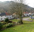
Glan Pelenna houses, Efail Fach - geograph.org.uk - 3801211.jpg 800 × 747; 183 KB
-
Glimpse of Tonmawr - geograph.org.uk - 6176463.jpg 3,264 × 2,448; 3.06 MB
-
Glowing moss - geograph.org.uk - 5935844.jpg 3,264 × 2,448; 2.63 MB
-
Graig Ddu - geograph.org.uk - 5480124.jpg 3,264 × 2,448; 3.38 MB
-
Hawkbit and ferns - geograph.org.uk - 6539831.jpg 1,536 × 2,048; 1.61 MB
-
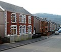
Houses in Efail Fach - geograph.org.uk - 3801224.jpg 800 × 648; 118 KB
-
In Cwm Pelenna - geograph.org.uk - 1019969.jpg 640 × 427; 181 KB
-
Jerusalem chapel, Pontrhydyfen - geograph.org.uk - 3798435.jpg 800 × 549; 121 KB
-
Llwybr hen reilffordd - Former railway path - geograph.org.uk - 6034409.jpg 1,024 × 768; 325 KB
-
Lonely Tree Stump - geograph.org.uk - 1956149.jpg 1,920 × 2,560; 1.79 MB
-
Macpelah Chapel and Graveyard - geograph.org.uk - 5480113.jpg 3,264 × 2,448; 2.32 MB
-
Macpelah Chapelyard, Pontrhydyfen - geograph.org.uk - 3799527.jpg 800 × 600; 121 KB
-
Macpelah houses, Pontrhydyfen - geograph.org.uk - 3799510.jpg 787 × 800; 139 KB
-
Main Road houses, Pontrhydyfen - geograph.org.uk - 3798474.jpg 800 × 581; 105 KB
-
Marker stone - geograph.org.uk - 5935097.jpg 2,448 × 3,264; 3.78 MB
-
Mine Water Treatment Information Board - geograph.org.uk - 5480875.jpg 3,264 × 2,448; 2.27 MB
-
Mine Water Treatment Scheme - geograph.org.uk - 5480118.jpg 3,264 × 2,448; 1.93 MB
-
Miners' Track - geograph.org.uk - 5480867.jpg 2,285 × 3,047; 1.64 MB
-
Morgans Terrace, Pontrhydyfen - geograph.org.uk - 3799419.jpg 800 × 686; 109 KB
-
Muddy track - geograph.org.uk - 6177526.jpg 1,536 × 2,048; 1.35 MB
-
My dog Shosh at Bryn Bettws - panoramio (1).jpg 2,821 × 1,807; 2.3 MB
-
My dog Shosh at Bryn Bettws - panoramio.jpg 5,184 × 3,456; 8.06 MB
-
Mynydd Pen Rhys - geograph.org.uk - 5470033.jpg 3,264 × 2,448; 2.35 MB
-
Mynydd y Gaer and Mynydd Foel Fynyddau - geograph.org.uk - 3685847.jpg 4,288 × 2,214; 2.13 MB
-
Nant Blaenpelenna - geograph.org.uk - 5480788.jpg 3,264 × 2,448; 3.68 MB
-
Orange toadstool - geograph.org.uk - 6542554.jpg 1,536 × 2,048; 1.04 MB
-
Ordnance Survey Cut Mark - geograph.org.uk - 4454629.jpg 480 × 640; 100 KB
-
Ordnance Survey Cut Mark - geograph.org.uk - 4454637.jpg 480 × 640; 96 KB
-
Ordnance Survey Cut Mark - geograph.org.uk - 4454644.jpg 480 × 640; 138 KB
-
Ordnance Survey Cut Mark - geograph.org.uk - 4454656.jpg 640 × 480; 140 KB
-
Ordnance Survey Cut Mark - geograph.org.uk - 4999256.jpg 480 × 640; 128 KB
-
Ordnance Survey Cut Mark - geograph.org.uk - 5399486.jpg 640 × 411; 110 KB
-
Ordnance Survey Cut Mark - geograph.org.uk - 6702355.jpg 793 × 1,024; 328 KB
-
Ordnance Survey Rivet - geograph.org.uk - 4454640.jpg 640 × 480; 120 KB
-
Ordnance Survey Rivet - geograph.org.uk - 6702357.jpg 698 × 1,024; 246 KB
-
Ordnance Survey Rivet - geograph.org.uk - 6702359.jpg 1,024 × 846; 355 KB
-
Ordnance Survey Rivet - geograph.org.uk - 6702361.jpg 698 × 1,024; 190 KB
-
Ordnance Survey Rivet - geograph.org.uk - 6702364.jpg 639 × 1,024; 257 KB
-
Path junction in Afan Forest Park - geograph.org.uk - 2491504.jpg 640 × 480; 146 KB
-
Pen y Cymoedd Wind Farm - geograph.org.uk - 6176771.jpg 3,264 × 2,448; 2.97 MB
-
Pen y Cymoedd Wind Farm - geograph.org.uk - 6176781.jpg 2,448 × 3,264; 2.78 MB
-
Pontrhydyfen Viaduct - geograph.org.uk - 5481184.jpg 3,264 × 2,448; 3.56 MB
-
River Afan seen from viaduct - geograph.org.uk - 2662524.jpg 1,024 × 768; 173 KB
-
Road from Efail Fach to Neath - geograph.org.uk - 3801241.jpg 800 × 697; 131 KB
-
Roadway leading to Penrhys Fawr - geograph.org.uk - 5469380.jpg 3,264 × 2,448; 2.29 MB
-
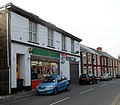
S.V.Superstore, Pontrhydyfen - geograph.org.uk - 3798436.jpg 800 × 697; 95 KB
-
Science imitating nature - geograph.org.uk - 6176765.jpg 1,019 × 2,154; 309 KB
-
Southern boundary of Efail Fach - geograph.org.uk - 3801177.jpg 640 × 480; 86 KB
-
Stile and footpath - geograph.org.uk - 6541065.jpg 3,024 × 4,032; 7.92 MB
-
The Afan Vestry, Pontrhydyfen - geograph.org.uk - 3801318.jpg 800 × 677; 126 KB
-
The Colliers, Efail Fach - geograph.org.uk - 3801228.jpg 800 × 539; 90 KB
-
Tonmawr Road, Efail Fach - geograph.org.uk - 3801252.jpg 800 × 563; 107 KB
-
Track junction - geograph.org.uk - 6176468.jpg 3,264 × 2,448; 3.39 MB
-
Track junction - geograph.org.uk - 6176472.jpg 3,264 × 2,448; 2.18 MB
-
Track through wind farm - geograph.org.uk - 6177101.jpg 2,048 × 1,536; 936 KB
-
Track towards Mynydd Nant y Bar - geograph.org.uk - 6176471.jpg 2,448 × 3,264; 2.29 MB
-
Tuag at Donmawr - Towards Tonmawr - geograph.org.uk - 6034390.jpg 1,024 × 768; 195 KB
-
Tuag at Donmawr - Towards Tonmawr - geograph.org.uk - 6034402.jpg 1,024 × 768; 312 KB
-
Tuag at Gyfylchi - Towards Gyfylchi - geograph.org.uk - 6034476.jpg 1,024 × 768; 189 KB
-
Twyn y Pandy houses in Pontrhydyfen - geograph.org.uk - 3799415.jpg 800 × 616; 115 KB
-
Tyle'r Waun - geograph.org.uk - 5421512.jpg 3,264 × 2,448; 1.82 MB
-
View from a Bridge - geograph.org.uk - 5104476.jpg 2,356 × 3,141; 2.37 MB
-
View from Queen Street, Pontrhydyfen - geograph.org.uk - 3801335.jpg 800 × 736; 120 KB
-
View towards Foel Fynyddau - geograph.org.uk - 5470339.jpg 3,264 × 2,448; 2.5 MB
-
Water under the bridge - geograph.org.uk - 6539823.jpg 2,048 × 1,536; 1.87 MB
-
Wind Turbine - geograph.org.uk - 5421508.jpg 3,264 × 2,448; 1.39 MB
-
Wind turbine - geograph.org.uk - 6176474.jpg 2,089 × 2,784; 2.03 MB
-
Woodland track - geograph.org.uk - 6176470.jpg 3,264 × 2,448; 3.45 MB


