Category:Peasemore
Jump to navigation
Jump to search
English: Peasemore is a village and civil parish in the English county of Berkshire. It is located in the West Berkshire unitary authority, west of the A34 road and north of the town of Newbury.
village in the United Kingdom  | |||||
| Upload media | |||||
| Instance of | |||||
|---|---|---|---|---|---|
| Location | West Berkshire, Berkshire, South East England, England | ||||
| Population |
| ||||
| Area |
| ||||
 | |||||
Subcategories
This category has the following 3 subcategories, out of 3 total.
Media in category "Peasemore"
The following 92 files are in this category, out of 92 total.
-
 A Ladybird's Hasty Retreat - geograph.org.uk - 39315.jpg 640 × 618; 232 KB
-
 Bluebells in Hailey Copse - geograph.org.uk - 4919471.jpg 1,600 × 1,165; 1.22 MB
-
 Bus shelter in Peasmore - geograph.org.uk - 2355887.jpg 3,648 × 2,736; 2.6 MB
-
 Catkins down Gidley Lane - geograph.org.uk - 5679739.jpg 2,592 × 3,498; 3.47 MB
-
 Chapel Farm near Hillgreen - geograph.org.uk - 39346.jpg 640 × 480; 161 KB
-
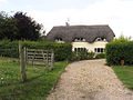
 Cottage by the church - geograph.org.uk - 6052273.jpg 1,024 × 683; 145 KB
-
 Equipment store - geograph.org.uk - 854255.jpg 640 × 427; 85 KB
-
 Farmland and restricted byway, Peasemore - geograph.org.uk - 2228863.jpg 640 × 480; 142 KB
-
 Farmland and track, Peasemore - geograph.org.uk - 2228870.jpg 640 × 480; 160 KB
-
 Farmland near Hillgreen - geograph.org.uk - 39348.jpg 640 × 480; 194 KB
-
 Farmland near Peasemore - geograph.org.uk - 2686798.jpg 2,525 × 1,920; 723 KB
-
 Farmland near Peasemore - geograph.org.uk - 39312.jpg 640 × 480; 146 KB
-
 Farmland near Stanmore - geograph.org.uk - 39306.jpg 640 × 480; 145 KB
-
 Farmland near Stanmore - geograph.org.uk - 39308.jpg 640 × 480; 191 KB
-
 Farmland, Brightwalton - geograph.org.uk - 6194795.jpg 1,024 × 683; 245 KB
-
 Farmland, Peasemore - geograph.org.uk - 2223957.jpg 640 × 480; 162 KB
-
 Farmland, Peasemore - geograph.org.uk - 2319826.jpg 640 × 480; 84 KB
-
 Farmland, Peasemore - geograph.org.uk - 2817115.jpg 640 × 480; 245 KB
-
 Field by Northfields, Peasemore - geograph.org.uk - 6071590.jpg 1,822 × 1,142; 1.04 MB
-
 Field in Lilley - geograph.org.uk - 6070557.jpg 1,920 × 1,280; 1,006 KB
-
 Field of oil-seed rape - geograph.org.uk - 3983285.jpg 640 × 480; 119 KB
-
 Field Road at the junction of Mud Lane - geograph.org.uk - 6063904.jpg 1,920 × 1,280; 1.71 MB
-
 Field Road, Peasemore - geograph.org.uk - 6063899.jpg 1,920 × 1,280; 996 KB
-
 Field Road, Peasemore - geograph.org.uk - 6071588.jpg 1,920 × 1,280; 1.22 MB
-
 Field South of Peasemore - geograph.org.uk - 1870858.jpg 3,552 × 2,524; 2.46 MB
-
 Field south of Sheep Leaze Lane - geograph.org.uk - 6694702.jpg 1,024 × 768; 390 KB
-
 Field south of Sheep Leaze Lane - geograph.org.uk - 6694911.jpg 1,024 × 768; 407 KB
-
 Fields near Peasemore - geograph.org.uk - 4294266.jpg 1,600 × 1,200; 435 KB
-
 Five way junction on Stanmore Road - geograph.org.uk - 2355875.jpg 3,648 × 2,736; 2.39 MB
-
 Footpath to Peasemore - geograph.org.uk - 2956286.jpg 480 × 640; 97 KB
-
 Footpath, Peasemore - geograph.org.uk - 2223960.jpg 480 × 640; 162 KB
-
 Ford at Chapel Wood - geograph.org.uk - 1804716.jpg 1,898 × 1,422; 1.09 MB
-
 Gidley Copse - geograph.org.uk - 5679730.jpg 3,888 × 2,592; 3.66 MB
-
 Grass Tracks - geograph.org.uk - 4279288.jpg 3,804 × 2,404; 1.5 MB
-
 Harvesting on Hazelhanger Farm - geograph.org.uk - 39229.jpg 636 × 480; 158 KB
-
 Ilsley Down Riding Route - geograph.org.uk - 854282.jpg 427 × 640; 106 KB
-
 Ilsley Down Riding Route - geograph.org.uk - 854291.jpg 640 × 427; 99 KB
-
 Junction of Old Street and Red Lane - geograph.org.uk - 2572304.jpg 497 × 640; 155 KB
-
 Junction with Field Road - geograph.org.uk - 1722567.jpg 640 × 480; 109 KB
-
 Make up your mind - geograph.org.uk - 850005.jpg 640 × 427; 91 KB
-
 Not the byway - geograph.org.uk - 854265.jpg 640 × 427; 88 KB
-
 Old stables, Peasemore - geograph.org.uk - 850055.jpg 640 × 427; 91 KB
-
 Old Street - geograph.org.uk - 2609323.jpg 558 × 640; 170 KB
-
 Old Street - geograph.org.uk - 2956251.jpg 480 × 640; 132 KB
-
 Old Street byway - geograph.org.uk - 2956399.jpg 640 × 480; 120 KB
-
 Old Street Lane - geograph.org.uk - 6694700.jpg 1,024 × 768; 494 KB
-
 Palmer Close, Peasemore - geograph.org.uk - 6063896.jpg 1,920 × 1,280; 1.55 MB
-
 Peacock in Hailey Copse - geograph.org.uk - 4919474.jpg 2,198 × 2,657; 1.72 MB
-
 Peasemore Farm - geograph.org.uk - 39285.jpg 640 × 480; 143 KB
-
 Peasemore Hill - geograph.org.uk - 2686794.jpg 1,920 × 2,512; 932 KB
-
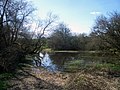
 Peasemore pond - geograph.org.uk - 6063897.jpg 1,920 × 1,280; 2.06 MB
-
 Peasemore post box - geograph.org.uk - 850062.jpg 427 × 640; 104 KB
-
 Peasemore Village Hall - geograph.org.uk - 2158525.jpg 640 × 480; 60 KB
-
 Poppies on the field edge - geograph.org.uk - 850219.jpg 640 × 427; 116 KB
-
 Public footpath, electric fence - geograph.org.uk - 850014.jpg 427 × 640; 88 KB
-
 Residence near Hazelhanger Farm - geograph.org.uk - 39212.jpg 640 × 480; 149 KB
-
 Restricted byway to North Heath - geograph.org.uk - 2158534.jpg 640 × 480; 80 KB
-
 Road junction by Hailey Copse - geograph.org.uk - 1722292.jpg 640 × 480; 124 KB
-
 Road junction, Lilley - geograph.org.uk - 6694917.jpg 1,024 × 768; 498 KB
-
 Road to Gidley Farm - geograph.org.uk - 5679770.jpg 3,888 × 2,592; 7.15 MB
-
 Sheep Leaze Lane - geograph.org.uk - 3983292.jpg 640 × 480; 102 KB
-
 Sheep Leaze Lane - geograph.org.uk - 6694704.jpg 1,024 × 768; 666 KB
-
 Sheep Leaze Lane - geograph.org.uk - 6694900.jpg 1,024 × 768; 564 KB
-
 Sheep Leaze Lane, Lilley - geograph.org.uk - 6070555.jpg 1,280 × 1,920; 2.51 MB
-
 Small Pond in Peasemore - geograph.org.uk - 4280632.jpg 4,000 × 3,000; 2.88 MB
-
 Snowdrops by the Path - geograph.org.uk - 5679784.jpg 3,888 × 2,592; 3.93 MB
-
 Start of the footpath - geograph.org.uk - 850070.jpg 427 × 640; 102 KB
-
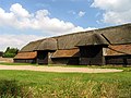
 Thatched Barn at Manor Farm - geograph.org.uk - 4280621.jpg 4,000 × 3,000; 1.83 MB
-
 The Orange Way after Wiltshire (100) - geograph.org.uk - 3528234.jpg 600 × 800; 154 KB
-
 The Orange Way after Wiltshire (101) - geograph.org.uk - 3528237.jpg 600 × 800; 153 KB
-
 The Orange Way after Wiltshire (103) - geograph.org.uk - 3528241.jpg 800 × 676; 207 KB
-
 The Orange Way after Wiltshire (92) - geograph.org.uk - 3528209.jpg 800 × 600; 154 KB
-
 The Orange Way after Wiltshire (93) - geograph.org.uk - 3528211.jpg 800 × 671; 204 KB
-
 The Orange Way after Wiltshire (95) - geograph.org.uk - 3528213.jpg 800 × 600; 120 KB
-
 The Orange Way after Wiltshire (96) - geograph.org.uk - 3528214.jpg 800 × 600; 124 KB
-
 The Orange Way after Wiltshire (97) - geograph.org.uk - 3528222.jpg 800 × 600; 158 KB
-
 The Orange Way after Wiltshire (98) - geograph.org.uk - 3528226.jpg 600 × 800; 216 KB
-
 The Orange Way after Wiltshire (99) - geograph.org.uk - 3528231.jpg 600 × 800; 195 KB
-
 Towards "Ash" - geograph.org.uk - 854331.jpg 640 × 424; 54 KB
-
 Track off Field Road, Peasemore - geograph.org.uk - 6070560.jpg 1,920 × 1,280; 1.66 MB
-
 Track off Sheepleaze Lane - geograph.org.uk - 2697873.jpg 2,240 × 1,920; 856 KB
-
 Winter Farmland near Peasemore - geograph.org.uk - 4294265.jpg 1,600 × 893; 280 KB
-
 Byway leading to North Heath - geograph.org.uk - 71379.jpg 640 × 480; 555 KB
-
 Common Farm on Beedon Common - geograph.org.uk - 39289.jpg 640 × 480; 162 KB
-
 Egypt - geograph.org.uk - 1800.jpg 640 × 480; 46 KB
-
 Farmland near Hazelhanger Farm - geograph.org.uk - 39210.jpg 640 × 480; 170 KB
-
 Farmland near Peasemore - geograph.org.uk - 39344.jpg 640 × 480; 157 KB
-
 Hazelhanger Farmland - geograph.org.uk - 39228.jpg 640 × 480; 119 KB
-
 Ilsley Down Riding Route - geograph.org.uk - 39278.jpg 640 × 480; 208 KB
-
 Princes Farm in Peasemore - geograph.org.uk - 39284.jpg 640 × 480; 210 KB
-
 Residence near Byway - geograph.org.uk - 39280.jpg 640 × 480; 167 KB
-
 South Stanmore Farm near Beedon - geograph.org.uk - 33280.jpg 632 × 480; 201 KB


_-_geograph.org.uk_-_3528234.jpg)
_-_geograph.org.uk_-_3528237.jpg)
_-_geograph.org.uk_-_3528241.jpg)
_-_geograph.org.uk_-_3528209.jpg)
_-_geograph.org.uk_-_3528211.jpg)
_-_geograph.org.uk_-_3528213.jpg)
_-_geograph.org.uk_-_3528214.jpg)
_-_geograph.org.uk_-_3528222.jpg)
_-_geograph.org.uk_-_3528226.jpg)
_-_geograph.org.uk_-_3528231.jpg)


