Category:Parwich
Jump to navigation
Jump to search
village and civil parish in Derbyshire Dales district, Derbyshire, England  | |||||
| Upload media | |||||
| Instance of | |||||
|---|---|---|---|---|---|
| Location | Derbyshire Dales, Derbyshire, East Midlands, England | ||||
| Population |
| ||||
 | |||||
Subcategories
This category has the following 3 subcategories, out of 3 total.
P
- Parwich Hall (3 F)
S
- Sycamore Inn, Parwich (6 F)
Media in category "Parwich"
The following 200 files are in this category, out of 327 total.
(previous page) (next page)-
 A corner of Parwich - geograph.org.uk - 3463372.jpg 750 × 570; 134 KB
-
 A corner of Parwich set on a hillside - geograph.org.uk - 2362232.jpg 713 × 950; 454 KB
-
 A Derbyshire Cow - geograph.org.uk - 5581139.jpg 3,685 × 5,038; 3.94 MB
-
 A gate, a pile of muck and a field - geograph.org.uk - 1881148.jpg 640 × 480; 63 KB
-
 A Parwich village scene - geograph.org.uk - 2362353.jpg 713 × 950; 442 KB
-
 A quiet day at Gotham crossroads - geograph.org.uk - 4570028.jpg 1,024 × 768; 230 KB
-
 A view of Foufinside Farm, Parwich - geograph.org.uk - 1881084.jpg 640 × 480; 90 KB
-
 A view of Parwich - geograph.org.uk - 2342741.jpg 3,648 × 2,736; 3.55 MB
-
 Across the valley - Parwich - geograph.org.uk - 1874934.jpg 1,500 × 996; 1.22 MB
-
 An old limestone barn south of Parwich - geograph.org.uk - 4520396.jpg 4,866 × 3,686; 4.52 MB
-
 Animals grazing at Parwich - geograph.org.uk - 3365226.jpg 640 × 435; 225 KB
-
 Approaching Pikehall from the south - geograph.org.uk - 3162137.jpg 4,398 × 2,639; 2.58 MB
-

-
 Backhill Lane - geograph.org.uk - 3463230.jpg 750 × 563; 122 KB
-
 Backhill Lane - geograph.org.uk - 4520884.jpg 5,184 × 3,888; 6.57 MB
-

-
 Barn and drystone wall - Parwich - geograph.org.uk - 1875051.jpg 1,500 × 996; 1.25 MB
-
 Barn beside a lane - Parwich - geograph.org.uk - 1874792.jpg 1,500 × 996; 1.73 MB
-
 Barn by Chapel Plantation, south of Pikehall - geograph.org.uk - 3283174.jpg 1,024 × 768; 214 KB
-
 Barn conversion on the edge of Pikehall - geograph.org.uk - 3162139.jpg 4,298 × 3,070; 2.91 MB
-
 Barn with Parwich Hill Behind - geograph.org.uk - 1965105.jpg 640 × 427; 284 KB
-
 Barn, lean to and stone wall - Parwich - geograph.org.uk - 1875082.jpg 1,500 × 996; 1.17 MB
-
 Bend in lane at Foufinside Farm - Parwich - geograph.org.uk - 1874802.jpg 1,500 × 996; 1.36 MB
-
 Big sky with track to Hawkslow Farm - Parwich - geograph.org.uk - 1874890.jpg 1,500 × 996; 1.3 MB
-
 Brentwood, Parwich.jpg 1,600 × 1,200; 691 KB
-
 Brick barn near Parwich - geograph.org.uk - 3463343.jpg 750 × 430; 76 KB
-
 Bus Stop, Parwich - geograph.org.uk - 1972795.jpg 640 × 427; 277 KB
-
 Cardlemere Lane - geograph.org.uk - 3099395.jpg 4,000 × 3,000; 2.8 MB
-
 Cattle grazing by Cobblersnook Lane - geograph.org.uk - 5553517.jpg 4,890 × 3,609; 3.44 MB
-

-
 Cattle grazing west of Pikehall - geograph.org.uk - 3162150.jpg 4,407 × 2,645; 2.46 MB
-
 Cattle near Sitterlow Farm - geograph.org.uk - 4520398.jpg 4,989 × 3,773; 4.86 MB
-
 Cattle on Hawks Low Hill - geograph.org.uk - 3130633.jpg 1,142 × 857; 558 KB
-
 Cattle Trough - geograph.org.uk - 1965121.jpg 640 × 427; 257 KB
-
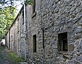
 Church Cottage - Parwich - geograph.org.uk - 1454832.jpg 640 × 425; 140 KB
-
 Church Cottage and Church Gate House.jpg 3,456 × 2,304; 4.25 MB
-
 Churchyard scene, Parwich - geograph.org.uk - 2362309.jpg 950 × 713; 432 KB
-
 Copse north of Dam Lane near Alsop-en-le-Dale - geograph.org.uk - 5581454.jpg 3,743 × 4,864; 3.5 MB
-
 Cottage beside a footpath - Parwich - geograph.org.uk - 1875161.jpg 1,500 × 996; 1.55 MB
-
 Cottage in Parwich - geograph.org.uk - 772712.jpg 427 × 640; 130 KB
-
 Cottage near the village green, Parwich - geograph.org.uk - 376649.jpg 640 × 400; 127 KB
-
 Cottage on a bend - Parwich - geograph.org.uk - 1874761.jpg 1,500 × 996; 1.41 MB
-
 Cottages approaching Church Walk - Parwich - geograph.org.uk - 1875206.jpg 1,500 × 996; 1.67 MB
-

-
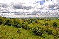
 Countryside view near Parwich - geograph.org.uk - 2362200.jpg 950 × 714; 345 KB
-
 Cows at Gotham Grange, Derbyshire - geograph.org.uk - 3010758.jpg 3,896 × 2,473; 2.02 MB
-
 Cowshed roof, Sitterlow Farm - geograph.org.uk - 4520404.jpg 5,184 × 3,888; 6.2 MB
-
 Cyclist on the High Peak Trail - geograph.org.uk - 3099432.jpg 4,000 × 3,000; 2.12 MB
-
 Dale and Lane near Parwich - geograph.org.uk - 4361087.jpg 4,000 × 3,000; 2.61 MB
-
 Dale End Farm - Parwich - geograph.org.uk - 1874812.jpg 1,500 × 947; 1.32 MB
-

-
 Dam Lane entering Parwich - geograph.org.uk - 3463377.jpg 750 × 567; 145 KB
-
 Dam Lane towards Parwich - geograph.org.uk - 3463384.jpg 750 × 563; 175 KB
-
 Dam Lane view towards Midhill Farm - geograph.org.uk - 997397.jpg 640 × 480; 80 KB
-
 Derbyshire UK parish map highlighting Parwich.svg 888 × 1,308; 2.34 MB
-
 Descent to Parwich - geograph.org.uk - 3365193.jpg 640 × 437; 202 KB
-
 Dew pond beside a road to Parwich - geograph.org.uk - 338849.jpg 640 × 463; 161 KB
-
 Drive to Peakway - geograph.org.uk - 3463394.jpg 750 × 563; 187 KB
-
 Drive to Uppermoor Farm - geograph.org.uk - 3010785.jpg 800 × 600; 112 KB
-
 Driveway near Parwich, Derbyshire - geograph.org.uk - 5436060.jpg 2,710 × 1,795; 3.31 MB
-
 Dry stone walls, copse and lane - geograph.org.uk - 1881135.jpg 640 × 480; 63 KB
-

-
 Drystone wall and fields on Hawks Low Hill - geograph.org.uk - 3130630.jpg 1,142 × 857; 599 KB
-
 Eaton Dale - geograph.org.uk - 4363611.jpg 4,000 × 3,000; 2.78 MB
-
 Eaton Dale - geograph.org.uk - 871200.jpg 640 × 480; 81 KB
-
 Eaton Dale - geograph.org.uk - 916981.jpg 640 × 480; 87 KB
-
 Entering the village from the north - Parwich - geograph.org.uk - 1875095.jpg 1,500 × 996; 1.38 MB
-
 Entrance to Midhill Farm - geograph.org.uk - 320742.jpg 640 × 480; 85 KB
-
 Farm Building in Ruins - geograph.org.uk - 772868.jpg 640 × 382; 94 KB
-
 Farm track and barn - geograph.org.uk - 326249.jpg 640 × 452; 151 KB
-
 Farmland around Gotham Granges - geograph.org.uk - 2362607.jpg 950 × 713; 360 KB
-
 Farmland round Gotham Granges - geograph.org.uk - 1613856.jpg 640 × 480; 77 KB
-

-
 Field near Parwich Lees - geograph.org.uk - 4167447.jpg 4,000 × 3,000; 2 MB
-
 Field of Livestock near Parwich Lees - geograph.org.uk - 4167496.jpg 4,000 × 3,000; 2.75 MB
-
 Fields above Parwich - geograph.org.uk - 3011686.jpg 800 × 600; 167 KB
-
 Fields and tumble down walls - geograph.org.uk - 2362582.jpg 640 × 338; 50 KB
-
 Fields to the North of Parwich - geograph.org.uk - 3099378.jpg 3,922 × 2,894; 2.13 MB
-
 Fields towards Parwich Hill - geograph.org.uk - 3463245.jpg 750 × 563; 107 KB
-
 Fields, walls, trees - geograph.org.uk - 3463403.jpg 563 × 750; 127 KB
-

-
 Flatts Stile Farm, Parwich.jpg 4,000 × 3,000; 4.83 MB
-
 Flaxdale House, Parwich.jpg 1,600 × 1,206; 708 KB
-
 Footbridge over Bletch Brook - geograph.org.uk - 772683.jpg 640 × 427; 184 KB
-
 Footbridge over Ditch - geograph.org.uk - 772697.jpg 640 × 427; 228 KB
-
 Footpath in Eaton Dale - geograph.org.uk - 1940867.jpg 640 × 480; 170 KB
-
 Footpath in Parwich - geograph.org.uk - 3463351.jpg 598 × 750; 146 KB
-
 Footpath junction - geograph.org.uk - 326247.jpg 640 × 448; 136 KB
-
 Footpath near Sitterlow Farm - geograph.org.uk - 4173434.jpg 4,000 × 3,000; 1.79 MB
-
 Footpath off the Parwich road - geograph.org.uk - 1930526.jpg 640 × 480; 138 KB
-
 Footpath route north of Lowmoor Farm - geograph.org.uk - 2362577.jpg 950 × 717; 432 KB
-

-

-
 Footpath to Parwich - geograph.org.uk - 3463239.jpg 750 × 563; 130 KB
-
 Footpath to the Hall - Parwich - geograph.org.uk - 1874758.jpg 1,500 × 996; 1.5 MB
-
 Footpath towards Eatondale Wood - geograph.org.uk - 1940581.jpg 640 × 480; 168 KB
-
 Footpath towards Parwich Lees - geograph.org.uk - 1940682.jpg 640 × 480; 181 KB
-
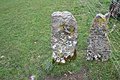
 Former Gate Post - geograph.org.uk - 772836.jpg 640 × 427; 195 KB
-
 Former Gate Post - geograph.org.uk - 772845.jpg 640 × 427; 211 KB
-
 Foufinside farmyard and barns - Parwich - geograph.org.uk - 1874805.jpg 1,500 × 996; 1.28 MB
-
 Gate and electric fence, Parwich - geograph.org.uk - 1881032.jpg 640 × 480; 68 KB
-
 Gateway with view to Parwich Hill - geograph.org.uk - 1875037.jpg 1,500 × 996; 1.12 MB
-

-
 Gotham Curve View of Gotham Granges - geograph.org.uk - 564031.jpg 640 × 480; 124 KB
-
 Gotham Curve View of Gotham Granges - geograph.org.uk - 564038.jpg 640 × 480; 115 KB
-
 Gotham Granges Farm - geograph.org.uk - 5553549.jpg 4,885 × 3,692; 4.2 MB
-
 Gotham view - geograph.org.uk - 2026896.jpg 640 × 426; 59 KB
-
 Gotham, Derbyshire - geograph.org.uk - 17544.jpg 640 × 481; 137 KB
-

-
 Grassland near Parwich Lees - geograph.org.uk - 4167458.jpg 4,000 × 3,000; 2.6 MB
-
 Grazing Land near Parwich - geograph.org.uk - 4173575.jpg 4,000 × 3,000; 2.06 MB
-
 Hawks Low tumulus (geograph 3130646).jpg 1,142 × 857; 581 KB
-
 High Peak Trail - geograph.org.uk - 5018426.jpg 4,699 × 3,345; 2.03 MB
-
 High Peak Trail - geograph.org.uk - 567713.jpg 640 × 480; 127 KB
-
 High Peak Trail at Gotham - geograph.org.uk - 564019.jpg 640 × 480; 120 KB
-
 High Peak Trail at Gotham Granges Farm, Derbyshire - geograph.org.uk - 4440309.jpg 4,000 × 3,000; 3.88 MB
-
 High Peak Trail in Chapel Plantation - geograph.org.uk - 3463868.jpg 750 × 563; 160 KB
-
 High Peak Trail, Minninglow - geograph.org.uk - 2864307.jpg 640 × 425; 262 KB
-
 Hillside fields - geograph.org.uk - 2362422.jpg 950 × 713; 386 KB
-
 Hillside hawthorn scrub - Parwich - geograph.org.uk - 1874914.jpg 1,500 × 996; 1.35 MB
-
 House and telephone box, Parwich - geograph.org.uk - 2362324.jpg 950 × 713; 439 KB
-
 House by the stream in Parwich - geograph.org.uk - 4520394.jpg 5,058 × 3,774; 5.13 MB
-
 House southwest of Ferndale, Parwich.jpg 1,600 × 1,181; 707 KB
-
 Isolated building in upland fields - geograph.org.uk - 2362581.jpg 950 × 744; 442 KB
-
 Isolated hillside tree - Parwich - geograph.org.uk - 1875063.jpg 1,500 × 996; 1.01 MB
-
 Ivy Cottage, Parwich - geograph.org.uk - 699884.jpg 640 × 426; 74 KB
-
 Joining the High Peak Trail - geograph.org.uk - 3011718.jpg 800 × 600; 135 KB
-
 Jubilee Pond, Parwich - geograph.org.uk - 953050.jpg 640 × 480; 130 KB
-
 Junction nr Gotham - geograph.org.uk - 1221150.jpg 640 × 427; 173 KB
-
 Junction on Creamery Lane - Parwich - geograph.org.uk - 1875104.jpg 1,500 × 996; 1.24 MB
-
 Kiln Lane - Parwich - geograph.org.uk - 1454848.jpg 640 × 425; 112 KB
-
 Kiln Lane, Parwich - geograph.org.uk - 2362345.jpg 950 × 718; 410 KB
-
 Landscape seen from Backhill Lane - geograph.org.uk - 4361049.jpg 4,000 × 3,000; 3.36 MB
-
 Lane - Approaching Dale End Farm - geograph.org.uk - 997498.jpg 640 × 480; 79 KB
-
 Lane - Passing Foufinside Farm - geograph.org.uk - 997473.jpg 640 × 480; 93 KB
-

-
 Lane and Dale - geograph.org.uk - 4361291.jpg 4,000 × 3,000; 3.01 MB
-
 Lane junction - Parwich - geograph.org.uk - 1874772.jpg 1,500 × 996; 1.83 MB
-
 Lane junction - Parwich - geograph.org.uk - 1874784.jpg 1,500 × 996; 1.98 MB
-
 Lane past Hilltop Farm - downhill view - geograph.org.uk - 2362432.jpg 950 × 602; 356 KB
-
 Lane past Hilltop Farm - uphill view - geograph.org.uk - 2362426.jpg 950 × 591; 341 KB
-
 Lane south to Dale End Farm - Parwich - geograph.org.uk - 1874884.jpg 1,500 × 996; 1.65 MB
-
 Lane to Alsop en le Dale - Parwich - geograph.org.uk - 1874739.jpg 1,600 × 1,063; 472 KB
-
 Lane to Dale End Farm - Parwich - geograph.org.uk - 1874811.jpg 1,500 × 996; 1.46 MB
-
 Lane to Peakway - geograph.org.uk - 3366352.jpg 640 × 427; 190 KB
-

-
 Large White (female) - Parwich - geograph.org.uk - 1455287.jpg 640 × 425; 67 KB
-
 Limestone barn north of Parwich - geograph.org.uk - 5581031.jpg 5,016 × 3,763; 3.74 MB
-
 Limestone farm building seen from Monsdale Lane - geograph.org.uk - 4521106.jpg 3,735 × 5,001; 5.77 MB
-
 Limestone outcrop - geograph.org.uk - 2152196.jpg 3,648 × 2,736; 4.13 MB
-

-

-
 Looking east on a footpath - geograph.org.uk - 1881128.jpg 640 × 480; 52 KB
-
 Looking south across old field patterns - geograph.org.uk - 2362583.jpg 950 × 695; 362 KB
-
 Looking up Creamery Lane, Parwich - geograph.org.uk - 2362257.jpg 950 × 821; 474 KB
-

-
 Meadow near Parwich Lees - geograph.org.uk - 3366348.jpg 640 × 427; 230 KB
-
 Methodist Chapel, Parwich.jpg 4,000 × 3,000; 4.92 MB
-
 Minninglow Lane - geograph.org.uk - 3011704.jpg 600 × 800; 144 KB
-
 Minor road near Middlemoor Farm - geograph.org.uk - 3011697.jpg 800 × 600; 151 KB
-
 Monsdale Lane - geograph.org.uk - 3463260.jpg 563 × 750; 195 KB
-
 Moss the dog in a village lane - Parwich - geograph.org.uk - 1875184.jpg 1,500 × 996; 2.17 MB
-
 Mountain Ash Farm - geograph.org.uk - 1965137.jpg 640 × 427; 238 KB
-
 Mountain Ash Farm from Parwich Lane - geograph.org.uk - 2362586.jpg 950 × 722; 388 KB
-
 Mountain Ash Farm from Parwich Lane - geograph.org.uk - 3463173.jpg 750 × 370; 86 KB
-
 Odd spot to have a building? - geograph.org.uk - 3765223.jpg 4,000 × 2,248; 5.33 MB
-
 Old cowshed near Sitterlow Farm - geograph.org.uk - 4520400.jpg 5,184 × 3,888; 6.31 MB
-
 Old lead workings at Roystone Rocks - geograph.org.uk - 4917153.jpg 1,280 × 960; 466 KB
-
 Old quarry at Gotham - geograph.org.uk - 4793437.jpg 1,280 × 960; 770 KB
-
 Old quarry by Green Lane - geograph.org.uk - 4793427.jpg 1,280 × 960; 486 KB
-
 On Dam Lane - geograph.org.uk - 5581220.jpg 5,067 × 3,801; 6.03 MB
-
 On Monsdale Lane near Parwich - geograph.org.uk - 4520886.jpg 3,888 × 5,001; 6.11 MB
-
 Open upland pasture with lines of trees - geograph.org.uk - 2362481.jpg 950 × 442; 236 KB
-
 Ordnance Survey Cut Mark - geograph.org.uk - 2992136.jpg 4,000 × 3,000; 5.77 MB
-
 Ordnance Survey Cut Mark - geograph.org.uk - 2992147.jpg 4,000 × 3,000; 4.14 MB
-
 Ordnance Survey Cut Mark - geograph.org.uk - 2992150.jpg 3,264 × 2,448; 2.74 MB
-
 Over Parwich rooftops - geograph.org.uk - 3365215.jpg 640 × 427; 200 KB
-
 Over the village and far away - Parwich - geograph.org.uk - 1454859.jpg 640 × 425; 118 KB
-
 Overlooking Lowmoor Farm - geograph.org.uk - 2362488.jpg 950 × 719; 401 KB
-
 Parish Boundary of Tissington and Parwich, Derbyshire - geograph.org.uk - 5434436.jpg 2,710 × 1,795; 3.16 MB
-
 Parwich - Car Park View - geograph.org.uk - 997612.jpg 640 × 480; 115 KB
-
 Parwich - footpath from Creamery Lane to Kiln Lane - geograph.org.uk - 4197537.jpg 1,162 × 1,600; 939 KB
-
 Parwich - footpath opposite Hallgates Cottage - geograph.org.uk - 4197548.jpg 1,600 × 1,239; 833 KB
-
 Parwich - former Wesleyan Methodist Chapel - geograph.org.uk - 4168912.jpg 1,178 × 1,600; 999 KB
-
 Parwich - geograph.org.uk - 1965109.jpg 640 × 427; 263 KB
-
 Parwich - Highway Lane - geograph.org.uk - 997557.jpg 640 × 480; 108 KB
-

-
 Parwich - house to NE of church - geograph.org.uk - 4197778.jpg 1,600 × 1,200; 830 KB
-
 Parwich - house to north of church - geograph.org.uk - 4197762.jpg 1,600 × 1,170; 1,006 KB
-
 Parwich - houses on Dam Lane - geograph.org.uk - 4141637.jpg 1,600 × 1,217; 823 KB
-
 Parwich - houses to north of pond - geograph.org.uk - 4197758.jpg 1,600 × 1,182; 649 KB
-
 Parwich - Main Street - geograph.org.uk - 997416.jpg 480 × 640; 111 KB
-
 Parwich - Nethergreen House - geograph.org.uk - 4197532.jpg 1,600 × 1,284; 705 KB
-
 Parwich - Primary School - from north - geograph.org.uk - 4197551.jpg 1,600 × 1,200; 873 KB
-
 Parwich - Primary School - from south - geograph.org.uk - 4197556.jpg 1,600 × 1,186; 741 KB
-
 Parwich - west end of footpath - geograph.org.uk - 4197754.jpg 1,600 × 1,224; 1.09 MB
-
 Parwich Bowling Club - geograph.org.uk - 4521114.jpg 4,294 × 3,548; 3.68 MB
-
 Parwich cat - geograph.org.uk - 3365202.jpg 640 × 427; 195 KB
-
 Parwich from The Limestone Way - geograph.org.uk - 772705.jpg 640 × 427; 114 KB
-
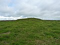
 Parwich Hill - geograph.org.uk - 953059.jpg 640 × 460; 67 KB


_-_geograph.org.uk_-_1881120.jpg)


.jpg)


_-_Parwich_-_geograph.org.uk_-_1455287.jpg)


