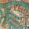
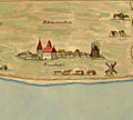
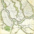
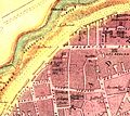
Category:Parts of old maps of Hamburg
Jump to navigation
Jump to search
Federal states of Germany:
Media in category "Parts of old maps of Hamburg"
The following 102 files are in this category, out of 102 total.
-
ElbkarteMelchiorLorichs1567.PNG 1,206 × 743; 1.23 MB
-
Alter Fischmarkt 1540.jpg 995 × 1,033; 278 KB
-
Kajen-um-1600.jpg 416 × 341; 233 KB
-
Schiffbauerbrook um 1600.jpg 415 × 235; 170 KB
-
1589年のハンブルクの地図に描かれたヨハネウム学院.png 1,200 × 1,060; 1.63 MB
-
St. Nikolai Hamburg Braun Hogenberg.jpg 1,536 × 1,792; 1 MB
-
Hambvrgvm (Merian) (detail).jpg 822 × 666; 360 KB
-
Hamburg Grooten 1690 Ausschnitt.png 1,786 × 1,596; 2.44 MB
-
The Free and Hanseatic Cities of Lübeck, Hamburg and Bremen.jpg 1,513 × 1,023; 649 KB
-
Schulterblatt schanzenviertel 1730.JPG 284 × 323; 92 KB
-
Bey-dem-schulterblatt.png 1,379 × 838; 1,003 KB
-
Elbkarte Vierlande bis Blankenese Pingeling 1773 Ausschnitt Reitbrook.jpg 1,245 × 708; 838 KB
-
Grasbrook johnsche ecke.jpg 607 × 555; 457 KB
-
Sternschanze aus varendorf(62)Altona Hamburg Harburg.png 989 × 955; 2.19 MB
-
Tollerort-map-varendorf.jpg 1,652 × 1,184; 2.52 MB
-
Varendorf(62)Altona Hamburg Harburg.jpg 3,565 × 3,602; 15.77 MB
-
Wallanlagen varendorf(62)Altona Hamburg Harburg.png 1,505 × 1,777; 6.2 MB
-
Karte harvestehude vahrendorf.jpg 565 × 754; 568 KB
-
Altona-1803-ausschnitt.jpg 821 × 580; 498 KB
-
Hamburg-Landgebiet1810.jpg 1,280 × 1,545; 1.02 MB
-
Hamburg.1813 neddermeyer.Elbe.300dpi.jpg 4,824 × 1,952; 6.51 MB
-
Reichenstraßenfleet.jpg 1,479 × 695; 1.06 MB
-
Niederhafen 1813.jpg 1,855 × 941; 1.77 MB
-
Stadtplanausschnitt Cremon 1841 (MHG).ajb.jpg 956 × 637; 466 KB
-
Stadtplanausschnitt Grimm 1841 (MHG).ajb.jpg 1,010 × 673; 501 KB
-
Hamburgs Bahnhöfe1880.png 2,097 × 1,804; 9.16 MB
-
Schanzenviertel gaedechens 1600-2.png 452 × 575; 436 KB
-
Schulterblatt-gaedechens-1880.jpeg 1,495 × 1,361; 2.24 MB
-
Dtor1883.jpg 616 × 483; 89 KB
-
Grburstah.jpg 354 × 242; 102 KB
-
Hamburg.Plan.1890 Ausschnitt Hochhaus.png 1,024 × 740; 632 KB
-
Karte-holstenstraße-1890.png 414 × 492; 174 KB
-
Altona-B.jpg 922 × 974; 1.68 MB
-
Bf-altona-karte1890.jpg 516 × 973; 388 KB
-
Hamburg-Plan1890-Ausschnitt.jpg 914 × 956; 835 KB
-
Geahlerplatz.png 970 × 514; 238 KB
-
Heiligengeistfeld.png 450 × 680; 744 KB
-
Innenstadthh.png 714 × 619; 265 KB
-
Karo1890.png 410 × 506; 97 KB
-
Begraebnisplatz 1890..jpg 906 × 589; 694 KB
-
Zollkanal.jpg 655 × 317; 269 KB
-
Altona Bf 1894 Ausschnitt.jpg 3,951 × 5,786; 5.13 MB
-
Altonaer sheruw.jpg 848 × 927; 1.11 MB
-
Hamburger elbgebiet 1915.jpg 743 × 416; 472 KB
-
Karte Hamburger Hafen 1910.jpg 2,512 × 1,129; 3.31 MB
-
Karte-holstenstraße-1910.jpg 570 × 546; 447 KB
-
Map hamburg environs 1910.jpg 798 × 1,184; 414 KB
-
Map hamburg altona 1910.jpg 2,605 × 1,980; 1.62 MB
-
Hamburger Hafen 1910.jpg 1,672 × 1,146; 2.28 MB
-
Janssen & schmilinsky.jpg 765 × 753; 707 KB
-
Janssen & schmilinsky2.jpg 765 × 753; 703 KB
-
Map port of hamburg 1910.jpg 656 × 518; 445 KB
-
Stülckenwerft.jpg 656 × 518; 441 KB
-
Hh-1910elbvororte.jpg 763 × 276; 108 KB
-
Map-Altona Große Bergstraße.jpg 568 × 312; 277 KB
-
Karte Hamburger Hafen 1910 Ausschnitt.JPG 850 × 614; 186 KB
-
Alter Fischmarkt 1810.jpg 450 × 409; 108 KB
-
Map hamburg inner 1910.jpg 2,091 × 1,219; 956 KB
-
Steinwerder werften um 1900.jpg 1,064 × 814; 1.02 MB
-
Alt Uetersen.jpg 896 × 749; 582 KB
-
Elbkarte-Altenwerder-1702.jpg 1,600 × 1,053; 1.04 MB
-
Bishorst Elbkarte 1567.jpg 503 × 422; 100 KB
-
Brockdorf Elbkarte 1567.jpg 667 × 603; 161 KB
-
Brunsbüttel Elbkarte 1567.jpg 734 × 658; 130 KB
-
Cut Hamburg 1855.jpg 2,235 × 831; 819 KB
-
Elbkarte-lorich-hamburg.png 531 × 379; 540 KB
-
Elbquerung Lauenburg-Hohnstorf Stielers Handatlas 1891.jpg 700 × 800; 272 KB
-
Elbkarte-lorich-hadeln.png 532 × 377; 456 KB
-
Altenwerder-Deichkarte-1615.jpg 1,600 × 777; 633 KB
-
Altenwerder-1878.jpg 2,171 × 1,549; 1.66 MB
-
Bergedorf und Nettelnburg um 1615.jpg 957 × 1,449; 185 KB
-
Varendorf(68)Vierlande Winsen.jpg 3,597 × 3,588; 13.66 MB
-
Vahrendorf63b.JPG 3,506 × 2,507; 3.93 MB
-
Eilbek.jpg 601 × 398; 68 KB
-
Hamburg-Hannover aus Bahnkarte Deutschland 1861.png 500 × 850; 884 KB
-
Reiherstiegwerft-karte1790-1910.jpg 1,051 × 1,361; 1.65 MB
-
Reiherstieg-vor-1800.jpg 1,178 × 1,378; 2.06 MB
-
Hamburg.Plan.1890 Ausschnitt Hochhaus Trockendock markiert.png 1,603 × 1,159; 4.53 MB
-
Hamburg.Plan.1890 Ausschnitt Hochhaus Trockendock.png 1,024 × 740; 416 KB
-
Hamburg 1645 Blaeu.jpg 855 × 518; 410 KB
-
Imperial City of Hamburg.jpg 1,280 × 960; 361 KB
-
Hamburg-Hannover aus Bahnkarte Deutschland 1899.png 400 × 750; 615 KB
-
Hamburger elbgebiet 1567 nach lorich.jpg 2,420 × 840; 1.69 MB
-
Hatzburg aus Elbkarte Melchior Lorichs 1567.jpg 450 × 301; 113 KB
-
Kartenausschnitt Altona Hamburg 1789.PNG 1,269 × 720; 2.72 MB
-
Kartenausschnitt Hamburg 1651.PNG 899 × 776; 1.87 MB
-
Langenhorn 1811.jpg 627 × 944; 345 KB
-
Langenhorn 1871.JPG 735 × 949; 186 KB
-
Lorichs Elbkarte-08.jpg 3,667 × 2,669; 10.9 MB
-
Lorichs Hamburger Elbkarte Detail.jpg 1,079 × 1,358; 1.23 MB
-
Lorichs Hamburgische Elbkarte detail right Google Art Project.jpg 6,299 × 2,221; 4.47 MB
-
Moorburg Melchior Lorichs 1568.jpg 2,400 × 1,600; 2.6 MB
-
Elbkarte-lorich-neuwerk.png 532 × 379; 414 KB
-
Karte niderhafen 1880.jpeg 2,141 × 1,381; 3.23 MB
-
Nördliche hamburger Neustadt ca 1880 001.jpg 949 × 849; 238 KB
-
Elbkarte-lorich-pagenwerder.png 531 × 379; 501 KB
-
Elbkarte-lorich-ritzebüttel.png 532 × 379; 430 KB
-
Elbkarte-lorich-scharhörn.png 531 × 379; 419 KB
-
Elbkarte-lorich-stade.png 531 × 378; 529 KB
-
Uetersen Elbkarte 1567.jpg 495 × 441; 129 KB
-
Elbkarte-lorich-vierlande.png 531 × 379; 547 KB
-
Vulcanwerft 1910.jpg 911 × 1,040; 1.1 MB


