Category:Partial maps of the New York City Subway
Jump to navigation
Jump to search
Media in category "Partial maps of the New York City Subway"
The following 30 files are in this category, out of 30 total.
-
2024 NYCS derailment diagram.gif 1,920 × 1,920; 1.41 MB
-
2nd ave subway.svg 800 × 2,400; 116 KB
-
34 St-Hudson Yards Opening (21225337359).jpg 1,440 × 925; 1.01 MB
-
42nd Street Fifth Avenue – Bryant Park (New York City Subway) (7237730598).jpg 1,200 × 1,600; 537 KB
-
7 subway extension and hudson yards.svg 700 × 400; 100 KB
-
7 subway extension hudson yards.svg 718 × 401; 92 KB
-
8th Ave Line schematic.png 650 × 1,436; 58 KB
-
BMT map excerpt 00.png 350 × 350; 52 KB
-
BMT map.png 3,200 × 3,546; 1.4 MB
-
Bowling Green-South Ferry.png 404 × 826; 19 KB
-
Central Ave. (9522494355).jpg 1,920 × 1,440; 780 KB
-
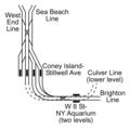
Coney Island-Stillwell Avenue.png 460 × 458; 13 KB
-
Extension ligne7.gif 793 × 960; 22 KB
-
IND after 6th Ave.png 554 × 850; 32 KB
-
IND Second System.png 2,432 × 3,452; 213 KB
-
InterBoroughExchange.webp 726 × 940; 146 KB
-
KK A New Service Brochure Map.gif 840 × 698; 314 KB
-
Layout stazione Times Square-42nd Street.png 1,482 × 875; 1.29 MB
-
Mappa B Division.png 4,289 × 4,825; 25.87 MB
-
Mappa Independent Subway System.png 3,769 × 4,025; 19.46 MB
-
MTA Kew Gdns Union Tpke td (2018-12-30) 02.jpg 3,648 × 5,472; 4.42 MB
-
NYC ligneT.gif 720 × 1,512; 25 KB
-
NYC subway map at Times Square showing Hudson Yards.jpg 2,448 × 2,635; 2.33 MB
-
NYCS H System 1904-1918.jpg 645 × 792; 109 KB
-
NYCS R.png 279 × 232; 8 KB
-
NYCWorldFair1939.jpg 756 × 500; 204 KB
-
Queensboro Plaza.png 1,761 × 887; 42 KB
-
Railway Operation Simulator NYC Subway Route.png 3,218 × 2,406; 381 KB
-
Second Avenue Subway Map vc.jpg 545 × 1,174; 1.02 MB
-
Woodhaven Bl Jamaica Av 26.jpg 3,864 × 5,152; 7.77 MB


