Category:Part of Old Monkland in Glasgow
Jump to navigation
Jump to search
part of a Scottish civil parish | |||||
| Upload media | |||||
| Instance of |
| ||||
|---|---|---|---|---|---|
| Part of | |||||
| Location |
| ||||
| Population |
| ||||
| Area |
| ||||
| |||||
Media in category "Part of Old Monkland in Glasgow"
The following 60 files are in this category, out of 60 total.
-
 Approaching the bend on Muirhead Road - geograph.org.uk - 1279055.jpg 640 × 480; 110 KB
-
 Baillieston, Buchanan Gardens - geograph.org.uk - 1657979.jpg 640 × 483; 35 KB
-
 Baillieston, Church Street - geograph.org.uk - 1657969.jpg 640 × 483; 41 KB
-
 Baillieston, Dyke Street - geograph.org.uk - 1657989.jpg 640 × 483; 40 KB
-
 Barrachnie - geograph.org.uk - 1657791.jpg 640 × 483; 59 KB
-
 Brodie Gardens - geograph.org.uk - 1261890.jpg 640 × 480; 107 KB
-
 Buchanan Street, Baillieston - geograph.org.uk - 1626219.jpg 640 × 483; 44 KB
-

-
 Current Junction 1 of the M74 - geograph.org.uk - 1280086.jpg 640 × 480; 109 KB
-
 David Place - geograph.org.uk - 1657877.jpg 640 × 483; 53 KB
-
 Ellismuir Farm - geograph.org.uk - 1775594.jpg 640 × 480; 77 KB
-
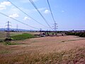
 Fields beside the M73 - geograph.org.uk - 1125076.jpg 640 × 480; 106 KB
-
 Flanagan Flooring - geograph.org.uk - 1261913.jpg 640 × 480; 112 KB
-
 Flight Lt. William Reid VC - geograph.org.uk - 1508257.jpg 640 × 480; 50 KB
-
 Forest road - geograph.org.uk - 1474602.jpg 640 × 483; 99 KB
-
 Freight Trains Passing - geograph.org.uk - 1499270.jpg 640 × 483; 219 KB
-
 Garrowhill, Florida Gardens - geograph.org.uk - 1657863.jpg 640 × 483; 60 KB
-
 Gillie's Lane - geograph.org.uk - 1462887.jpg 580 × 396; 49 KB
-
 Glasgow Business Park - geograph.org.uk - 1261903.jpg 640 × 480; 122 KB
-
 Glenburn Avenue, Swinton - geograph.org.uk - 1654831.jpg 640 × 483; 60 KB
-
 Heatheryknowe Road - geograph.org.uk - 1125097.jpg 640 × 480; 101 KB
-
 Landscaping at Glasgow Business Park - geograph.org.uk - 1261916.jpg 640 × 480; 142 KB
-
 Langbar Crescent from Wardle Road - geograph.org.uk - 1261937.jpg 640 × 480; 114 KB
-
 Lochend Road flats - geograph.org.uk - 1261971.jpg 640 × 480; 109 KB
-
 Longlee - geograph.org.uk - 1463373.jpg 640 × 483; 54 KB
-
 More traditional Easterhouse flats - geograph.org.uk - 1261954.jpg 640 × 480; 118 KB
-
 Mount Vernon Park - geograph.org.uk - 1281519.jpg 640 × 480; 129 KB
-
 Mount Vernon Park - geograph.org.uk - 1281521.jpg 640 × 480; 102 KB
-
 Old Line of Burn - geograph.org.uk - 1484961.jpg 640 × 480; 62 KB
-
 Parkway Court - geograph.org.uk - 1261907.jpg 640 × 480; 145 KB
-
 Pasture by Cuilhill Road - geograph.org.uk - 1125116.jpg 640 × 480; 110 KB
-

-
 Railway Culvert - geograph.org.uk - 1485002.jpg 640 × 480; 114 KB
-
 Railway to Coatbridge - geograph.org.uk - 1482903.jpg 480 × 640; 124 KB
-
 River Clyde at Daldowie - geograph.org.uk - 1477232.jpg 640 × 483; 109 KB
-
 Road into Greenoakhill Quarry - geograph.org.uk - 1279046.jpg 640 × 480; 155 KB
-
 Road sign near M74's end - geograph.org.uk - 1280089.jpg 640 × 480; 121 KB
-
 Roundabout at Glasgow Business Park - geograph.org.uk - 1261901.jpg 640 × 480; 112 KB
-
 Seasonal Burn - geograph.org.uk - 1474597.jpg 640 × 483; 125 KB
-
 Shandwick Square - geograph.org.uk - 1261982.jpg 640 × 480; 122 KB
-

-
 South Scott Street, Baillieston - geograph.org.uk - 1499234.jpg 640 × 426; 46 KB
-
 Stepford Wives^ - geograph.org.uk - 1261941.jpg 640 × 480; 115 KB
-
 Suburban Lane - geograph.org.uk - 1472084.jpg 600 × 453; 162 KB
-
 Swinton Avenue - geograph.org.uk - 1654901.jpg 640 × 483; 57 KB
-
 Swinton Crescent - geograph.org.uk - 1654839.jpg 640 × 483; 61 KB
-
 Swinton Crescent - geograph.org.uk - 1654895.jpg 640 × 483; 58 KB
-
 The aptly named Bushes Bar - geograph.org.uk - 1280093.jpg 640 × 480; 154 KB
-

-
 The Avenues, Calderpark - geograph.org.uk - 1281537.jpg 640 × 480; 109 KB
-
 The Bulls - geograph.org.uk - 1482923.jpg 640 × 480; 55 KB
-
 The Calder and the Clyde - geograph.org.uk - 1477254.jpg 640 × 483; 74 KB
-
 The Serpent's Twist - geograph.org.uk - 1472122.jpg 600 × 453; 123 KB
-
 The Serpent's Twist - geograph.org.uk - 1499251.jpg 640 × 480; 83 KB
-
 Track to Bargeddie - geograph.org.uk - 1482913.jpg 480 × 640; 65 KB
-
 View of Barrachnie - geograph.org.uk - 1657795.jpg 640 × 483; 60 KB
-
 Webster's Pond - geograph.org.uk - 1474637.jpg 640 × 483; 85 KB
-
 Wee Brig - geograph.org.uk - 1484976.jpg 640 × 480; 130 KB
-
 Wee Brig at Bredisholm - geograph.org.uk - 1484994.jpg 640 × 480; 147 KB
-
 Westerhouse Road - geograph.org.uk - 1261979.jpg 640 × 480; 105 KB


