Category:Pagėgiai train station in maps
Jump to navigation
Jump to search
Media in category "Pagėgiai train station in maps"
The following 12 files are in this category, out of 12 total.
-
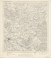
Karte des Deutschen Reiches - 010 - Medischkehmen - 018 - Tilsit (1861).jpg 6,623 × 7,591; 19.06 MB
-
KdwR K21 1904.jpg 10,579 × 11,845; 11.24 MB
-
Ukvme Tilsit.jpg 8,771 × 7,315; 12.17 MB
-
KDR Tilsit 1934.jpg 13,148 × 11,373; 8.78 MB
-
P28 S34 Tilsit 1934.jpg 11,524 × 8,662; 16.46 MB
-
KAM map 1501.jpg 4,659 × 3,512; 3.21 MB
-
R200 N34-05ne.jpg 2,244 × 1,460; 4.22 MB
-
WIG Mapa Operacyjna Polski - 25 Kłajpeda 1936.jpg 6,465 × 5,839; 10.18 MB
-
R100 n-34-032.jpg 4,564 × 5,906; 2.17 MB
-
Ukvme Tilsit 1940.jpg 9,921 × 7,529; 4.49 MB
-
Poland H-16.jpg 5,169 × 3,793; 8.24 MB
-
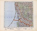
USSR map NN 34-2 Klaipeda.jpg 5,733 × 4,349; 5.84 MB


