Category:Padrón Real
Jump to navigation
Jump to search
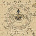
- Also known as the Padrón General, the Royal Standard Map of the Spanish Empire during the Age of Exploration, kept and updated at the Casa de Contratacion in Seville.
The standard map of the Spanish Empire and its discoveries held by the House of Trade at Seville during the Age of Exploration, now lost | |||||
| Upload media | |||||
| Instance of | |||||
|---|---|---|---|---|---|
| Creator | |||||
| |||||
Media in category "Padrón Real"
The following 17 files are in this category, out of 17 total.
-
Spice Islands 1518 map.jpg 700 × 433; 76 KB
-
Castiglione Map.png 2,820 × 866; 3.65 MB
-
Geocarta Nautica Universale (color).png 1,396 × 593; 1.57 MB
-
Geocarta Nautica Universale.jpg 25,332 × 11,006; 54.14 MB
-
Juan Vespucci 1526.jpg 10,824 × 3,867; 4.79 MB
-
Kunstmann IV Compass rose.jpg 3,300 × 3,300; 1.43 MB
-
Kunstmann IV.jpg 10,507 × 5,613; 3.4 MB
-
Map Diego Ribero 1529.jpg 4,048 × 1,736; 4.64 MB
-
Map of Turin 1523 Compass rose.jpg 1,500 × 1,500; 262 KB
-
Map of Turin 1523.jpg 14,298 × 6,261; 3.94 MB
-
Planisferio Salviati.jpg 1,941 × 875; 416 KB
-
Propaganda Map Compass rose.jpg 3,200 × 3,200; 1.9 MB
-
Propaganda Map.jpg 17,175 × 7,482; 22.1 MB
-
Salviati Planisphere.jpg 736 × 371; 63 KB
-
Weimar 1527.png 22,881 × 9,034; 312.34 MB


