Category:PEF map of Western Palestine (details of sheet 6)
Jump to navigation
Jump to search
Media in category "PEF map of Western Palestine (details of sheet 6)"
The following 31 files are in this category, out of 31 total.
-
Cana Where.png 4,549 × 2,049; 26.71 MB
-
Historical map series for the area of al-'Ubaydiyya (1870s).jpg 745 × 749; 176 KB
-
Historical map series for the area of al-Butayha (1870s).jpg 747 × 751; 152 KB
-
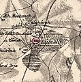
Historical map series for the area of al-Majdal, Tiberias (1870s).jpg 747 × 750; 182 KB
-
Historical map series for the area of Al-Manara, Palestine (1870s).jpg 746 × 750; 228 KB
-
Historical map series for the area of al-Manshiyya, Tiberias (1870s).jpg 745 × 749; 201 KB
-
Historical map series for the area of al-Mansura, Tiberias (1870s).jpg 747 × 751; 218 KB
-
Historical map series for the area of al-Qudayriyya (1870s).jpg 747 × 751; 244 KB
-
Historical map series for the area of al-Samakiyya (1870s).jpg 747 × 751; 194 KB
-
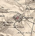
Historical map series for the area of al-Shajara, Tiberias (1870s).jpg 746 × 750; 220 KB
-
Historical map series for the area of al-Shuna (1870s).jpg 747 × 751; 256 KB
-
Historical map series for the area of Arab al-Shamalina (1870s).jpg 745 × 748; 230 KB
-
Historical map series for the area of Ghuwayr Abu Shusha (1870s).jpg 747 × 750; 213 KB
-
Historical map series for the area of Hadatha (1870s).jpg 745 × 749; 227 KB
-
Historical map series for the area of Hittin (1870s).jpg 746 × 750; 230 KB
-
Historical map series for the area of Kafr Sabt (1870s).jpg 746 × 749; 220 KB
-
Historical map series for the area of Khirbat Karraza (1870s).jpg 747 × 751; 228 KB
-
Historical map series for the area of Lubya (1870s).jpg 746 × 750; 234 KB
-
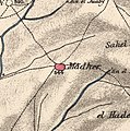
Historical map series for the area of Ma'dhar (1870s).jpg 745 × 749; 228 KB
-
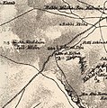
Historical map series for the area of Nasir ad-Din, Tiberias (1870s).jpg 746 × 750; 229 KB
-
Historical map series for the area of Nimrin (1870s).jpg 746 × 750; 231 KB
-
Historical map series for the area of Samakh, Tiberias (1870s).jpg 746 × 749; 107 KB
-
Historical map series for the area of Tabgha (1870s).jpg 747 × 751; 195 KB
-
Historical map series for the area of Yaquq (1870s).jpg 747 × 751; 229 KB
-
Lower Galilee Cana marks.jpg 2,508 × 1,680; 3.78 MB
-
Reineh in the Survey of Western Palestine 1880.06 (cropped).jpg 644 × 496; 377 KB
-
TiberiasRegion1870s.jpg 1,299 × 934; 436 KB
-
Umm Junieh - PEF map 1880.jpg 1,081 × 857; 195 KB


