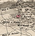
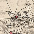
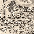
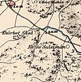
Category:PEF map of Western Palestine (details of sheet 5)
Jump to navigation
Jump to search
Media in category "PEF map of Western Palestine (details of sheet 5)"
The following 27 files are in this category, out of 27 total.
-
Atlit1870s.jpg 806 × 801; 115 KB
-
Cana Where.png 4,549 × 2,049; 26.71 MB
-
El Burg - Haifa - PEF map 1880.jpg 398 × 344; 29 KB
-
El Tireh.jpg 3,341 × 2,533; 3.68 MB
-
Haifa 1875.jpg 3,008 × 2,000; 6.62 MB
-
Historical map series for the area of al-Birwa (1870s).jpg 747 × 751; 228 KB
-
Historical map series for the area of al-Damun (1870s).jpg 747 × 751; 204 KB
-
Historical map series for the area of al-Jalama, Haifa (1870s).jpg 746 × 749; 206 KB
-
Historical map series for the area of Al-Mazar, Haifa (1870s).jpg 745 × 749; 190 KB
-
Historical map series for the area of al-Mujaydil (1870s).jpg 745 × 749; 239 KB
-
Historical map series for the area of al-Ruways (1870s).jpg 747 × 750; 238 KB
-
Historical map series for the area of Al-Tira, Haifa (1870s).jpg 746 × 750; 233 KB
-
Historical map series for the area of Balad al-Sheikh (1870s).jpg 746 × 750; 187 KB
-
Historical map series for the area of Hawsha (1870s).jpg 746 × 750; 225 KB
-
Historical map series for the area of Khirbat Al-Dumun (1870s).jpg 746 × 749; 188 KB
-
Historical map series for the area of Khirbat Al-Kasayir (1870s).jpg 746 × 750; 186 KB
-
Historical map series for the area of Khirbat al-Mansura (1870s).jpg 745 × 749; 213 KB
-
Historical map series for the area of Khirbat Sa'sa' (1870s).jpg 746 × 750; 197 KB
-
Historical map series for the area of Mi'ar (1870s).jpg 747 × 751; 249 KB
-
Historical map series for the area of Wa'arat al-Sarris (1870s).jpg 746 × 750; 182 KB
-
Historical map series for the area of Yajur, Haifa (1870s).jpg 746 × 750; 186 KB
-
Lower Galilee Cana marks.jpg 2,508 × 1,680; 3.78 MB
-
Merj ibn 'Amir in the PEF Survey of Western Palestine composite.jpg 2,020 × 2,169; 1.46 MB
-
Survey of Western Palestine - Tell Abu Hawam.jpg 1,081 × 1,057; 204 KB


