Category:Oxshott
Jump to navigation
Jump to search
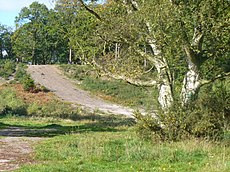
English: Oxshott is a village in Surrey, England with a growing population of around 6,100 in Metropolitan Green Belt heath and woodlands between Esher and Leatherhead centred a mile along the A244 from the A3 (Portsmouth Road) and the M25 London Orbital motorway. It is in London's stockbroker belt. Two factors to its high proportion of substantial houses and gardens are:
- the historic associations with Esher, which in the same way as Weybridge, Surrey and Richmond, London, was selected for the new homes of members of the royal family in the 19th century,
- Most of its developed land formerly belonged to the Crown Estate which acquired its central and eastern areas in the 19th century.
village in Surrey, England. | |||||
| Upload media | |||||
| Instance of | |||||
|---|---|---|---|---|---|
| Location | Elmbridge, Surrey, South East England, England | ||||
| Area |
| ||||
 | |||||
Subcategories
This category has the following 2 subcategories, out of 2 total.
A
R
- Oxshott railway station (33 F)
Media in category "Oxshott"
The following 37 files are in this category, out of 37 total.
-
A Rare Sight^ - geograph.org.uk - 3057678.jpg 1,600 × 1,200; 286 KB
-
A243 Entrance to Leatherhead Golf Club - geograph.org.uk - 55105.jpg 640 × 480; 126 KB
-
A243 near Telegraph Hill - geograph.org.uk - 52047.jpg 640 × 480; 139 KB
-
A244 - entering Oxshott - geograph.org.uk - 2702825.jpg 640 × 428; 121 KB
-
A244 - geograph.org.uk - 5706829.jpg 640 × 377; 85 KB
-
Arbrook Farm - geograph.org.uk - 51296.jpg 640 × 480; 135 KB
-
Bowling Green, Oxshott - geograph.org.uk - 2490876.jpg 640 × 480; 74 KB
-
Bridge over the River Mole - geograph.org.uk - 51477.jpg 640 × 480; 150 KB
-
Bridleway crossing on A244 - geograph.org.uk - 3097500.jpg 640 × 428; 122 KB
-
Coal tax obelisk N111 372x.jpg 291 × 424; 21 KB
-
Copsem Lane - geograph.org.uk - 1203689.jpg 640 × 480; 115 KB
-
Little Heath pond in Surrey.jpg 3,387 × 2,259; 3 MB
-
Oxshott 1.jpg 852 × 593; 818 KB
-
Oxshott 20231030 160821 01.jpg 4,000 × 3,000; 4.66 MB
-
Oxshott 20231030 160821 07.jpg 4,000 × 3,000; 5.19 MB
-
Oxshott Heath (geograph 2117522).jpg 2,560 × 1,920; 1.76 MB
-
Oxshott Heath 20231030 160821 03.jpg 4,000 × 3,000; 6.18 MB
-
Oxshott Heath 20231030 160821 04.jpg 4,000 × 3,000; 5.09 MB
-
Oxshott Heath 20231030 160821 05.jpg 4,000 × 3,000; 5.42 MB
-
Oxshott Village Centre sign 20231030 160821 06.jpg 4,000 × 3,000; 5.45 MB
-
Oxshott Village Hall sign and entrance 20231030 160821 08.jpg 4,000 × 3,000; 5.29 MB
-
Oxshott Village Hall sign and entrance 20231030 160821 09.jpg 3,000 × 4,000; 4.7 MB
-
OxshottHeath.jpg 2,816 × 2,112; 1.43 MB
-
Peace, but not for long^ - geograph.org.uk - 3057697.jpg 1,600 × 1,200; 336 KB
-
Railway bridge over Heath Road - geograph.org.uk - 51306.jpg 640 × 480; 132 KB
-
Silverdale Avenue, Oxshott (geograph 2117418).jpg 2,560 × 1,920; 1.87 MB
-
The Victoria, Oxshott (geograph 2117394).jpg 2,560 × 1,920; 1.74 MB
-
D'Abernon Chase - geograph.org.uk - 52045.jpg 640 × 254; 68 KB
-
M25, J9 - geograph.org.uk - 25449.jpg 640 × 420; 53 KB
-
New Road (byway) - geograph.org.uk - 51300.jpg 640 × 480; 173 KB
-
Office building in Business Park - geograph.org.uk - 64492.jpg 640 × 439; 56 KB
-
River Mole - geograph.org.uk - 233136.jpg 640 × 480; 141 KB
-
Teazlewood Park - geograph.org.uk - 25450.jpg 640 × 426; 52 KB
-
Woodlands Farm - geograph.org.uk - 61533.jpg 640 × 480; 92 KB


