Category:Outdoor maps of KČT
Jump to navigation
Jump to search
Subcategories
This category has the following 2 subcategories, out of 2 total.
Media in category "Outdoor maps of KČT"
The following 22 files are in this category, out of 22 total.
-
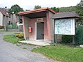
 Broumy, obecní úřad a zastávka.jpg 2,048 × 1,536; 621 KB
-
 Brádlerovy boudy, mapa Krkonoš.jpg 2,592 × 1,944; 3.82 MB
-
 Hrabří, autobusová zastávka.jpg 2,048 × 1,536; 663 KB
-
 Informační deska, náves, Kanina, okr- Mělník, Středočeský kraj.jpg 1,600 × 1,065; 769 KB
-
 Informační tabule na návsi, Vetlá (Vrbice), okr. Litoměřice, Ústecký kraj.jpg 1,065 × 1,600; 1.62 MB
-
 Kaproun pamětní deska.jpg 2,048 × 1,536; 695 KB
-
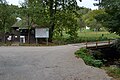
 Kemp Moře u rybníka Řeka (03).jpg 2,592 × 1,944; 3.43 MB
-
 Kemp Moře u rybníka Řeka (04).jpg 1,944 × 2,592; 3.36 MB
-
 Konojedská osvěžovna.JPG 2,048 × 1,536; 1.45 MB
-
 Kostel Bela nad Radbuzou.JPG 1,919 × 1,478; 631 KB
-
 Malá Skála, Vranové I, turistická mapa u kaple.jpg 3,264 × 2,448; 1.99 MB
-
 Maňávka, Nová-Soutěžní, information board (01).jpg 1,840 × 2,880; 2.41 MB
-
 Mšeno, náměstí Míru, radnice a turistická mapa.jpg 3,264 × 2,448; 1.54 MB
-
 Mšeno, Romanov, hájovna Na Rovinách, mapa a lavička.jpg 3,264 × 2,448; 2.62 MB
-
 Na Honculi, Stará Bělá, Ostrava.jpg 8,000 × 6,000; 9.02 MB
-
 Na Krásné vyhlídce, mapa Českého ráje.jpg 5,184 × 3,888; 7.11 MB
-
 Rozcestník hrad.jpg 3,648 × 2,736; 3.58 MB
-
 Sobíňov, na hrázi, mapa a rozcestníky.jpg 2,592 × 1,944; 4.2 MB
-
 Střelnice ČL V1.JPG 2,048 × 1,536; 1.39 MB
-
 Ústí nad Orlicí, křižovatka Moravská - T. G. Masaryka.jpg 3,264 × 2,448; 1.6 MB
-
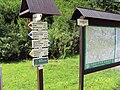
 Šerlich, Masarykova chata, mapa a rozcestník.jpg 2,592 × 1,944; 1.8 MB
-
 Šmelcovna (Javůrek) - most přes Bílý potok, 2023-10, obr05.jpg 4,608 × 3,072; 7.45 MB


,_okr._Litom%C4%9B%C5%99ice,_%C3%9Asteck%C3%BD_kraj.jpg)

.jpg)
.jpg)


.jpg)


_-_most_p%C5%99es_B%C3%ADl%C3%BD_potok,_2023-10,_obr05.jpg)