Category:Oudezijds Achterburgwal 203, Amsterdam
Jump to navigation
Jump to search
| Object location | | View all coordinates using: OpenStreetMap |
|---|
 | |||||
| Upload media | |||||
| Instance of |
| ||||
|---|---|---|---|---|---|
| Location | Amsterdam, North Holland, Netherlands | ||||
| Street address |
| ||||
| Located on street | |||||
| Heritage designation |
| ||||
 | |||||
|
This is a category about rijksmonument number 66
|
| Address |
|
Media in category "Oudezijds Achterburgwal 203, Amsterdam"
The following 9 files are in this category, out of 9 total.
-
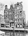
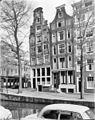
 Amsterdam - Oudezijds Achterburgwal 203-205.jpg 1,936 × 2,592; 2.78 MB
-
 Gevels - Amsterdam - 20015580 - RCE.jpg 945 × 1,200; 288 KB
-
 Gevels - Amsterdam - 20015581 - RCE.jpg 952 × 1,200; 317 KB
-
 Jacobus van Eck, Afb 012000004326.jpg 2,048 × 2,752; 604 KB
-
 Jacobus van Eck, Afb A01634000461.jpg 969 × 1,614; 226 KB
-
 Ludwig Willem Reymert Wenckebach, Afb 010194000519.jpg 1,862 × 2,024; 946 KB
-
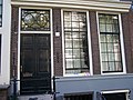 Oudezijds Achterburgwal 203 door.JPG 2,304 × 1,728; 944 KB
-
 Oudezijds Achterburgwal 203 top.JPG 1,728 × 2,304; 1.14 MB
-
 Oudezijds Achterburgwal 203A.jpg 2,592 × 3,888; 4.61 MB


