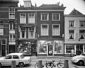
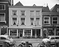
Category:Oude Kerkstraat 6, Delft
Jump to navigation
Jump to search
| Object location | | View all coordinates using: OpenStreetMap |
|---|
building in Delft, Netherlands  | |||||
| Upload media | |||||
| Instance of | |||||
|---|---|---|---|---|---|
| Location | Delft, South Holland, Netherlands | ||||
| Street address |
| ||||
| Located on street | |||||
| Heritage designation |
| ||||
 | |||||
|
This is a category about rijksmonument number 12135
|
| Address |
|
Media in category "Oude Kerkstraat 6, Delft"
The following 4 files are in this category, out of 4 total.
-
 Delft - Oude Kerkstraat 5-6.jpg 1,868 × 1,896; 833 KB
-
 Gevel - Delft - 20052875 - RCE.jpg 3,060 × 2,446; 2.76 MB
-
 Gevel - Delft - 20052877 - RCE.jpg 3,078 × 2,451; 2.56 MB
-
 Gevels - Delft - 20052878 - RCE.jpg 2,224 × 3,313; 2.02 MB


