Category:Ordnance Survey 1:63360 maps
Jump to navigation
Jump to search
Subcategories
This category has the following 15 subcategories, out of 15 total.
O
Media in category "Ordnance Survey 1:63360 maps"
The following 103 files are in this category, out of 103 total.
-
Alvamap1945.png 842 × 647; 1.31 MB
-
Ascot Racecoursemap 1947.png 1,210 × 918; 2.46 MB
-
Borrowstounnessmap.png 2,018 × 1,125; 4.86 MB
-
Bowaters Paper Railway-old map.jpg 223 × 435; 80 KB
-
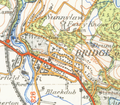
Bridge of Allanmap1945.png 913 × 797; 1.65 MB
-
Bristol map 1946.jpg 4,960 × 4,608; 3.75 MB
-
Built up bit from london NW OS map 1944.jpg 4,880 × 5,760; 4.45 MB
-
Burnham marketmap 1946.png 1,029 × 1,037; 2.6 MB
-
Caldey Island map 1952.jpg 2,400 × 1,104; 172 KB
-
Chippenham1896.jpg 782 × 800; 150 KB
-
Chippenham1946.png 1,094 × 1,176; 2.21 MB
-
Clackmannanshire West 1895.png 1,000 × 819; 567 KB
-
Composite map of Festiniog Railway OS old series 1 63360.jpg 2,203 × 1,396; 846 KB
-
Composite map of Festiniog Railway OS Popular Edition 1 63360.jpg 4,196 × 2,265; 1.4 MB
-
Composite one-inch map of Monkland Canal Ordnance Survey 1945-47.jpg 9,848 × 2,833; 4.52 MB
-
Conwymap1947.png 1,047 × 876; 1.64 MB
-
Docks on G&s1946.png 1,091 × 1,140; 2.66 MB
-
Dollarmap1945.png 863 × 712; 1.34 MB
-
Dovermap1945.jpg 879 × 706; 502 KB
-
Dunblane1945.png 1,152 × 862; 2.22 MB
-
Dunfermlinemap1945.jpg 2,385 × 1,689; 2.47 MB
-
Dunstablemap 1944.jpg 2,368 × 1,648; 457 KB
-
East Derehammap 1946.png 1,073 × 909; 2.13 MB
-
East Grinsteadmap1946.jpg 2,048 × 1,504; 1.92 MB
-
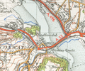
Ennerdalewatermap 1948.png 1,678 × 1,325; 5.74 MB
-
Fakenhammap 1946.png 1,354 × 1,378; 3.08 MB
-
Fifth Edition Ordnance Survey one-inch map numbers.jpg 1,514 × 879; 89 KB
-
Grangemouthmap1945.jpg 3,525 × 2,894; 4.92 MB
-
Gravesendmap 1946.jpg 2,669 × 1,625; 936 KB
-
Grays Thurrockmap 1946.jpg 1,568 × 1,408; 313 KB
-
Great ormes headmap1947.png 1,556 × 1,144; 3.04 MB
-
Halwill Junctionmap 1946.png 960 × 1,667; 2.99 MB
-
Halwillmap 1946.png 720 × 804; 749 KB
-
Haweswater Reservoirmap 1948.png 1,765 × 2,200; 8.43 MB
-
High Wycombe map1945.jpg 2,011 × 1,253; 1.94 MB
-
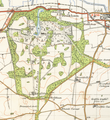
Holkham Hall estatemap1946.png 1,909 × 2,091; 8.14 MB
-
Horleymap1946.jpg 1,179 × 1,131; 381 KB
-
Isles of Scillymap 1946 unedited.png 3,444 × 2,500; 18 MB
-
Isles of Scillymap1946 sub12,5 million pixels.png 3,833 × 2,961; 15.28 MB
-
Kincardine Bridgemap1945.jpg 1,861 × 606; 611 KB
-
Kincardinemap1945 very high res.jpg 2,108 × 2,078; 1.77 MB
-
Kincardinemap1945.png 665 × 647; 923 KB
-
Kinrossmap1945.png 961 × 933; 1.72 MB
-
Lands end map1946.png 1,533 × 1,206; 2.62 MB
-
Little walsinghammap 1946.png 1,054 × 766; 1.78 MB
-
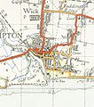
Littlehamptonmap 1946.jpg 1,104 × 1,248; 164 KB
-
Llandudnomap1947.png 1,564 × 1,021; 3.64 MB
-
Llyn Cwellynmap1947.png 1,354 × 1,351; 4.32 MB
-
Loch Nevisand surroundings map 1947.jpg 2,544 × 3,504; 1.54 MB
-
LondonSE map 1946 nw courner.jpg 7,014 × 5,088; 5.57 MB
-
Londonsw ne courner.jpg 5,024 × 6,992; 5.75 MB
-
Longmoor campmap 1947.png 1,930 × 1,437; 5.14 MB
-
Longships map1946.png 705 × 456; 460 KB
-
Lorn and Lochaber.jpg 9,805 × 11,882; 59.41 MB
-
Lydney map 1946.jpg 1,424 × 1,504; 292 KB
-
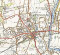
Maidenhead map 1945.jpg 916 × 841; 682 KB
-
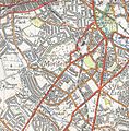
Morden map 1944.jpg 766 × 778; 633 KB
-
Narberthmap1952.jpg 1,273 × 873; 692 KB
-
Newlyn Tidal observatory Map 1946.png 777 × 801; 1.46 MB
-
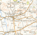
North Tawtonmap 1946.png 1,178 × 1,115; 2.42 MB
-
North York Moors OS Map.jpg 11,028 × 8,827; 13.71 MB
-
Okehamptonmap 1946.png 1,242 × 1,102; 2.33 MB
-
Ordnance Survey 1 inch Nottingham 1947.jpg 2,550 × 3,600; 7.95 MB
-
Ordnance Survey Alston & Weardale 1" Popular edition 1925 Rookhope area.jpg 2,400 × 1,700; 2.95 MB
-
Ordnance Survey Durham & Sunderland 1" Popular edition 1925 Consett area.jpg 2,400 × 1,700; 3.3 MB
-
Ordnance Survey Northern Ireland One-inch Third Series Map Numbering.jpg 1,760 × 3,095; 344 KB
-
Ordnance Survey Popular Edition 1" map Darlington sheet 1925 a section.jpg 2,400 × 1,700; 3.04 MB
-
Ordnance Survey Sheet 302 Geological Map of Horsham, Published 1972.jpg 20,685 × 15,174; 21.1 MB
-
Ordnance Survey Small Scale Description One-inch Scotland Plate 6.jpg 2,291 × 3,900; 684 KB
-
Ordnance Survey Small Scale Description One-inch War Rev Plate 8.jpg 2,278 × 3,896; 654 KB
-
OS map Eddington Farm Kent 1932 002.jpg 2,682 × 1,780; 2.9 MB
-
OS map Eddington Kent 1908 001.jpg 2,467 × 2,589; 5.09 MB
-
OS One-inch Sheet 100 Extract Runcorn Bridgewater Canal 1966.jpg 1,546 × 842; 252 KB
-
Penmaen-mawrmap 1947.png 1,371 × 1,061; 3.25 MB
-
Plymouth OS 1 inch 1936.JPG 2,592 × 1,944; 1.87 MB
-
Popular Edition one-inch map numbering.jpg 1,776 × 2,992; 535 KB
-
Popular Edition Scotland one-inch map numbering 02.jpg 1,817 × 3,204; 511 KB
-
Popular Edition Scotland one-inch map numbering.jpg 1,528 × 2,792; 316 KB
-
Puffin islandmap1947.png 1,041 × 765; 1.18 MB
-
Royal Tunbridge Wellsmap 1946.jpg 1,677 × 1,141; 1.33 MB
-
Severn Railway Bridge map 1946.jpg 1,504 × 1,520; 334 KB
-
Shipdhammap 1946.png 1,071 × 1,069; 2.06 MB
-
St Albansmap 1944.jpg 2,336 × 2,112; 696 KB
-
St ivesmap 1946.png 1,200 × 1,086; 1.9 MB
-
St Michael's Mount map 1946.png 580 × 661; 798 KB
-
Steyningmap 1946.png 1,007 × 939; 2 MB
-
Stirlingmap1945.png 1,734 × 1,308; 5.88 MB
-
Stourport-on-Severn OS map 1942.jpg 874 × 600; 373 KB
-
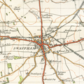
Swaffham map1946.png 1,692 × 1,685; 5.68 MB
-
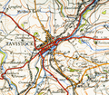
Tavistockmap 1946.png 1,815 × 1,581; 5.14 MB
-
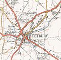
Tetbury map 1946.jpg 1,104 × 1,072; 150 KB
-
The Peak District, One-inch Ordnance Survey Tourist Map, published 1963.jpg 10,630 × 17,852; 20.05 MB
-
Tilburymap 1946.png 1,181 × 987; 2.33 MB
-
Tillicoultrymap1945.png 1,177 × 884; 2.29 MB
-
Tonbridgemap 1946.jpg 1,691 × 1,181; 1.21 MB
-
Wells next the seamap 1946.png 1,584 × 1,495; 5.54 MB
-
Whitlandmap1952.jpg 740 × 642; 278 KB
-
Whitlandrailway lines map1952.jpg 2,912 × 1,648; 587 KB
-
Wimbledon common 1944.jpg 626 × 811; 515 KB
-
Worthingmap 1946.png 2,420 × 1,909; 6.04 MB
-
Wotton-under-Edge1946.jpg 1,358 × 1,182; 1.01 MB
-
Yatton Keynell1946.png 1,245 × 1,203; 1.62 MB


