Category:OpenStreetMap maps of the canton of Vaud
Jump to navigation
Jump to search
Media in category "OpenStreetMap maps of the canton of Vaud"
The following 66 files are in this category, out of 66 total.
-
 A1 Aubonne, map OSM 2022.png 709 × 240; 71 KB
-
 A1 Avenches, map OSM 2022.png 720 × 418; 74 KB
-
 A1 Chavornay, map OSM 2022.png 247 × 643; 70 KB
-
 A1 Coppet, map OSM 2022.png 511 × 752; 191 KB
-
 A1 Cossonay, map OSM 2022.png 450 × 861; 121 KB
-
 A1 Gland, map OSM 2022.png 718 × 617; 258 KB
-
 A1 La Sarraz, map OSM 2022.png 438 × 882; 124 KB
-
 A1 Lausanne-Crissier, map OSM 2022.png 499 × 600; 175 KB
-
 A1 Morges Est, map OSM 2022.png 392 × 252; 86 KB
-
 A1 Morges Ouest, map OSM 2022.png 679 × 576; 293 KB
-
 A1 Nyon, map OSM 2022.png 522 × 832; 176 KB
-
 A1 Payerne, map OSM 2022.png 583 × 322; 70 KB
-
 A1 Restoroute Bavois, map OSM 2022.png 341 × 900; 117 KB
-
 A1 Restoroute La Côte, map OSM 2022.png 702 × 547; 145 KB
-
 A1 Rolle, map OSM 2022.png 837 × 450; 192 KB
-
 A1 Yverdon-Sud, map OSM 2022.png 592 × 313; 97 KB
-
 A1a Lausanne-Maladière, map OSM 2022.png 363 × 238; 65 KB
-
 A1a Lausanne-Malley, map OSM 2022.png 435 × 348; 111 KB
-
 A9 Aigle, map OSM 2022.png 397 × 617; 99 KB
-
 Aigle (Vaud) OSM 01.png 1,100 × 750; 1.05 MB
-
 Aigle (Vaud) OSM 02.png 1,106 × 762; 1.95 MB
-
 Aigle (Vaud) OSM 03.png 1,298 × 1,066; 2.26 MB
-
 AW Champillon Corbeyrier.PNG 749 × 724; 410 KB
-
 AW La Braye.png 474 × 525; 307 KB
-
 AW Pre Giroud.png 853 × 562; 135 KB
-
 A9 Ballaigues, map OSM 2022.png 563 × 300; 52 KB
-
 A9 Bex, map OSM 2022.png 1,023 × 1,984; 838 KB
-
 Carte OpenStreetMap Morges.png 2,120 × 1,868; 2.91 MB
-
 CH VD WLM2018.png 949 × 907; 884 KB
-
 CH-Hauptstrasse1-OSM.png 570 × 390; 397 KB
-
 CH-Hauptstrasse11-OSM.png 836 × 493; 355 KB
-
 CH-Hauptstrasse21-OSM.png 873 × 541; 364 KB
-
 CH-Hauptstrasse5-OSM.png 482 × 359; 323 KB
-
 CH-Hauptstrasse9-OSM.png 458 × 306; 225 KB
-
 A9 Chexbres, map OSM 2022.png 559 × 322; 117 KB
-

-

-

-
-

-
 Festung Dailly.PNG 1,408 × 797; 653 KB
-
 Gare Aigle-Dépôt, OSM map 2022.png 527 × 365; 177 KB
-
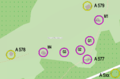
 A5 Grandson, map OSM 2022.png 505 × 516; 77 KB
-
 A9 Lausanne-Blécherette, map OSM 2022.png 426 × 386; 84 KB
-
 A9 Lausanne-Vennes, map OSM 2022.png 875 × 491; 294 KB
-
 A9 Les Clées, map OSM 2022.png 530 × 232; 41 KB
-
 A9 Belmont, map OSM 2022.png 421 × 207; 51 KB
-
 A9 Belmont-Lutry-La Croix, map OSM 2022.png 1,776 × 779; 746 KB
-
 A9 Lutry, map OSM 2022.png 627 × 271; 92 KB
-
-
 Map Mon-Repos OSM.png 826 × 667; 251 KB
-
 Map Montbenon OSM.png 837 × 579; 286 KB
-
 Map palud.png 454 × 380; 74 KB
-
 Map Parc de Milan OSM.png 733 × 616; 231 KB
-
 Map place du Marche de Vevey.png 864 × 588; 196 KB
-
 Map place Riponne.png 769 × 659; 203 KB
-
 Map st francois.png 956 × 962; 313 KB
-
 A9 Montreux, map OSM 2022.png 564 × 412; 162 KB
-
 A9 Orbe, map OSM 2022.png 626 × 263; 75 KB
-
 Plan Morges.png 1,026 × 942; 338 KB
-
 A9 Saint-Triphon, map OSM 2022.png 441 × 472; 97 KB
-
 Sperre Chillon.PNG 818 × 767; 340 KB
-
 Stadt Aigle 2021.png 4,281 × 3,279; 5.39 MB
-
 A9 Vevey, map OSM 2022.png 696 × 702; 226 KB
-
 A9 Villeneuve, map OSM 2022.png 418 × 651; 145 KB
-
 A5 Yverdon-Ouest, map OSM 2022.png 331 × 679; 111 KB


_OSM_01.png)
_OSM_02.png)
_OSM_03.png)


_A1(N)_A1a(S)_-_detail_map_by_OpenStreetMap_contributors,_2022.png)
_A1(N)_A1-A9(S)_-_detail_map_by_OpenStreetMap_contributors,_2022.png)
_A12(N)_A9(S)_-_detail_map_by_OpenStreetMap_contributors,_2022.png)
_A9(E)_A1(S)_-_detail_map_by_OpenStreetMap_contributors,_2022.png)
_A5(N)_A1(E)_-_detail_map_by_OpenStreetMap_contributors,_2022.png)


_A9(S)_Lutry(W)_-_detail_map_by_OpenStreetMap_contributors,_2022.png)


