Category:OpenStreetMap maps of the Ionian Islands
Jump to navigation
Jump to search
Media in category "OpenStreetMap maps of the Ionian Islands"
The following 8 files are in this category, out of 8 total.
-
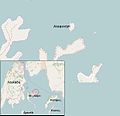
Alaphonisi.JPG 619 × 597; 31 KB
-
Argostoli 2 centuries in 2 hours map.jpg 673 × 531; 120 KB
-
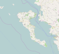
Corfu OSM.png 1,386 × 1,186; 736 KB
-
Longos Paxoi.jpg 819 × 508; 33 KB
-
Map of Corfu town.png 2,017 × 1,869; 992 KB
-
Map of island Corfu.png 2,062 × 1,910; 1.07 MB
-
Prigiponisia Lefkada.jpg 856 × 509; 34 KB
-
Zakynthos Map.svg 496 × 441; 299 KB


