Category:OpenStreetMap maps of Yorkshire
Jump to navigation
Jump to search
Subcategories
This category has the following 3 subcategories, out of 3 total.
O
Media in category "OpenStreetMap maps of Yorkshire"
The following 23 files are in this category, out of 23 total.
-
2011 West Yorkshire Built-up Area.svg 1,055 × 980; 1.22 MB
-
2019 Barnsley Council election.png 849 × 492; 347 KB
-
Adlingfleet map.jpg 758 × 635; 69 KB
-
Airedale & Wharfedale lines.png 2,702 × 1,795; 3.58 MB
-
Calder Valley line.png 3,007 × 1,879; 4.55 MB
-
Doncaster–Lincoln line.png 1,733 × 1,390; 1.56 MB
-
Harrogate line (Arthington Viaduct).png 2,585 × 1,894; 3.67 MB
-
Harrogate line.png 2,585 × 1,894; 2.81 MB
-
Hope Valley Line map.png 1,229 × 584; 791 KB
-
HS3-2017-map.png 2,157 × 1,440; 3.51 MB
-
Location map United Kingdom Beverley Central.png 2,006 × 1,422; 1.08 MB
-
Location map United Kingdom Borough of Doncaster.svg 1,425 × 1,221; 8.36 MB
-
Map of Wades Causeway Location Within North York Moors National Park.png 1,168 × 1,068; 744 KB
-
Penistone Line.png 2,198 × 1,956; 3.31 MB
-
Settle–Carlisle line.png 1,633 × 1,421; 1.87 MB
-
South West Yorks green belt.svg 1,170 × 1,312; 3.75 MB
-
Stainland branch.png 1,055 × 867; 584 KB
-
Swinefleet and Reedness map.jpg 684 × 769; 72 KB
-
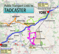
Public transport routes in Tadcaster.png 300 × 275; 152 KB
-
Thumbnail of transport links to Tadcaster, 2015.png 300 × 275; 170 KB
-
WestYorkshireUrbanAreaAerial.JPG 394 × 321; 46 KB
-
Yorkshire Dales map.png 729 × 521; 481 KB
-
Yorkshire Dales map.xcf 729 × 521; 686 KB


