Category:OpenStreetMap maps of Norfolk
Jump to navigation
Jump to search
Media in category "OpenStreetMap maps of Norfolk"
The following 16 files are in this category, out of 16 total.
-
A1270 Broadland Northway.png 1,739 × 951; 1.62 MB
-
Gariannonum BP.png 1,862 × 1,130; 520 KB
-
Great Yarmouth Corporation Tramways.jpg 600 × 600; 71 KB
-
Great Yarmouth third river crossing proposals.png 674 × 470; 99 KB
-
Kastell Caister on Sea, Befunde von 1951-1972.png 2,495 × 1,262; 1.04 MB
-
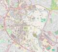
Location map United Kingdom Great Yarmouth Central.png 1,605 × 2,297; 2.24 MB
-
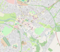
Location map United Kingdom King's Lynn Central.png 1,827 × 2,146; 1.08 MB
-
Location map United Kingdom Norwich Central.png 2,115 × 1,887; 2.63 MB
-
Location map United Kingdom Thetford Central.png 2,145 × 1,833; 1.64 MB
-
Norwich Northern Distributor Road map.png 1,024 × 768; 469 KB
-
Norwich northern distributor.png 1,023 × 754; 547 KB
-
Norwich northern distributor.svg 1,024 × 758; 2.68 MB
-
Norwich rackheath map.png 810 × 759; 461 KB
-
Norwich rackheath map.svg 1,024 × 758; 2.68 MB
-
Proposed A11 Fiveways - Thetford Improvement.png 550 × 422; 67 KB
-
Proposed Acle Straight development.png 678 × 428; 85 KB


