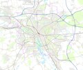
Category:OpenStreetMap maps of Hannover
Jump to navigation
Jump to search
Media in category "OpenStreetMap maps of Hannover"
The following 8 files are in this category, out of 8 total.
-
Alexrk2-osm-wikipedia-test.jpg 865 × 560; 258 KB
-
Geplante Radschnellwege in Hannover.png 5,658 × 691; 3.43 MB
-
Hannover - Basiskarte (grell).png 2,847 × 2,421; 3.33 MB
-
Hannover - Basiskarte.pdf 4,270 × 3,631; 5.7 MB
-
Hannover - Basiskarte.png 2,847 × 2,421; 3.25 MB
-
Radschnellwege Hannover.png 9,126 × 6,194; 28.13 MB
-
Stadtbahn Hannover Netzplan.svg 1,533 × 1,936; 15.13 MB
-
Stadtbahn Hannover Quelldatei.svg 1,626 × 1,903; 3.9 MB


