Category:OpenStreetMap maps of Hampshire
Jump to navigation
Jump to search
Media in category "OpenStreetMap maps of Hampshire"
The following 32 files are in this category, out of 32 total.
-
Alton line.png 1,935 × 1,358; 2.02 MB
-
Ascot-Guildford line.png 1,506 × 1,930; 2.52 MB
-
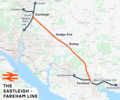
Eastleigh–Fareham line.png 1,856 × 1,542; 2.29 MB
-
Eastleigh–Romsey line.png 1,475 × 1,081; 1.34 MB
-
Lymington branch line.png 1,415 × 1,505; 945 KB
-
West Coastway line.png 2,771 × 1,134; 2.24 MB
-
Befundskizze Clausentum 70 - 410 n. Chr..png 2,381 × 1,151; 1.36 MB
-
Fawley branch line.png 1,713 × 1,405; 1.95 MB
-
Lageskizze Kastell Portsmouth, Open Street Map, 2022.png 2,387 × 1,133; 749 KB
-
Lageskizze von Clausentum und Hamwic (Southampton).png 912 × 960; 1.06 MB
-
Location map United Kingdom Southampton Central.png 2,020 × 1,964; 2.6 MB
-
Location map United Kingdom Southampton Central1.png 1,923 × 2,079; 2.66 MB
-
Location map United Kingdom Winchester Central.png 2,164 × 1,818; 1.58 MB
-
Location of the Isambard Kingdom Brunel pub, Portsmouth.png 1,039 × 474; 371 KB
-
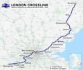
London Crosslink.png 2,353 × 1,992; 5.2 MB
-
Map of Bentworth.png 686 × 834; 867 KB
-
New Forest Tour map.png 658 × 621; 105 KB
-
OpenStreetMapTracklogsHedgeEnd.png 642 × 630; 16 KB
-
Portsmouth location map.png 1,777 × 2,205; 3.47 MB
-
Reading–Basingstoke line.png 1,812 × 1,494; 1.97 MB
-
South Downs National Park map.svg 1,425 × 884; 1.98 MB
-
South Downs National Park UK location map.svg 1,425 × 884; 2.03 MB
-
Southampton from OpenStreetMap.png 460 × 394; 261 KB
-
Southampton Map.svg 1,146 × 1,179; 3.38 MB
-
Southampton OSM 01.png 469 × 405; 377 KB
-
Southampton OSM 02.png 469 × 405; 457 KB
-
Southampton OSM 03.png 630 × 544; 643 KB
-
Southampton–Fareham line.png 2,000 × 1,405; 2.12 MB
-
Wessex Main Line.png 2,630 × 2,022; 3.83 MB
-
West of England line.png 2,578 × 1,481; 3.19 MB


