Category:OpenStreetMap maps of Brussels
Jump to navigation
Jump to search
Media in category "OpenStreetMap maps of Brussels"
The following 22 files are in this category, out of 22 total.
-
2016-Brussels-Bombings-OpenStreetMap.png 4,924 × 3,208; 19.66 MB
-
453 Avenue Louise, Bruxelles (plan).png 732 × 473; 166 KB
-
Atentados de Bruselas de marzo de 2016.jpg 684 × 701; 280 KB
-
Belgian Railway Line 161A.png 1,498 × 1,097; 2.41 MB
-
Bruselaj eksplodoj (mapo).jpg 305 × 303; 63 KB
-
Brussels location map.png 431 × 434; 299 KB
-
Brussels Map.png 686 × 701; 644 KB
-
Brussels SNCV.png 1,379 × 1,308; 2.74 MB
-
Carte Neder-Over-Hembeek.jpg 1,991 × 1,971; 1.69 MB
-
Carte-Laeken.jpg 1,991 × 1,971; 1.75 MB
-
Explosiones aeropuerto de Bruselas 2016.jpg 1,526 × 887; 283 KB
-
Map Bruxelles-Capitale.jpg 1,991 × 1,971; 1.18 MB
-
Map Bruxelles-Europe.png 1,880 × 1,134; 3.02 MB
-
Map mutsaard.jpg 1,991 × 1,971; 1.7 MB
-
Map mutsaert.jpg 1,991 × 1,971; 1.71 MB
-
Promenade verte-Bruxelles.png 1,991 × 1,971; 9.24 MB
-
Square montgomery.png 920 × 942; 282 KB
-
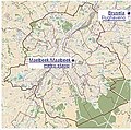
Ubicación metro Maelbeek Maalbeek.png 1,041 × 701; 1.24 MB
-
Ville de Bruxelles OSM 01.png 942 × 763; 706 KB
-
Ville de Bruxelles OSM 02.png 363 × 546; 274 KB
-
Ville de Bruxelles OSM 03.png 363 × 546; 226 KB


