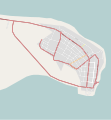
Category:OpenStreetMap maps of Banjul
Jump to navigation
Jump to search
Media in category "OpenStreetMap maps of Banjul"
The following 4 files are in this category, out of 4 total.
-
OpenStreetMap Banjul 2010-06-15.svg 2,389 × 2,578; 427 KB
-
OpenStreetMap Banjul 2011-07-24.svg 844 × 831; 470 KB
-
OpenStreetMap Banjul 2017-04-09.svg 1,799 × 1,021; 2.27 MB
-
OpenStreetMap Greater Banjul Area 2011-08-01.svg 790 × 534; 984 KB


