Category:OpenRailwayMap maps
Jump to navigation
Jump to search
Media in category "OpenRailwayMap maps"
The following 32 files are in this category, out of 32 total.
-
Ankara-Sivas YHT.svg 400 × 100; 21 KB
-
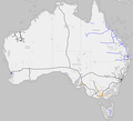
Australia OpenRailway gauge map.agr.png 1,948 × 1,762; 1.24 MB
-
Bahnstrecke Ludwigsstadt–Lehesten.png 2,087 × 1,261; 1.93 MB
-
Bahnstrecke Warburg-Kassel.png 588 × 645; 496 KB
-
Burgenlandbahn ehemalige Strecken.png 938 × 693; 609 KB
-
East African Rail.svg 512 × 425; 339 KB
-
Ferrocarriles y Elevadores Depietri (OpenRailwayMap).png 832 × 780; 134 KB
-
Flughafenspange-Karte.png 2,006 × 1,880; 1.16 MB
-
Gleisplan Hauptbahnhof Gera.svg 882 × 469; 242 KB
-
Gula linjens sträckning.png 2,474 × 5,775; 1.31 MB
-
Jaynagar-Bijalpura railway line.jpg 1,080 × 1,454; 509 KB
-
Latour-de-Carol – Enveitg, power system sectioning points.png 1,619 × 963; 649 KB
-
Latour-de-Carol – Enveitg, track gauges.png 1,615 × 963; 570 KB
-
Ligne Guë - Menaucourt.png 996 × 720; 755 KB
-
Linienverlauf des RE 82.jpg 899 × 813; 831 KB
-
Lokalbahn Bad Aibling-Feilnbach.svg 512 × 380; 47 KB
-
Lunds spårväg.png 984 × 796; 604 KB
-
Manistique Sub Map.png 897 × 652; 409 KB
-
Map of Swedish railways.svg 897 × 812; 2.24 MB
-
Nordwestbahnhof Schienen 1887 2019.jpg 3,478 × 5,172; 2.25 MB
-
Nordwestbahnhof Vienna OpenRailwayMap 191017.jpg 1,041 × 1,537; 405 KB
-
OpenRailwayMap DeltaMapExample.png 240 × 320; 69 KB
-
OpenRailwayMap of Northeastern US and Southeastern Canada.png 1,920 × 962; 1.51 MB
-
Perleberger Brücke.jpg 520 × 458; 57 KB
-
Plan Anschlussbahn.jpg 1,765 × 735; 68 KB
-
Railway map Chernivtsi Ocnița.png 1,329 × 701; 721 KB
-
Saint Petersburg railways from OpenRailwayMap.png 1,530 × 1,032; 1.09 MB
-
South America OpenRailwayMap gauge map.png 636 × 988; 193 KB
-
Verlauf der Strecke 6607.png 1,617 × 849; 1,017 KB
-
World RR Gauge Map.agr.png 3,783 × 2,110; 4.11 MB
-
Yuzhnaya Portovaya Vetv.png 2,463 × 1,031; 2.06 MB


