Category:Old topographic maps of Paris
Jump to navigation
Jump to search
Subcategories
This category has the following 5 subcategories, out of 5 total.
A
Media in category "Old topographic maps of Paris"
The following 22 files are in this category, out of 22 total.
-
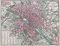
 Plan de Paris 1838.jpg 4,325 × 3,287; 9.94 MB
-
 1849 – Carte topographique des Environs de Paris d’après la nouvelle carte des Chasses du Roy.jpg 12,264 × 8,640; 22.21 MB
-
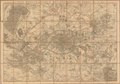
 1880 Clerot Pocket Map of Paris and Environs, France - Geographicus - Paris-clerot-1880.jpg 5,904 × 4,216; 16.09 MB
-

-

-
-

-
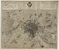
 Atlas administratif de Paris, Plan lavé topographiquement - Princeton University.jpg 3,812 × 2,885; 14.44 MB
-
 Carte d'État-major de la France, Feuille Paris S.E.jpg 23,339 × 13,431; 101.98 MB
-
 Carte d'État-major de la France, Feuille Paris S.O.jpg 22,913 × 13,227; 101.16 MB
-
 Carte d'État-major de la France, Feuille Paris.jpg 30,000 × 9,600; 294.07 MB
-
 Carte topographique des environs de Paris, 1856 - Stanford Libraries.jpg 15,418 × 10,771; 31.69 MB
-
 Carte topographique des environs de Paris, 1856 - Stanford Libraries.tif 15,418 × 10,771; 158.38 MB
-
 Carte topographique des environs et du plan de Paris - 1735 - btv1b8442730b.jpg 9,930 × 8,469; 22.65 MB
-
 Carte topographique du département de Paris et de ses environs - 18?? - btv1b84424161.jpg 11,122 × 8,603; 20.66 MB
-

-
 Environs de Paris. Nouvel atlas topographique. 1862 - Gallica.jpg 8,124 × 6,877; 13.56 MB
-
 Georges-Louis Le Rouge, Environs de Paris, 1730s - Gallica.jpg 8,220 × 6,556; 11.69 MB
-
 Joseph Meyer, Topographische Karte von Paris und Gegend, 1852 - David Rumsey.jpg 6,002 × 4,750; 20.8 MB
-
 N. M. Maire, Carte topographique et statistique des environs de Paris, 1832.jpg 10,071 × 7,912; 28.1 MB
-
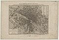
 Paris map - Donnet (Kaufmann) Architectonographie 1837 - Gallica.jpg 6,398 × 4,928; 18.02 MB
-
 Victor Clerot, Nouvelle carte topographique des environs de Paris, 1860 - David Rumsey.jpg 23,106 × 16,234; 187.82 MB


_Architectonographie_1837_-_Gallica.jpg)
