Category:Old submaps of Paris 20e arrondissement
Jump to navigation
Jump to search
Media in category "Old submaps of Paris 20e arrondissement"
The following 14 files are in this category, out of 14 total.
-
Picquet map of Paris 1814 - U of Chicago right half 400 dpi (cropped).jpg 3,195 × 3,191; 8.14 MB
-
Belleville-Ménilmontant sur plan Roussel.png 687 × 455; 712 KB
-
Château et parc de Ménilmontant, Roussel 1731.jpg 645 × 549; 265 KB
-
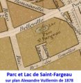
Lac de Saint-Fargeau sur plan de 1878.png 416 × 428; 267 KB
-
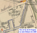
Lac de Saint-Fargeau sur plan de 1898.png 430 × 384; 285 KB


