Category:Old railroad maps of New York (state)
Jump to navigation
Jump to search
Subcategories
This category has only the following subcategory.
N
Media in category "Old railroad maps of New York (state)"
The following 33 files are in this category, out of 33 total.
-
 1834 Erie.jpg 13,824 × 6,848; 15.47 MB
-
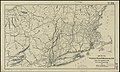
 1860 Shore Line Railroad.jpg 6,806 × 5,517; 10.04 MB
-

-
 1882 map of Long Island Railroad.jpg 6,294 × 2,232; 4.15 MB
-

-
 1897 Philadelphia, Reading and New England Railroad map.jpg 3,296 × 3,309; 1.46 MB
-
 1906 New York, New Haven and Hartford Railroad map.png 2,048 × 1,342; 3.75 MB
-
 1909 New York, New Haven and Hartford Railroad map.png 3,000 × 1,610; 5.29 MB
-
 1923 New York, New Haven and Hartford Railroad map.png 1,500 × 913; 1.22 MB
-
 DLW map 1922.gif 751 × 509; 87 KB
-
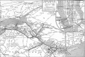
 Electric Railway Review-New York, Auburn and Lansing Railroad map.png 526 × 528; 156 KB
-
 FNS back.jpg 2,544 × 3,048; 1.15 MB
-
 FNS front.jpg 2,560 × 3,056; 1.15 MB
-
 FNS map only.jpg 1,160 × 483; 124 KB
-
 HempsteadRR-1897.JPG 783 × 628; 124 KB
-

-
 LIRR map 1876.svg 1,152 × 684; 532 KB
-
 Map of Bethpage Branch 1873.jpg 465 × 341; 66 KB
-

-

-
-
 Map of the Hudson River Rail Road from New York to Albany. LOC 98688681-1.jpg 45,354 × 5,691; 34.81 MB
-
 Map of the New York Central & Hudson River and Boston & Albany Railroads (2674596070).jpg 2,000 × 1,631; 3.67 MB
-

-

-
 NYWB-Map.jpg 476 × 1,265; 265 KB
-
 Parks and parkways in the Borough of the Bronx, New York City (1914) (14771565552).jpg 2,216 × 2,970; 1.21 MB
-
 Red House 1923.jpg 800 × 404; 89 KB
-
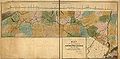
 Sectional map of N. Y. N. H. & H. R.R. Berkshire Hills Route.jpg 1,746 × 3,666; 1.23 MB
-
 Sectional map of the N.Y. N.H. and H. Berkshire Hills Route.png 1,808 × 4,528; 3.1 MB
-
 The Commercial and financial chronicle (1909) (14576583138).jpg 2,588 × 4,200; 2.64 MB
-
 Treat's illustrated New York, Philadelphia and surroundings (1876) (14763152295).jpg 4,480 × 2,596; 1.2 MB
-
 WVRR 1899.jpg 447 × 288; 151 KB


_(14783102212).jpg)


.jpg)
.jpg)
.jpg)
.jpg)
.jpg)
_(14771565552).jpg)


_(14576583138).jpg)
_(14763152295).jpg)

.jpg)