Category:Old maps of the Tribes of Israel
Jump to navigation
Jump to search
Subcategories
This category has the following 7 subcategories, out of 7 total.
1
Media in category "Old maps of the Tribes of Israel"
The following 171 files are in this category, out of 171 total.
-
Ca. 1320 map of the Holy Land by Pietro Vesconte.jpg 3,276 × 1,551; 945 KB
-
Tabula Moderna Terre Sancte.jpg 13,413 × 9,250; 26.41 MB
-
1525 map of the Holy Land by Lorenz Fries.jpg 10,596 × 7,501; 10.54 MB
-
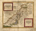
Cosmographia - Beschreibung aller Lender durch Sebastianum Munsterum (1545) 27.jpg 11,030 × 7,115; 7.54 MB
-
Fotothek df tg 0005109 Geographie ^ Karte.jpg 800 × 652; 284 KB
-
Das heylig Jüdisch land mit auftheilung der zwölf geschlechter — um 1579.jpg 8,759 × 6,808; 17.74 MB
-
Das heilig Lande mit Ausztheilung der zwoelff Geschlechter. LOC 2006629144.jpg 4,967 × 4,289; 3.56 MB
-
Das heilig Lande mit Ausztheilung der zwoelff Geschlechter. LOC 2006629144.tif 4,967 × 4,289; 60.95 MB
-
Das Heilig Landt mit Auftheilung der zwolff Geschlechter.jpg 8,944 × 7,889; 17.92 MB
-
Map of the Holy Land (1600) North West.jpg 800 × 600; 135 KB
-
Map of the Holy Land (1600).jpg 800 × 600; 123 KB
-
Map of Israel by Abraham Ortelius.jpeg 3,054 × 2,348; 2.24 MB
-
SanudoHolyLandMap.jpg 2,357 × 1,071; 1.08 MB
-
Pietro Vesconte, The Holy Land (FL199398406 2369099).jpg 6,546 × 5,455; 13.95 MB
-
Palestina Sive Terrae Sanctae Descriptio.jpg 13,809 × 10,744; 37.98 MB
-
Description De La Terre Ste. A Laquelle Aeste Adioute Diverses Observations 1637 (cropped).jpg 13,254 × 6,866; 21.16 MB
-
Description De La Terre Ste. A Laquelle Aeste Adioute Diverses Observations 1637.jpg 13,254 × 10,274; 30.76 MB
-
Nicolas Sanson. Iudæa. 1653.jpg 13,567 × 15,022; 10.39 MB
-
1655 Samaria map by Conrad Buno.jpg 2,522 × 2,104; 1.77 MB
-
Het Beloofde Land (22917584915).jpg 5,000 × 3,380; 4.19 MB
-
The Tribes of Benjamin and Ephraim.jpg 2,525 × 1,903; 2.08 MB
-
Giacomo Cantelli and Domenico De Rossi. TERRA SANCTA. 1677-1688.jpg 856 × 677; 242 KB
-
1695 Eretz Israel map in Amsterdam Haggada by Abraham Bar-Jacob.jpg 1,454 × 809; 391 KB
-
מפת אברהם בר יעקב.jpg 2,328 × 1,300; 3.4 MB
-
Nolin Map.Jpg 2,806 × 2,208; 1.57 MB
-
Amsterdam Haggadah Map of Palestine.jpg 11,731 × 6,628; 12.65 MB
-
Terre Sainte moderne (with) Descriptio acurata Terrae Promissae.jpg 8,854 × 6,463; 16.96 MB
-
Map - Special Collections University of Amsterdam - OTM- HB-KZL 33.10.25.tif 5,656 × 4,823; 78.05 MB
-
1729 Schryver Map of Israel showing 12 Tribes - Geographicus - Israel-schryver-1729.jpg 1,667 × 3,000; 1.09 MB
-
Judaea seu Palaestina map by Homann c1741.jpg 2,953 × 2,561; 4.48 MB
-
1744 map of the Holy Land by Matthaus Seutter.jpg 6,469 × 5,036; 8.03 MB
-
1746 map of Palestine by Georges Louis Le Rouge.jpg 5,251 × 6,893; 6.66 MB
-
Ivdaea sev Palaestina ob sacratissima Redemtoris vestigia hodie dicta Terra Sancta. LOC 99466737.tif 6,699 × 5,766; 110.51 MB
-
1750 map of Palestine published by Homannsche Erben.jpg 13,793 × 12,416; 21.57 MB
-
1759 map Holy Land and 12 Tribes.jpg 2,000 × 1,676; 1.74 MB
-
1770 Bonne Map of Israel showing the Twelve Tribes - Geographicus - Israel-bonne-1770.jpg 4,000 × 2,847; 2.61 MB
-
Guillaume Delisle, Terrae Sanctae Tabula e Scripturae Sacrae (FL36378790 2368519).jpg 12,740 × 17,298; 306.98 MB
-
Palestine, Tribes, and Jerusalem WDL136.png 1,289 × 1,024; 2.67 MB
-
Map - Special Collections University of Amsterdam - OTM- HB-KZL 33.10.18.tif 7,468 × 6,387; 136.47 MB
-
1836 Tanner Map of Palestine - Israel - Holy Land - Geographicus - Palestine-tanner-1836.jpg 3,256 × 4,000; 2.19 MB
-
אהרן בן חיים. 1836. מפת גבולי ארץ הצבי. ורשה 1883.jpg 2,312 × 1,896; 1.72 MB
-
Carte de la Palestine ou Terre Sainte - dressée par Pierre Tardieu - btv1b53035311v.jpg 7,501 × 10,544; 10.86 MB
-
Carte de la Palestine ou Terre Sainte - dressée par Pierre Tardieu - btv1b53087595z.jpg 7,592 × 10,912; 10.78 MB
-
Carte de la Palestine ou Terre Sainte - dressée par Pierre Tardieu - btv1b53087537c.jpg 7,536 × 10,536; 9.38 MB
-
Carte de la Palestine ou Terre Sainte LOC 2012590215.jpg 7,657 × 10,193; 9.28 MB
-
Bible dictionary for the use of Bible classes, schools and families (1851) (14597191349).jpg 2,204 × 3,596; 1.96 MB
-
1852 Philip Map of Palestine - Israel - Holy Land - Geographicus - Palestine-philip-1852.jpg 3,377 × 4,000; 2.29 MB
-
T.V.(1857) - (14) MAPA DELA PALESTINA O TIERRA SANTA.jpg 2,316 × 3,283; 1.01 MB
-
1862 Johnson Map of Palestine - Israel - Holy Land - Geographicus - Palestine-johnson-1864.jpg 3,948 × 4,926; 15.76 MB
-
Alexander Keith Johnston, Canaan or Palestine (FL37129722 3912035).jpg 3,092 × 4,088; 6.35 MB
-
Palestine or the Holy land (FL37821218 3922872).jpg 7,355 × 8,959; 93.44 MB
-
1864 Johnson Map of Israel, Palestine, or the Holy Land - Geographicus - Palestine-j-64.jpg 2,500 × 3,074; 2.05 MB
-
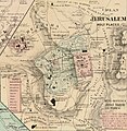
1873 plan of Jerusalem's holy places.jpg 1,647 × 1,689; 907 KB
-
Rawson, A.L. Map of Palestine and all Bible lands. 1873.jpg 5,823 × 8,139; 44.47 MB
-
The Collegiate Atlas 1876 (82451719).jpg 6,704 × 8,497; 6.38 MB
-
Meyers b12 s0618a.jpg 1,647 × 2,048; 762 KB
-
(1881) LA PALESTINE.jpg 1,980 × 2,977; 2.42 MB
-
A dictionary of the Bible.. (1887) (14779534654).jpg 2,068 × 3,328; 969 KB
-
Jesse Lyman Hurlbut, Palestine among the tribes (FL36567348 3908880).jpg 2,470 × 3,270; 4.18 MB
-
1889 Palestine, as divided among the Twelve Tribes.jpg 1,698 × 2,877; 2.33 MB
-
Palestine (1889 book) 30.jpg 1,647 × 2,813; 546 KB
-
The Holy Bible containing the Old and New Testaments (1896) (14765996672).jpg 2,196 × 3,424; 975 KB
-
MACCOUN(1899) p077 11250412543 fb10c05e4a o.jpg 1,990 × 3,598; 2.5 MB
-
MACCOUN(1899) p079 SECOND DIVISION BY JOSHUA.jpg 1,998 × 3,610; 2.67 MB
-
MACCOUN(1899) p085 SAMUEL.jpg 3,606 × 1,904; 3.39 MB
-
Butler Palestina 2 B.jpg 896 × 948; 305 KB
-
Butler Palestina A.jpg 1,500 × 1,217; 587 KB
-
Butler Palestina B.jpg 1,479 × 1,311; 721 KB
-
Butler Palestina E.jpg 555 × 525; 136 KB
-
Butler Palestina F.jpg 796 × 644; 230 KB
-
Butler Palestina.jpg 1,914 × 2,954; 1.64 MB
-
An essay on western civilization in its economic aspects (1911) (14598201470).jpg 1,304 × 2,170; 297 KB
-
שבטי ישראל. Elijah Saphir, מפת ארץ ישראל (פלשתינה) (FL199992287 2369250) (cropped).jpg 4,602 × 6,046; 39.13 MB
-
Palestine in the period of Israel's settlement and of the Judges (Smith, 1915).jpg 1,158 × 1,846; 1.81 MB
-
ארץ כנען לפי חלוקת השבטים. Samuel Klein, מפת ארץ-ישראל 01 (FL25553948 2366963).jpg 7,795 × 10,151; 63.61 MB
-
Biblia Wujka - mapa str. 1155.jpg 1,950 × 3,101; 1.49 MB
-
A map of Canaan (8343807206).jpg 7,062 × 5,759; 38.43 MB
-
Amsterdam Haggadah Map.jpg 11,863 × 6,567; 11.62 MB
-
Asher. Rawson, A.L. Map of Palestine and all Bible lands. 1873.jpg 1,463 × 1,718; 2.22 MB
-
CanaanMap Philistines.jpg 800 × 1,338; 592 KB
-
Carta Della Terra Promessa.jpg 5,809 × 11,239; 13.51 MB
-
Geographiae Claudii Ptolemaei Alexandrini (Münster, 1552) 52.jpg 10,504 × 6,766; 6.72 MB
-
Jean Baptiste Bourguignon d'Anville. La Palestine. 1767.Tribes.jpg 2,122 × 3,193; 974 KB
-
Karte von Palästina oder dem heiligen Lande.jpg 6,112 × 8,500; 11 MB
-
Map Ancient Palestine 1928-1940 - Touring Club Italiano CART-TRC-36.jpg 4,196 × 6,414; 2.61 MB
-
Map ofGalilee. Johnson's Palestine. 1862.jpg 1,692 × 1,207; 1.84 MB
-
Phebe Ellen Nichols. Map of Palestine or Canaan. 1853.jpg 5,040 × 6,515; 11.28 MB
-
Toussaint, A. Carte de la Palestine. 1834.jpg 8,590 × 5,987; 7.18 MB
-
Tribe of Manasseh map 1650.jpg 2,520 × 2,044; 872 KB
-
Tribes of Israel 1658.jpg 2,483 × 1,995; 2.13 MB
-
Tribus Aser.jpg 2,809 × 1,740; 1.99 MB
-
Tribus des Juifs et Peuples avoisinants. 1905-1905.jpg 1,864 × 2,385; 1.06 MB
-
Tribus Simeon 1658.jpg 2,487 × 1,896; 2.23 MB
-
אהרן בן חיים. 1836. מפת גבולי ארץ הצבי. התרס.jpg 800 × 600; 742 KB


