Category:Old maps of the Sea of Japan
Jump to navigation
Jump to search
Subcategories
This category has only the following subcategory.
Media in category "Old maps of the Sea of Japan"
The following 73 files are in this category, out of 73 total.
-
'The Sea Serpent' by George Roux 13.jpg 1,128 × 1,653; 891 KB
-
082 china-und-japan (1905).png 2,175 × 1,797; 2.64 MB
-
084 japan-und-korea (1905).png 1,824 × 2,215; 2.55 MB
-
CaronMap.jpg 514 × 350; 140 KB
-
CEM-36-NE-corner.jpg 2,560 × 1,920; 2.02 MB
-
Delisle - L'Asie (Ausschnitt Jesso Japan).jpg 572 × 646; 363 KB
-
Delisle - Carte d'Asie (Compagnieland).jpg 783 × 799; 576 KB
-
L'Asie divisée en tous ses Etats 2.jpg 1,089 × 1,515; 376 KB
-
1780 Raynal and Bonne Map of China, Korea, and Japan - Geographicus - Chine-bonne-1780.jpg 1,686 × 2,500; 1.24 MB
-
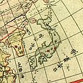
Chikyu zenzu.JPG 326 × 326; 70 KB
-
SeaEst in Koeea18c.jpg 730 × 564; 283 KB
-
La-Perouse-Chart-of-Discoveries.jpg 3,216 × 4,144; 1.39 MB
-
1809 Pinkerton Map of Korea ^ Japan - Geographicus - JapanKorea-pinkerton-1809.jpg 3,000 × 2,329; 1.54 MB
-
1814 Thomson Map of Tartary ( Mongolia, Tibet ) - Geographicus - Tartary-t-1814.jpg 3,500 × 2,912; 2.21 MB
-
Corea and Japan Map in 1815.jpg 2,161 × 1,641; 904 KB
-
1818 Pinkerton Map of Korea and Japan - Geographicus - JapanKorea-pinkerton-1818.jpg 3,500 × 2,733; 2.12 MB
-
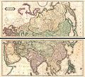
1820 Lizars Wall Map of Asia (in two panels) - Geographicus - Asia-lizars-1820.jpg 5,000 × 4,531; 6.65 MB
-
1827 Finley Map of China - Geographicus - China-finley-1827.jpg 3,000 × 2,308; 2.02 MB
-
1837 Malte-Brun Map of China and Japan - Geographicus - China-mb-1837.jpg 2,328 × 1,758; 772 KB
-
1855 Colton Map of Japan - Geographicus - Japan-colton-1855.jpg 3,500 × 2,927; 2.86 MB
-
1862 Johnson Map of Japan - Geographicus - Japan-johnson-1862.jpg 3,000 × 2,601; 2.2 MB
-
Nan bei yang he tu. LOC gm71005215.jpg 5,106 × 7,122; 4.64 MB
-
Nan bei yang he tu. LOC gm71005215.tif 5,106 × 7,122; 104.04 MB
-
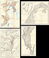
Admiralty Chart No 452 Yezo Island (Hokkaido), Published 1882.jpg 16,193 × 10,887; 50.53 MB
-
Atlas Van der Hagen-KW1049B13 053-IAPONIA REGNVM.jpeg 5,500 × 4,120; 2.99 MB
-
B-29 target cities in Japan.png 1,138 × 852; 131 KB
-
Battlefields in the Russo Japanese War.jpg 1,220 × 1,610; 1.66 MB
-
Brockhaus and Efron Encyclopedic Dictionary b82 709-0.jpg 2,127 × 2,684; 981 KB
-
Bungyun by Japan 1878.jpg 500 × 654; 132 KB
-
Chassiron 1858 carte japon.jpg 763 × 1,200; 271 KB
-
China 1910.jpg 2,208 × 1,689; 1.38 MB
-
China Korea und Japan im Massstab 1-7.500.000 LOC 2006629397 clipping matsushima.jpg 1,886 × 1,691; 2.74 MB
-
Delisle - L'Asie.jpg 3,672 × 2,872; 9.08 MB
-
Homann map of Japan (Iaponia) 1730.jpg 1,000 × 815; 795 KB
-
Jap-Rus Image7.jpg 1,099 × 740; 431 KB
-
Japan 1844.jpg 2,000 × 1,658; 3.54 MB
-
Japan korea map 1882 by Japan.jpg 600 × 489; 173 KB
-
Japan map Brochhaus.jpg 1,064 × 1,342; 202 KB
-
Japan1821.png 1,126 × 938; 1.59 MB
-
Karta över Japan vid 1900-talets början (ur Nordisk familjebok).jpg 2,548 × 3,480; 1.86 MB
-
Kunyu Wanguo Quantu by Matteo Ricci Plate Japan.jpg 3,500 × 3,000; 1.47 MB
-
L'Empire Chinois et du Japon (1833) (cropped1).jpg 1,035 × 1,986; 614 KB
-
L'Empire Chinois et du Japon (1833).jpg 4,977 × 3,681; 5.98 MB
-
Lange diercke sachsen asien japan.jpg 1,564 × 1,526; 1.22 MB
-
Letts-Popular-Atlas-1883-Russia-in-Asia-Chinese-Empire-etc.jpg 6,744 × 5,982; 8.81 MB
-
Map of Asia in 1700 by Guillaume de L'Isle.jpg 7,647 × 5,826; 13.98 MB
-
Map of Japan 1855.jpg 1,872 × 2,310; 599 KB
-
Map-of-Japan-1707-William-Adams-Visits-Shogun.png 3,203 × 2,197; 10.08 MB
-
Mapa východní Asie.jpg 2,150 × 1,781; 1.3 MB
-
Maps of the Far East, illustrating Russo-Japanese War (2709958051).jpg 1,265 × 2,000; 2.83 MB
-
Matteo Ricci Far East 1602 Larger.jpg 1,925 × 2,463; 1.62 MB
-
Mea du japon1704.jpg 2,328 × 1,701; 1.78 MB
-
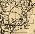
Mer Orientale 1700.jpg 626 × 608; 379 KB
-
Military Strength in the Russo Japanese War.jpg 1,723 × 1,158; 127 KB
-
Mongolie. L'Empire Chinois et du Japon (1833) (cropped).jpg 1,839 × 1,498; 1,020 KB
-
PYH2011050209790001300 P2.jpg 500 × 334; 79 KB
-
Rozhestvenskii Voyage.jpg 831 × 639; 71 KB
-
Sea of japan in ricci world map.jpg 1,035 × 777; 1.1 MB
-
Stielers Handatlas 1891 62 NE.jpg 1,250 × 1,250; 687 KB
-
Stielers Handatlas 1891 63.jpg 5,050 × 4,250; 6.22 MB
-
The mikado's empire (1894) (14597607818).jpg 2,032 × 3,320; 1.48 MB
-
William Adams 1707 map of Japan.jpg 784 × 558; 280 KB
-
Zyutei bankoku zenzu 1855.jpg 466 × 466; 135 KB
-
Карта Дальнего Востока 1904.jpg 2,940 × 1,926; 3.99 MB
-
Табурин - Театр военных действий.jpg 3,124 × 2,240; 3.29 MB


