Category:Old maps of the Mississippi River
Jump to navigation
Jump to search
Subcategories
This category has the following 5 subcategories, out of 5 total.
C
M
Media in category "Old maps of the Mississippi River"
The following 131 files are in this category, out of 131 total.
-
1674 Jaillot Map with Chucagua.png 327 × 351; 246 KB
-
Western New France, 1688.jpg 953 × 709; 186 KB
-
1697Louvigny.png 4,275 × 3,450; 8.51 MB
-
1732 map of Louisiana.jpg 9,482 × 5,386; 11.85 MB
-
Homo-Graphic Chart of the Settlements on the Mississippi River.jpg 15,733 × 24,704; 71.2 MB
-
Preliminary chart of the northwestern part of the Gulf of Mexico. Unfinished proof. LOC 99447059.tif 21,114 × 9,826; 593.57 MB
-
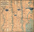
1862 map of the Mississippi published in Harper's Weekly.jpg 476 × 11,368; 1.87 MB
-
Coltons plans of U.S. harbors (The Mississippi River).jpg 1,574 × 5,714; 1.64 MB
-
Lloyd's map of the lower Mississippi from St. Louis to the Gulf of Mexico (NBY 1469).jpg 3,600 × 2,637; 1.9 MB
-
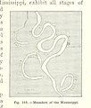
343 of 'Elementary Physical Geography' (11301550953).jpg 1,343 × 1,026; 319 KB
-
344 of 'Elementary Physical Geography' (11138722843).jpg 947 × 713; 183 KB
-
773 of 'The International Geography. ... Edited by H. R. Mill' (11164828374).jpg 472 × 1,316; 240 KB
-
18th Century French map of the Mississippi basin and eastern North America.png 692 × 707; 1,003 KB
-
18th Century French map of the Ohio basin.png 270 × 130; 79 KB
-
1927 LA Flood Map.jpg 2,292 × 5,214; 9.56 MB
-
213 of 'Eclectic Physical Geography' (11291973795).jpg 1,315 × 1,283; 436 KB
-
234 of 'Eclectic Physical Geography' (11200145746).jpg 1,315 × 2,066; 696 KB
-
285 of 'History of the American Civil War, etc' (11246500965).jpg 976 × 1,703; 307 KB
-
A map of Florida and ye Great Lakes of Canada - by Robt. Morden. NYPL433721.tiff 1,293 × 1,404; 5.2 MB
-
A map of Louisiana and of the River Mississipi (4231931192).jpg 2,000 × 1,782; 3.83 MB
-
Abraham Lincoln and the battles of the Civil War (1886) (14759637671).jpg 2,062 × 1,590; 918 KB
-
BattleOfStLouis.png 1,024 × 1,607; 3.23 MB
-
Bulletin of the U.S. Department of Agriculture (1913-1923.) (20474517256).jpg 3,474 × 2,550; 1.47 MB
-
Chart of the Mississippi River from the Ohio River to Gulf of Mexico (5961386478).jpg 1,572 × 2,000; 2.94 MB
-
Coal mining in Illinois (1915) (14774316051).jpg 3,616 × 1,484; 454 KB
-
Costantino Beltrami, mappa del Mississippi, 1828.jpg 1,920 × 668; 250 KB
-
Côtes des environs de la rivière Mississippi en 1701.jpg 1,743 × 1,073; 886 KB
-
Darlington map of the mississippi river 1680.png 657 × 680; 943 KB
-
District map of the lower Mississippi River (8347224414).jpg 655 × 800; 138 KB
-
Fort Kaskaskia Illinois Country Map 1778 Cropped.jpeg 569 × 472; 117 KB
-
Fort San Fernando on the Mississippi, in 1795.png 720 × 532; 482 KB
-
From Vicksburg to New Orleans (2674692374).jpg 1,593 × 2,000; 3.02 MB
-
Histoire des Yncas 1737.jpg 3,000 × 2,570; 846 KB
-
JNBellinMap1744MississippiLaBalize.jpg 600 × 403; 106 KB
-
JNN-1843-Map.jpg 9,484 × 11,491; 11.96 MB
-
Kaskaskia Cahokia Trail Map 1778.jpg 555 × 930; 100 KB
-
King, Pike, & Nau Map of the Mississippi River 1810 UTA.jpg 9,011 × 2,901; 9.62 MB
-
La Rivière de Missisipi- 1715 - Nicolas de Fer 1646-1720.JPG 1,104 × 794; 123 KB
-
Landmarks in the vicinity of Vicksburg Vidalia and Natchez circa 1863.jpg 1,423 × 1,779; 746 KB
-
Lloyd's map of the lower Mississippi River (map no. 4).jpg 3,032 × 11,755; 13.05 MB
-
Lloyds map of the lower Mississippi River from St. Louis to the Gulf of Mexico (4586553317).jpg 11,400 × 8,574; 72.22 MB
-
Lloyds new map of the Mississippi River from Cairo to its mouth (5960828391).jpg 605 × 2,000; 1.16 MB
-
Loc.gmd g4042m.cw0048420 Mississippi River SHEET 1 1864 by US Coast Survey.jpg 1,311 × 1,692; 231 KB
-
Long & Carey & Lea Country Drained by the Mississippi, Western Section 1823 UTA.jpg 2,892 × 4,390; 9.65 MB
-
Map of the Greenville Bends of the Mississippi surveyed 1894.jpg 1,933 × 1,881; 1.94 MB
-
Map of the Louisiana and the Mississippi River - NARA - 77452263.jpg 4,288 × 3,565; 1,012 KB
-
Marquette and jolliet map 1681 (rotated vertical).jpg 600 × 250; 69 KB
-
Marquette and jolliet map 1681.jpg 2,056 × 860; 792 KB
-
Mississipi River, from Iberville to Yazous (3045765651).jpg 804 × 2,000; 1.04 MB
-
Mississippi floodways and spillways map by Charles H. Owens, 1928.jpg 3,790 × 7,469; 2.89 MB
-
Mississippi river map 1702.jpg 300 × 250; 10 KB
-
Mississippi River near Vicksburg and vicinity (5121169712).jpg 1,305 × 2,000; 1.8 MB
-
Ohio archæological and historical quarterly (1887) (14578061279).jpg 1,972 × 1,428; 345 KB
-
Pais des Illinois.jpg 780 × 570; 363 KB
-
Panorama of the Mississippi Valley - and its fortifications LOC 85695690.jpg 7,728 × 7,120; 7.22 MB
-
Papers in Illinois history and transactions (1914) (14758568376).jpg 2,542 × 1,740; 552 KB
-
Papers in Illinois history and transactions (1914) (14781565945).jpg 2,396 × 1,774; 473 KB
-
R. Mitchisipi ou grande rivière - Liébaux sculp. - btv1b85960405.jpg 6,658 × 2,966; 2.83 MB
-
Senex A map of Louisiana and of the River Mississipi 1721 UTA.jpg 6,868 × 5,957; 16.9 MB
-
The centennial history of Illinois (1922) (14578469890).jpg 1,626 × 2,878; 573 KB
-
The making of a park system in La Crosse (1911) (20768761745).jpg 3,644 × 2,678; 1.14 MB
-
The siege of Vicksburg, its approaches by Yazoo Pass and other routes.jpg 966 × 1,438; 312 KB
-
Homann Amplissimae Regionis Mississipi c. 1720 UTA.jpg 6,000 × 5,321; 16.4 MB


