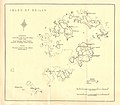
Category:Old maps of the Isles of Scilly
Jump to navigation
Jump to search
Media in category "Old maps of the Isles of Scilly"
The following 18 files are in this category, out of 18 total.
-
Gascoyne's Map of Cornwall (cartouche and inset).jpg 1,822 × 2,789; 1.22 MB
-
The earth and its inhabitants (1881) (14597736167).jpg 1,930 × 1,654; 625 KB
-
Admiralty Chart No 2565 Trevose Head to Dodman Point, Published 1888.jpg 16,206 × 11,112; 47.24 MB
-
Ordnance Survey One-Inch Map Sheet 189 Land's End (1946).jpg 8,220 × 9,605; 7.51 MB
-
A new chart of the islands of Scilly... - btv1b53010681j.jpg 8,550 × 6,371; 7.87 MB
-
Admiralty Chart 34 The Scilly Isles published 1911.jpg 15,950 × 10,918; 15.89 MB
-
Admiralty Chart No 883 Scilly Isles St. Mary's Road and Crow Sound, Published 1900.jpg 16,464 × 11,345; 56.82 MB
-
Heathers New and Improved Chart of the Isles of Scilly (8249819881).jpg 2,000 × 1,622; 2.89 MB
-
Isles of Scilly Ancient Monuments Map O'Neil 1949.jpg 4,604 × 4,025; 2.42 MB
-
Isles of Scillymap 1946 unedited.png 3,444 × 2,500; 18 MB
-
Isles of Scillymap 1946.png 4,293 × 3,316; 18.74 MB
-
Isles of Scillymap1946 sub12,5 million pixels.png 3,833 × 2,961; 15.28 MB
-
MPH1-368 Scilly Isles, 1707 (11051540513).jpg 4,765 × 3,750; 3.72 MB
-
Rennell Current map 1793.jpg 5,586 × 4,225; 2.94 MB
-
Scilly 1753 Thomas Kitchin.jpg 2,445 × 2,112; 1.29 MB
-
Scilly-bartholomew02 large.jpg 2,017 × 1,536; 2.41 MB


