Category:Old maps of the Ionian Islands
Jump to navigation
Jump to search
Subcategories
This category has the following 8 subcategories, out of 8 total.
C
I
- Old maps of Ithaka (18 F)
K
- Old maps of Kefalonia (34 F)
- Old maps of Kythira (38 F)
L
P
- Old maps of Paxoi (18 F)
S
- Old maps of Strofades (7 F)
Z
Media in category "Old maps of the Ionian Islands"
The following 22 files are in this category, out of 22 total.
-
 IAN 0752 Pinargenti 1571 Preveza.jpg 8,483 × 5,882; 30.24 MB
-

-

-
 IAN 0111 Longhi 1684 Preveza.png 7,634 × 5,823; 65.49 MB
-
 IAN 0212 d Anville 1734 Battle of Actium.jpg 5,136 × 3,459; 15.71 MB
-
 William Faden. Composite Mediterranean. 1785.R.jpg 1,218 × 1,143; 400 KB
-
 1851 Tallis map of British Possessions in the Mediterranean (engraved by John Rapkin).jpg 1,587 × 2,187; 1.63 MB
-
 IAN 0632 Chrysochoou 1881.jpg 7,128 × 5,800; 44.34 MB
-
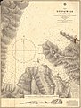
 IAN 0634 K.u.K 1895 Gulf of Arta.jpg 6,221 × 5,488; 56.7 MB
-
 IAN 0179 Dokaupil 1912 Preveza.jpg 5,853 × 7,887; 41.34 MB
-
 IAN 0180 Dokaupil 1912 Preveza.jpg 5,800 × 7,968; 52.65 MB
-
 IAN 0178 Fotiadis 1920 Preveza.jpg 5,615 × 7,424; 42.61 MB
-
 IAN 0346.jpg 10,672 × 7,757; 32.78 MB
-
 Admiralty Chart Catalogue 1967 Page 043.jpg Index F2.jpg 8,576 × 6,862; 8.19 MB
-
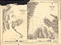 Admiralty Chart No 1620 Meganisi Channel Port Vliko Gulf of Molo and Port Vathi, Published 1866.jpg 11,007 × 8,199; 23.68 MB
-
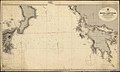 Admiralty Chart No 1800 Malta to Cape Malea, Published 1894.jpg 13,902 × 8,363; 16.83 MB
-

-
-
 IAN 0631 Chrysochoou 1881.jpg 7,194 × 5,847; 53.76 MB
-
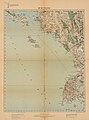
 IAN 0944 Heather 1802 Corfu.jpg 4,639 × 3,759; 9.94 MB
-
 Island of Santa Maura - Goodisson William - 1822.jpg 1,500 × 1,000; 695 KB
-
 Odyssey (Butler) Map of the Ionian Islands.png 1,005 × 1,161; 362 KB


.jpg)


_;_(d%27apr%C3%A8s_A._Thevet)_-_btv1b5962320q.jpg)


_Map_of_the_Ionian_Islands.png)