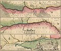
Category:Old maps of the Dnieper River
Jump to navigation
Jump to search
Media in category "Old maps of the Dnieper River"
The following 22 files are in this category, out of 22 total.
-
1550 Map of Poland - Book Museum - National Library - Minsk - Belarus (27448006382).jpg 3,648 × 2,736; 3.32 MB
-
"Tractus Borysthensis vulgo Dniepr et Niepr" (22239940682).jpg 4,191 × 3,015; 2.15 MB
-
1788 map of the Mouth of the Dnieper River.jpg 7,500 × 2,834; 4.67 MB
-
Brockhaus and Efron Encyclopedic Dictionary b20 796-3.jpg 1,724 × 2,789; 1.02 MB
-
Ca. 1640 map of the Dnieper River by Willem Janszoon Blaeu.jpg 8,333 × 18,204; 23.84 MB
-
Magni Ducatus Lithuaniae Dnieper.jpg 1,024 × 2,260; 3.12 MB
-
Map Velikiy Lug 1894.jpg 800 × 576; 136 KB
-
Partie Du Cours du Dneper Chez le Rouge (Paris, 1769).jpg 2,500 × 1,740; 1.32 MB
-
Plan Eroberung Festung Otschakow 1788 randlos.jpg 1,803 × 1,194; 849 KB
-
Plan Eroberung Festung Otschakow 1788.jpg 2,045 × 1,500; 660 KB
-
The earth and its inhabitants (1883) (20508725533).jpg 1,472 × 1,974; 942 KB
-
Tractus Bonysthenis, vulgo Dnieper.jpg 6,417 × 5,473; 6.3 MB
-
Tshertosch ukrainskim i tsherkaskim gorodam ot Moskwij dokrijma.jpg 11,135 × 9,624; 12.04 MB
-
Великий Луг 1775.jpg 10,742 × 4,408; 6.85 MB
-
Днепровские пороги в XVIII веке.jpg 2,447 × 3,211; 1.15 MB
-
Камянськийретраншемент1778.jpg 712 × 473; 267 KB
-
Пороги XVIII в.jpg 5,073 × 6,745; 4.95 MB


