Category:Old maps of the American Revolution
Jump to navigation
Jump to search
Subcategories
This category has the following 2 subcategories, out of 2 total.
P
Media in category "Old maps of the American Revolution"
The following 93 files are in this category, out of 93 total.
-
SiegeOfFortStanwix1777FleuryMap.jpg 6,184 × 4,088; 5.53 MB
-
1777BurgoyneTiconderoga.jpg 1,382 × 2,602; 1.22 MB
-
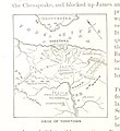
299 of 'The American Revolution' (11209529933).jpg 1,952 × 1,161; 243 KB
-
American Revolution Campaigns 1775 to 1781.jpg 1,157 × 1,768; 547 KB
-
ArnoldExpeditionRouteMarked.jpg 2,240 × 5,552; 3.07 MB
-
Battle of Bunker Hill map.jpg 2,352 × 2,300; 1.57 MB
-
Battle of Monmouth, June 28, 1778. LOC gm71002212.jpg 3,120 × 2,219; 957 KB
-
Battle of Monmouth, June 28, 1778. LOC gm71002212.tif 3,120 × 2,219; 19.81 MB
-
Battle of Valcour Island (Oct 11, 1776).jpg 14,000 × 12,310; 35.37 MB
-
Battle-of-Long-Island-Map-sml.jpg 800 × 565; 188 KB
-
Battleground of battle of bunker hill.jpg 3,840 × 4,608; 2.68 MB
-
BattleOfFortsClintonAndMontgomery1777.jpg 4,132 × 2,212; 2.42 MB
-
BattleOfGreatBridge.jpg 633 × 931; 247 KB
-
BattleOfGrotonHeightsSketch.jpg 3,443 × 5,066; 4.95 MB
-
BattleOfHubbardtonMap1777.jpg 5,344 × 4,240; 6.85 MB
-
BattleOfPetersburg1781.jpg 1,218 × 999; 417 KB
-
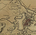
Boston 1775.jpg 797 × 776; 250 KB
-
BostonCapeAnn1775.png 766 × 551; 707 KB
-
British at Frogs Neck (1776).jpg 1,362 × 884; 349 KB
-
British colonies 1763-76 shepherd1923.jpg 1,651 × 1,010; 625 KB
-
Bunker Hill battle map.jpg 1,836 × 2,043; 869 KB
-
ChamplainValley1777.jpg 632 × 1,980; 641 KB
-
Charleston (1780).jpg 525 × 357; 77 KB
-
Charlestown Bar (1780).jpg 532 × 722; 165 KB
-
Chart of New York Harbour and its Defences 1781.jpg 1,961 × 3,383; 3.66 MB
-
CoochsBridge1777.jpg 2,516 × 2,072; 1.13 MB
-
Dominica1778.jpg 3,354 × 4,361; 1.91 MB
-
EasternVirginia1775.jpg 3,360 × 2,660; 2.84 MB
-
Ewald BoundBrook 1777.jpg 3,000 × 1,844; 1.02 MB
-
Ewald SpencersOrdinary 1781.jpg 1,617 × 2,100; 542 KB
-
GreysRaid.png 3,648 × 2,695; 20.75 MB
-
HessianMapMudIsland.jpg 2,580 × 3,508; 1.43 MB
-
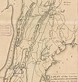
HudsonValley1777.jpg 360 × 1,470; 249 KB
-
Left-Bank-James-River-Rochambeau-map.jpg 5,849 × 5,674; 4.48 MB
-
Lexington Concord Siege of Boston crop.jpg 2,861 × 2,188; 1.89 MB
-
Lexington Concord Siege of Boston.jpg 3,211 × 2,476; 1.55 MB
-
Manhattan1781.jpg 864 × 1,680; 893 KB
-
Map of the Battle of Bunker Hill area.jpg 2,208 × 1,584; 1.18 MB
-
MontresorChaudiereMap1760.jpg 4,618 × 5,510; 3.16 MB
-
MontresorChaudiereMap1760HeightOfLand.jpg 960 × 1,212; 370 KB
-
MontresorNewYorkState1777Detail.jpg 1,332 × 3,664; 1.96 MB
-
MontresorNewYorkState1777DetailBW.jpg 1,332 × 3,664; 1.28 MB
-
New York state (1775-1883).jpg 1,014 × 854; 154 KB
-
NJBritishOutposts.jpg 5,640 × 3,080; 2.84 MB
-
NYC1776 crop.jpg 2,706 × 2,545; 4.65 MB
-
NYC1776 labelled.jpg 4,360 × 3,360; 7.88 MB
-
NYC1776.jpg 4,360 × 3,360; 6.9 MB
-
NYCGreatFire1776.jpg 3,512 × 2,325; 12.33 MB
-
PenobscotExpedition1779.jpg 3,588 × 3,460; 5.89 MB
-
Philadelphia - Howe Survey - 1777.jpg 1,346 × 2,263; 457 KB
-
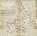
Plan of the country at and in the vicinity of Forts Lee and Independency, 1776.jpg 1,951 × 2,395; 660 KB
-
Plan von Quibeltown by Johann von Ewald.jpg 1,536 × 1,218; 308 KB
-
Detail of 1778 Erskine Map of Quaker Hill.jpg 1,446 × 1,905; 344 KB
-
Red Banke. LOC gm71002224.tif 4,102 × 2,848; 33.42 MB
-
RichelieuValleyMontrealThreeRivers1777.png 562 × 872; 816 KB
-
Roatan1782.jpg 5,882 × 3,725; 4.54 MB
-
Route of Scammell's Light Infantry Detachment from August 19-29, 1781.png 1,095 × 879; 312 KB
-
Savannah, 1779 RCIN 734052.jpg 2,000 × 1,574; 1.08 MB
-
SavannahCapture1778.jpg 1,774 × 1,443; 204 KB
-
Siege of Savannah map.jpg 1,759 × 2,008; 1.02 MB
-
Theatre de la guerre en Amerique (2674327425).jpg 1,517 × 2,000; 2.82 MB
-
Towhiteplains.JPG 595 × 634; 85 KB
-
ValcourIslandMap1776Detail.jpg 803 × 889; 337 KB
-
ValcourIslandMap1776Overview.jpg 837 × 529; 213 KB
-
Virginia1781 SpencersAndGreenSpring.jpg 1,520 × 1,552; 986 KB
-
White Plains Battle Plans.jpeg 760 × 689; 607 KB


